I recently visited Lewes, DE for ‘Maritime Day’ by the harbor and there were a lot of interesting booths on the watersheds, environmental agencies that discussed their purpose with harbor issues and what the town of Lewes does for the environment.
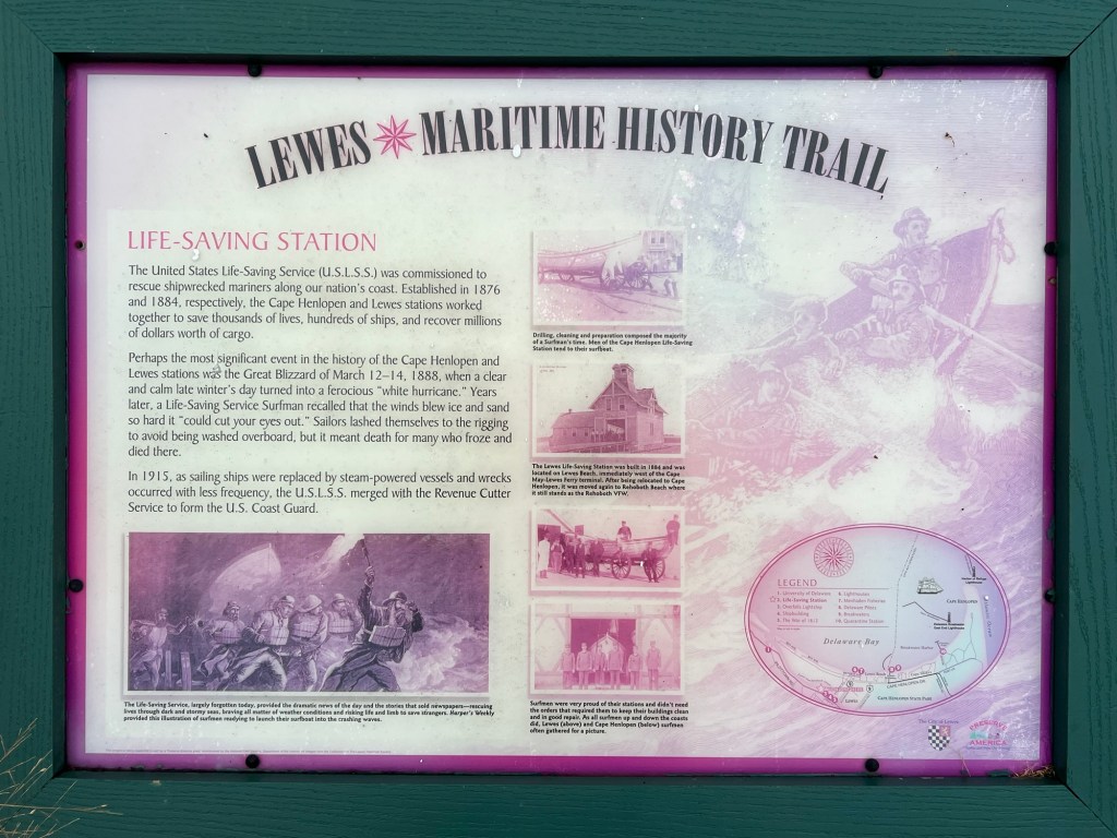
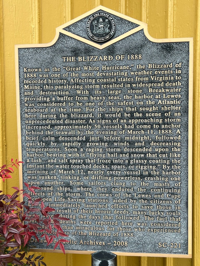
The historic Blizzard from 1888
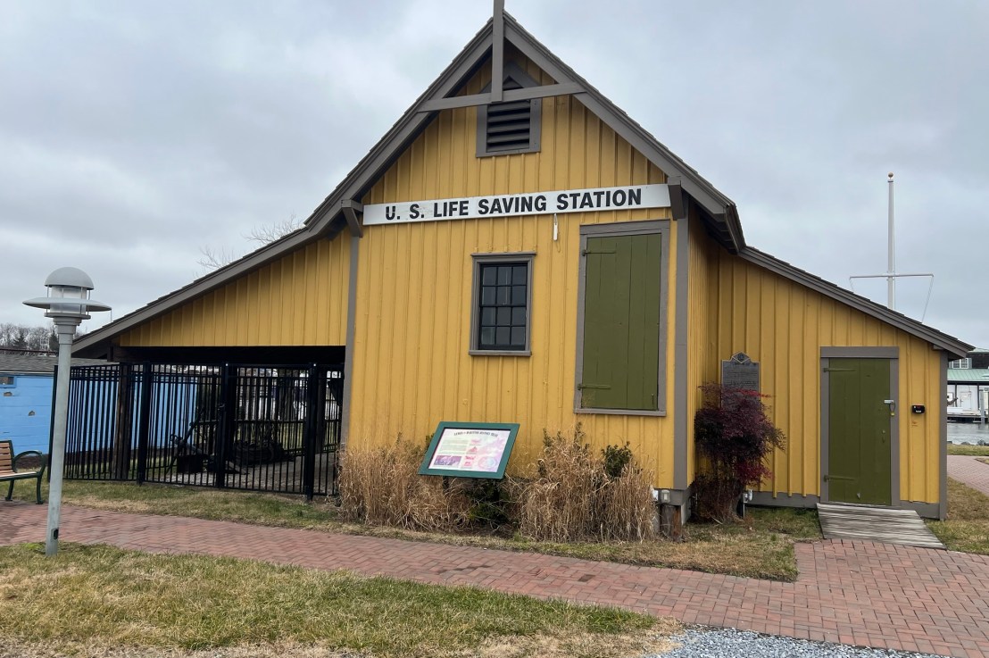
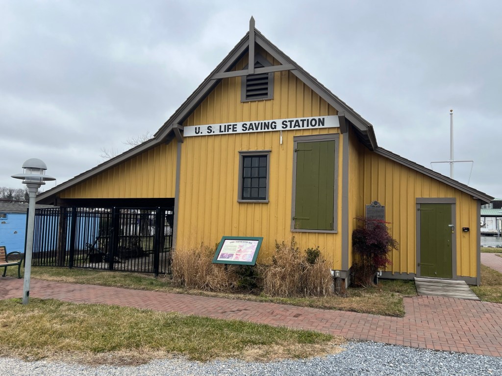
History of the Lewes Life Saving Station & Museum:
(From Historic Lewes.com)
It was also a busy station, guarding both the mouth of Delaware Bay and the protected waters created by the massive breakwaters of the National Harbor of Refuge. Its string of Keepers and their six- or seven-man crews of Surfmen enacted scores of rescues through the years and in particular won great praise for their tireless heroics during the Great White Hurricane of 1888, when they pulled scores of sailors from the frigid waters and iced-over hulks of wrecked vessels to safety.
The front of the museum
The History of the Lewes Lifeguard Museum:
(From the Historic Lewes.com)
The United States Life-Saving Service (USLSS) protected the American coast and saved lives in peril at sea from 1871 until 1915, when it became a part of the new United States Coast Guard (USCG). This incredible humanitarian mission came to Lewes in 1884, making it the fourth of six stations to be established in Delaware. Lewes was among the most desirable stations for the Keepers and Surfmen who manned it, with its original location on the site of the present-day Cape May-Lewes Ferry Terminal placing it not far from town and therefore civilization.
The view of the harbor which has changed over the years
I spent my time touring the Lewes Lifeguard Museum, which is an interesting little museum on the history of life saving along the Delaware coast. The museum’s artifacts show some of the earliest and innovative forms of rescue equipment from before the Civil War. This was the precursor to the United States Coast Guard.
The inside of the museum
The lower part of the museum contained most of the equipment, items like rescue ropes, wenches, rescue apparatus, lanterns and uniforms like jackets and boots.
Pulled and equipment used to rescue stranded people
History of the Lewes Historical Museum:
(Historic Lewes.com)
The United States Coast Guard maintained the Station Lewes from 1915 until 1969, when it was closed, declared surplus, and sold. The original main station building was relocated numerous times and still stands today, heavily modified, as the Rehoboth Beach VFW. The Boat House preserved by Historic Lewes, a unique 1884 addition to the USLSS station intended to launch lifeboats on a marine railway directly into the harbor, was acquired from the Pilots’ Association of the Bay & River Delaware in 1979 and moved to its present home at Canalfront Park. It stands proudly beside the Lightship OVERFALLS (LV-118), together commemorating the nation’s and community’s efforts to preserve life on hazardous waters.
The bullies and wenches used by the men
Information in the Lewes Life Saving Station
Biography of the men who worked there
Information on the Boat House
Some of the ropes and wenches used in the rescue procedures
On the other side of the building was the rescue boat the ‘Life Car’, a rudimentary form of rescue boat that the docents said was effective but clunky and hard to use. It shows how we have progressed in life saving.
The Life Car rescue unit
Information on the ‘Life Car’
The ‘Life Car’
The ores and other rescue equipment used
The small rope cannon
The ores
The rope equipment
The story of the ‘Great White Hurricane of March 1888’
The Men’s Dining area in the front of the building
There was no living area in the facility but a place to gather the team, eat and socialize when manning the station.
History of Lewes Lifeguard Museum:
(From the Lewes Lifeguard.com)
Guests visiting the USLSS Boat House today will find it furnished just as Keeper John Clampitt and his courageous Surfmen left it on March 12, 1888, as they pushed out into the roaring gale and whipping snow for their finest hours. It also features a display of early life-saving equipment, including the rope-and-pulley Breeches Buoy rescue system, a steel life-car, and a rare 1887 Long Branch, New Jersey-style surfboat under restoration.
The dining area and the schedule
The dining room table
The Lewes Life Saving Station & Museum is an example of early beach and shipping rescue at the East Coast Shore. It also shows the daily life of these brave men and how lonely and dangerous this job could be. It shows how times have progressed and how they have stayed the same. To save people and property.
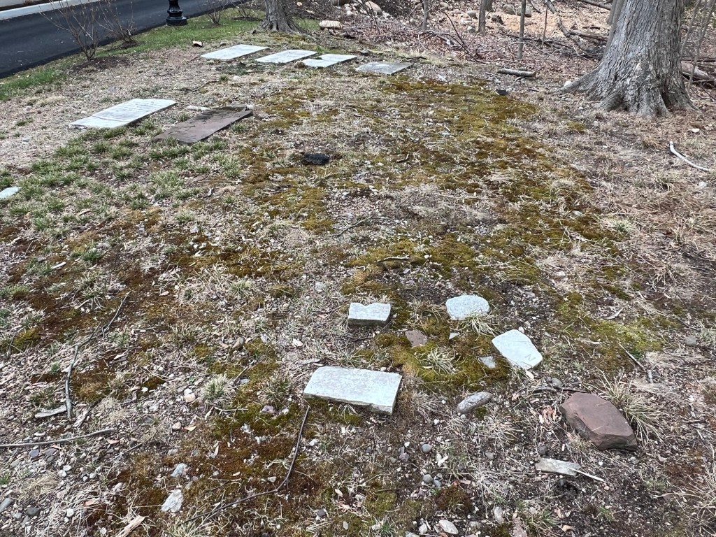
The Sturr Family Cemetery sits on a bend of the driveway of the Chabad Jewish Center of Northwest Bergen County and is a small cemetery that once sat on the edge of the J.H, Sturr farm.
The Sturr Family Cemetery
The farmhouse of the Sturr Family sits on the lot across the street from the cemetery property. This is located on a small buff on what was the edge of the farm.
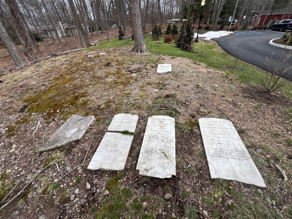
The Sturr Family cemetery tombstones
The tombstones of the Courter and Carlouch family members
The grave of William Courter
The only visible tombstones that are left in the cemetery are an Ackerman family member, Anny Ackerman and members of the Courter and the Carlouch family’s (who must have married into the family).
The Ackerman family tombstones (the one to the right was unreadable)
The other tombstones are broken and no one is sure who is buried where in the cemetery.
The History of the Cemetery:
(From Find a Grave website)
The cemetery is located in Franklin Township, Bergen County, New Jersey, on what was once the family farm of J.H. Sturr. As of October 1991 only 6 markers were still remaining.
The Sturr Family Cemetery in full view
History of the House:
(From the Franklin Lakes Municipal Website)
H. Sturr House or Blue Meadow Farm Built 1860 378 Pulis Avenue, Block 1510, Lot 8 Franklin Lakes, New Jersey 07417
The Sturr House – also known as Blue Meadow Farm -is a handsome and little altered example of mid 19th century vernacular architecture which incorporates several stylistic elements such as gable returns and frieze area of the early 19th century Greek Revival style. The Borough of Franklin Lakes lists the erection year of the house as 1860.
The façade of this 2 ½ story house consists of clapboard. The front porch has five bays with square posts and a rectangular entrance door with rectangular sidelights. Two tall 1st story windows are on one side of the porch. A single hitching post with iron rings sits in front of the porch stairs. The building has a frieze area with linear design. Semi-circular headed louvered vents are in all gable ends. The rear of the house has a one story wing. There is a detached garage to the west side of the house as well as a round frame well. Further west of the house is a stable which has been extensively remodeled and converted into a residence in recent times. The house combined with associated structures is a significant remnant of the large farmsteads which ones dotted the Borough’s landscape prior to the recent suburban housing boom.
History of the Family:
(From the Franklin Lakes Municipal website)
This Sturr house and the nearby more altered house at 402 Pulis Avenue were duplicate structures and were probably built around the same time by members of the Sturr family. The 19th century Sturr family was descended from Conraedt Sturr who purchased 190 acres of land in this area with John Coeter from Robert Livingston in 1793.
The non-extant homestead and mill was located at present-day 930 Old Mill Road. It is known that Henry Sturr, the son of Conraedt, had a fanning mill at this location in 1850. In a will dated 1852 he bequeathed his property and mill to his grandsons John, Henry, and Daniel (Maria Braun – 1976 page 26 & 27).
The property along Pulis Avenue upon which these houses are situated was probably included in this will since the homes were built around the mid-19th century. Future deed research is recommended to identify the original builder and the construction date of the house (1861: H. Sturr, 1876 Estate of H.M. Sturr). Presently the house is privately owned and occupied.
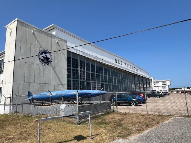
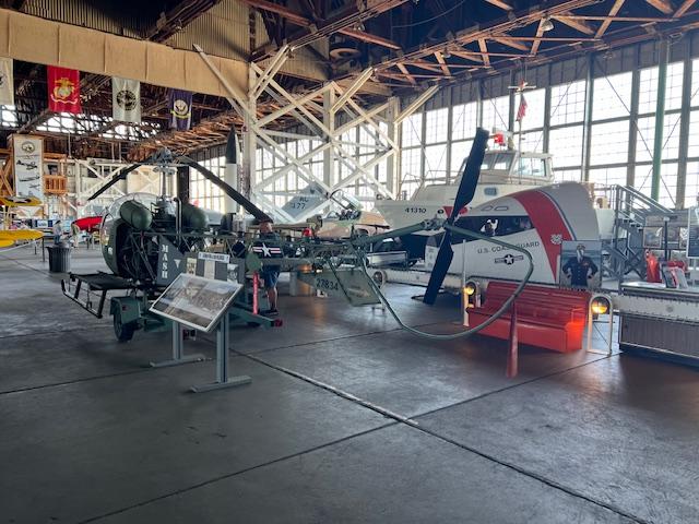
The Naval Air Station Wildwood Aviation Museum is located at the back of the Cape May Airport. Just follow the road to the back of the airport at 500 Forrestal Road in Hangar #1.
The front of the museum
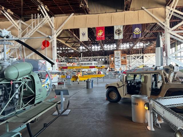
This interesting museum is a treasure trove of artifacts from WWII to today from jeeps to cars and trucks to airplanes. Some of the vehicles you can step into and see what it was like to ride these pieces of aviation history.
The main gallery of the Aviation Museum
There are several airplanes that with the assistance of the staff you can enter and see what air travel was like for these pilots. All the planes have been carefully restored and displayed for viewing and use by tourists. There is even a air traffic control tower you can enter and see how thing the functioning of the tower was done. These displays were interactive from the perspective of the people who once worked there.
The Hanger with plane displays
In the front of the museum as you enter, along the ways there is a display of the history of the Naval Hangar and how it developed and became part of the community. There were pictures of members walking the boardwalk in Wildwood and having a good time. There were stories of many interactions between the sailors and the locals and what an exciting time it was for everyone.
The history of the time as Wildwood Training Facility
Many local heroes stories were told all over the building of Navy personal from the area and the part that they played in the war years and when they returned. Each story board told of their early lives, how they got involved in the war, the roles that played and jobs that were accomplished and what their lives were like when they returned. The mindset of this generation is very different than from today.
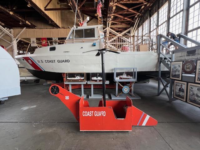
The Coast Guard display
What I really enjoyed was the documentary “Boatlift”, the story of the 9/11 rescue of thousands of people off Manhattan island on 9/11 (it was around the 20th Anniversary of the event when I toured the museum) and the bravery and involvement of boaters and sailors all over the New York maritime region. Hundreds of boats were involved in getting people to safety to New Jersey and other parts of the NYC. It was a lesson in selflessness and involvement in one of the darkest days of American history.
The main gallery of the museum
Outside the hangar, there are more planes to tour and equipment that is used. Each display is carefully explained of its role in the armed forces so take the time to read the plaques as well.
The outside of the hanger of the museum
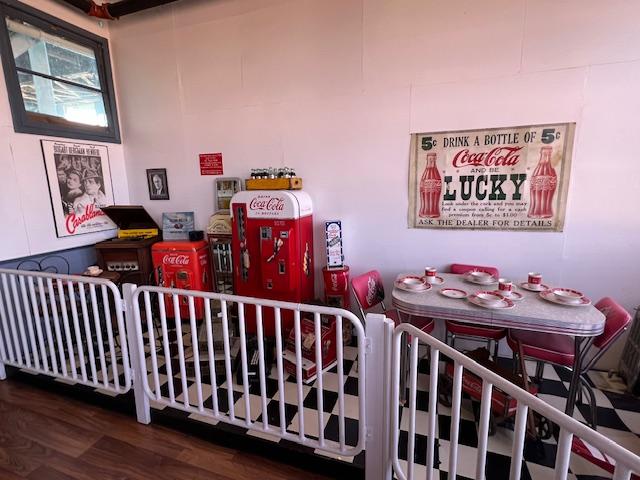
Inside the building towards the back, there is a display of commercial establishments and even the role of Coca Cola during the war and it being used in the ration boxes of the men and women fighting for our country. There were pictures of USO dances and get togethers and parties for the enlisted men.
The Coca Cola display during WWII
There is even a space shuttle piece to explore and admire showing our progression into different types of transportation over time. The museum has carefully displayed items so that there is an order to follow around the room to admire each piece. Take the time to look them over and read about them.
The MASH helicopter on display
This museum is an interesting step back in time to show the role New Jersey and Cape May County played during the war years and then going forward.
The main gallery of the Aviation Museum
The Mission of the Museum:
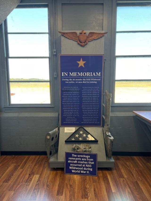
Restoring Hangar #1, educating the public on Cape May Country’s history during WWII and memorializing the 42 naval aviators who were training at the Naval Air Station Wildwood.
WWII Ends display
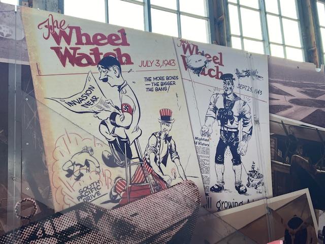
WWII Propaganda Posters
The History of the Naval Air Station Wildwood Aviation Museum:
(Taken from the Museum website)
WWII:
Following the outbreak of World War II, this all wood double wide aircraft hangar was assembled by the U.S. Navy in 1942 from a kit delivered via railroad. On April 1st, 1943, NAS Wildwood was commissioned as a training facility for dive bomber squadrons that would go on to fight in the Pacific. Between 1943 and 1945, activities included night flying and target practice over the Delaware Bay, reaching a peak of almost 17.000 takeoffs and landings in the month of October 1944. Before NAS Wildwood was decommissioned, 129 crashes occurred and 42 airmen died in training exercises.
The Memorial from the WWII
Following World War II, United States Overseas Airlines was operated out of Hangar #1, offering both national and international charter flights. The airline was owned by Dr. Ralph Cox, a dentist and U.S. navy pilot during WWII. Cox also used the hanger to display his collection of early automobiles and other transportation memorabilia including a steam locomotive.
1970-1990:
Southern Jersey Airways operated a commuter airline known as the Allegheny Commuter out of the Cape May Airport. The service was started by Captain Curt Young, ho was a bomber pilot during WWII. The Allegheny Commuter offered twenty-two daily flights between Atlantic City and Philadelphia as well as eight round trips out of Cape May.
1997-Present:
After many years of neglect, Hangar #1 was rediscovered by Dr. Joseph Salvatore and his wife, Patricia Anne, who acquired the building from Cape May County for $1.00. Listed on both the state and national registers of historic places, Hangar #1 is an exhibit in and of itself. Since 1997, the Salvatore’s and the NASW Foundation have worked hard to restore the hangar to its original condition. Today, Hangar #1 is open to the public as part of the NAS Wildwood Aviation Museum.
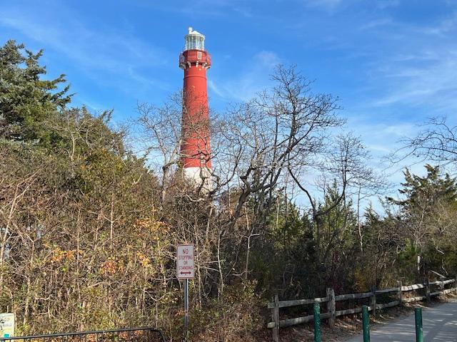
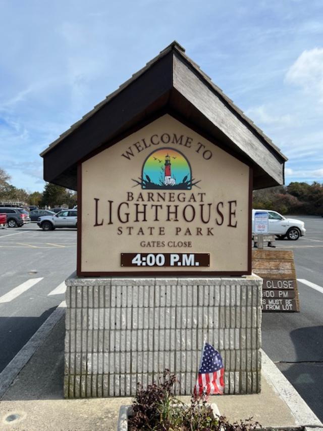
I was able to visit the Barnegat Lighthouse State Park on a recent trip to Long Beach and what a beautiful park with wonderful views of the inlet and of the Atlantic Ocean.
The Barnegat Lighthouse in the fall 2023.
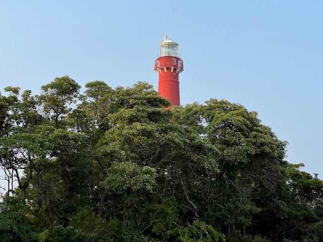
The view of the lighthouse from the parking lot in the summer months
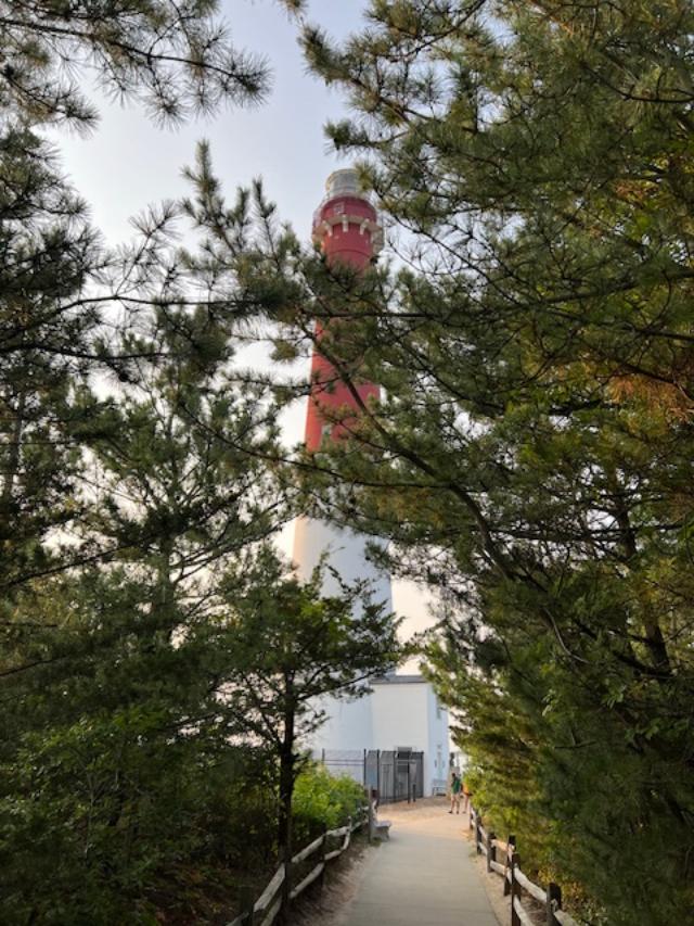
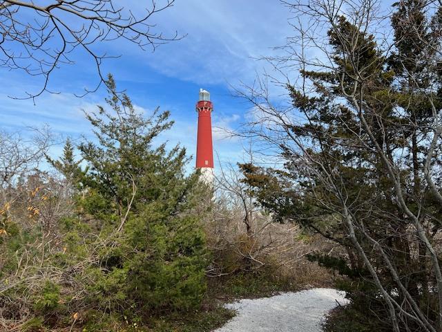
The lighthouse through the woods in the Summer of 2024
In 2020, the lighthouse was closed because of COVID so I had to wait in the future to climb the stairs which is noted for people who like to explore lighthouses but still you are able to admire the building from the outside. In the fall of 2023, the lighthouse was opened for limited hours during the fall after Labor Day weekend and I was able to climb all 216 stairs in ten minutes.
The Barnegat Lighthouse on the inlet side of the park
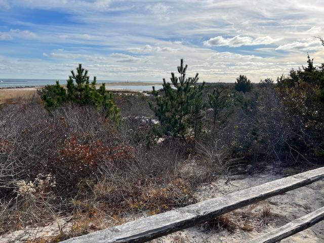
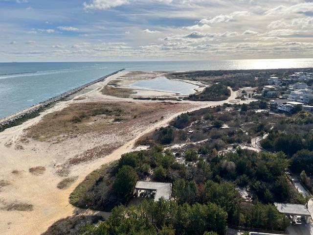
The paths around the dunes in the summer months
The beginning of the dunes in the winter months
The dunes in the summer months
The dunes in the fall
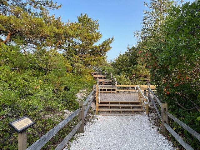
The beginning of the dunes path as you leave the lighthouse.
The start of the path in the summer months
The start of the path in the Summer of 2024
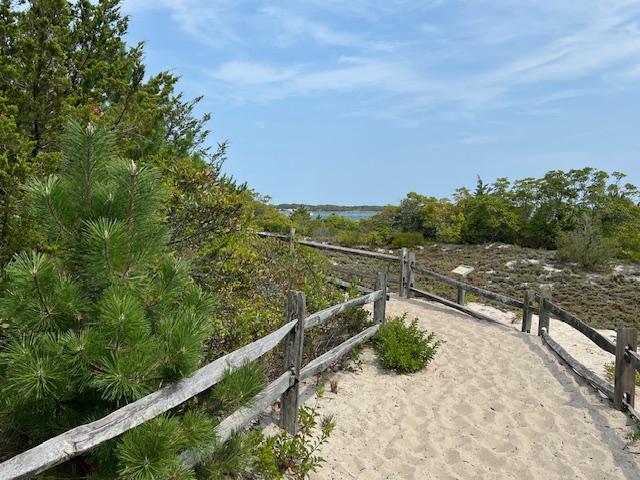
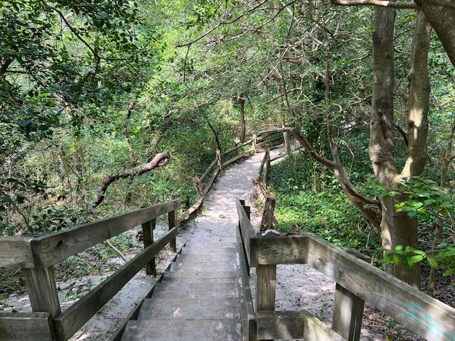
The pathway through the dunes
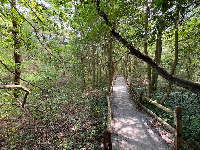
There is a walking path through the bush areas of dunes. In all season, you can admire the trees and what is left at this point of the season of flowering plants. It was interesting to read how these species survive the ocean and salt air. It is amazing how these plants can survive the storms and how they keep the beach from eroding.
The pathway through the Dunes
Path through the Dunes woods
The turn by the beaches
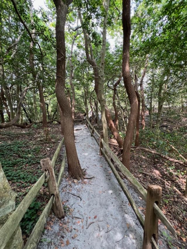
The Maritime Forest Trail is a 1/5 mile long, self-guided loop through one of the last remnants of maritime forest in New Jersey. The forest, which is dominated by black cherry, sassafras, eastern red cedar and American Holly, which is an important resting and feeding area for migratory birds on their long journey to and from their breeding areas (Park Literature).
The pathway through the dunes
The path in the summer months
Walking through the pathway
It is also the home for migrating birds. There were all sorts of ducks swimming around and there a a bird that looked like a crane who looked like it was getting vain from all the pictures that people were taking of it.
The pathway leading back to the lighthouse.
Walking through the pathways
The pathway from a distance
The Dunes woods at its thickest point
The Inlet Movement sign on the pathway
Exiting the woods
Exiting the woods near the entrance of the light house path
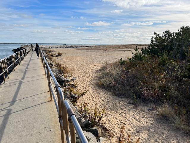
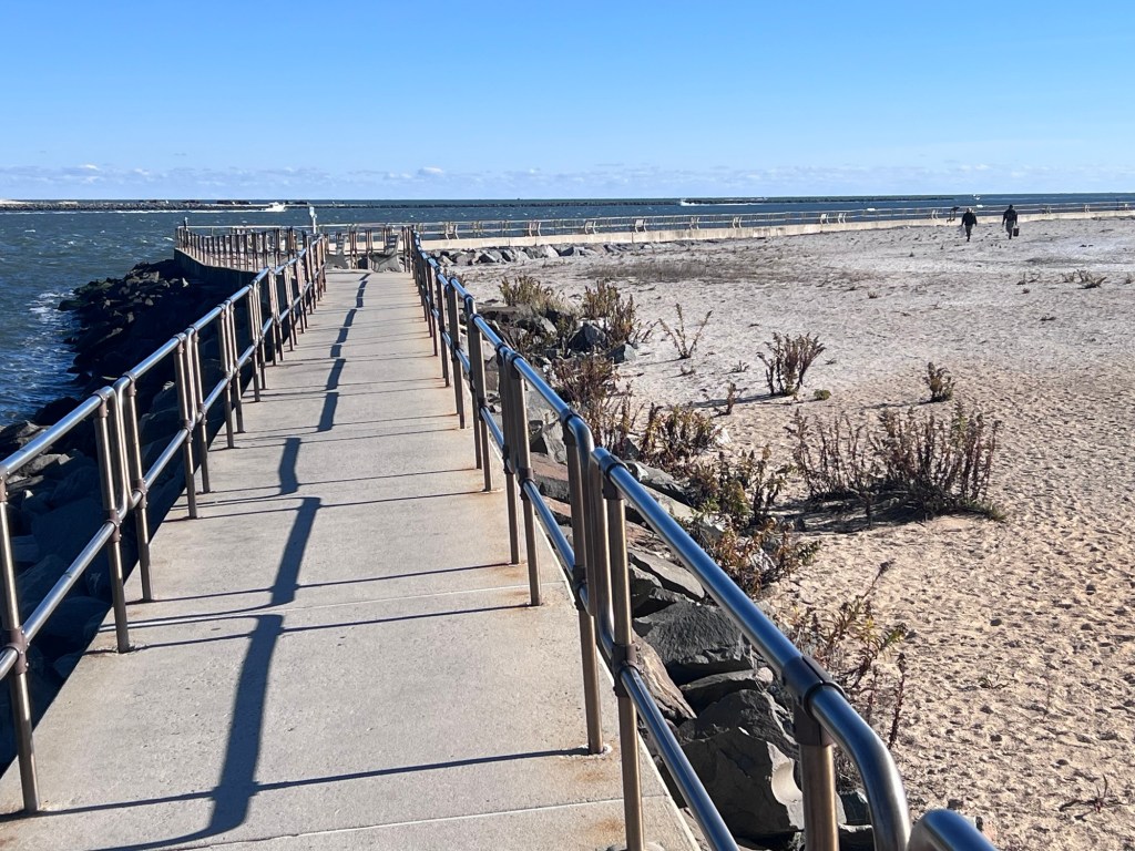
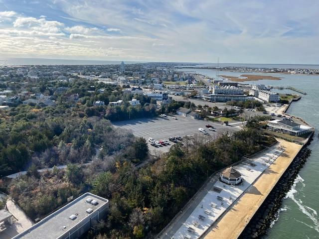
The park has a 1033 foot concrete walkway that the fisherman use and people were sitting along the benches watching people fish and boaters come and go from the inlet. The walkway was a nice place to see the waves crash along the sides of the park.
The lighthouse and the walkway.
The pathway out to the bunker
The pathway during the Summer of 2024
The bunker that protects the shoreline and the lighthouse.
The bunker and the lighthouse
Following the pathway to the bunker head
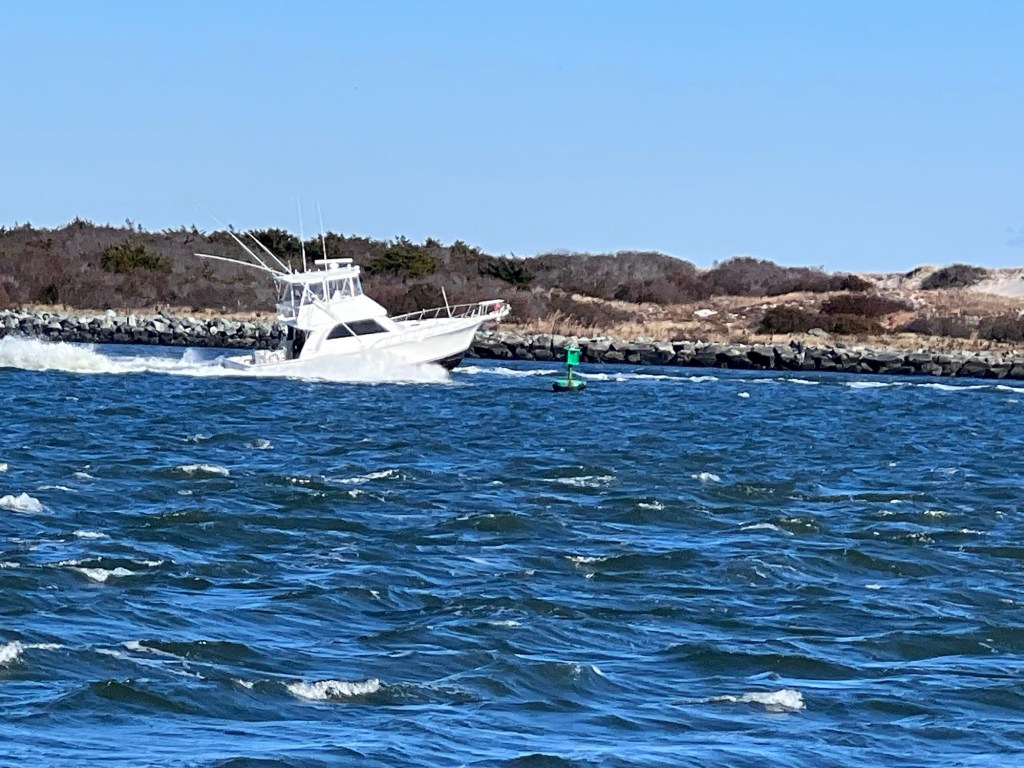
I just saw a lot of dumb people walking along the wet rocks with waves crashing by which is not smart. Still you got great views of Seaside Park and the Atlantic Ocean from this part of the park. It is fun watching the fisherman casting lines, sharing stories and the fishing boats in the distance go out to sea close to the beach.
The view of the Barnegat inlet from the top of the lighthouse.
The boats on the inlet on a cool December day
The boats passing by
On a nice day take the time to walk through the nature trails and the dunes that face the ocean. It is a small but interesting trail with all sorts of native plants and a very nice description that the park gives you about each and their place at the shore. Each has a place with the wild life and the migration patterns for birds on their way to their next home. It shows what an important place that New Jersey serves for wildlife.
The inlet and dunes from the top of the lighthouse.
I revisited the park in November of 2021 and on a very windy day, the lighthouse was open and I finally made my way to the top. It was quite a hike up those narrow stairs on a extremely windy day but I made it to the top in about fifteen minutes. Along the way, there was small landings with sweeping views of the ocean.
The view of Barnegat Light from the Barnegat lighthouse in 2023.
Once to the top, there was a landing that surrounded the top of the lighthouse with views of the park and lagoon areas and the surrounding tip of the island. The strong winds prevented me from staying there too long plus there was not much space to move around and you felt like you were caged in but the views were spectacular. I made it down in ten minutes since there were only six other people there.
The view of all of Long Beach Island from the Barnegat Lighthouse in November 2023.
I finally got back to Long Beach Island in November of 2023 and was able to tour the lighthouse and the grounds again with time on my hands. The COVID restrictions had been long lifted and even in the off season the lighthouse was busy with people climbing to the top of it and taking pictures and then admiring the grounds.
The Barnegat Lighthouse from the approach.
It gave me a chance to really spend time inside the lighthouse, walking through the dunes pathway, exploring the bunker and the surrounding park. I also took time to admire the statuary and read the signs. During COVID when the lighthouse was open, you felt rushed not to be around anyone. Now I was able to converse with people as I walked up and down the stairs and in the park. Walking through the dunes you can just relax and enjoy nature in the quiet sense. It was nice of them to finally open the lighthouse where we could just enjoy it again.
The History of Barnegat Lighthouse State Park:
Barnegat Lighthouse State Park, located on the northern tip of Long Beach Island along the New Jersey Atlantic coastline, is one of New Jersey’s most recognized landmarks and a veteran of service to seafarers for 68 years. The park is easily accessible from the Garden State Parkway by taking exit 63 and following Route 72 east to Long Beach Boulevard northbound.
The Barnegat Lighthouse in the fall of 2023.
Park visitors can picnic, sunbathe, fish, bird watch, climb the historic lighthouse (post COVID), walk the Interpretive Center (post COVID) and enjoy the seashore. Swimming, however is not permitted. Barnegat Lighthouse is included as a maritime site on the New Jersey Heritage Trail Route (Barnegat Lighthouse State Park Pamphlet).
The Massacre of Long Beach during the Revolutionary War.
Barnegat Lighthouse stands on the south side of Barnegat Inlet, The inlet was named “Barendegat” or “Breakers Inlet” by early Dutch explorers because of the large cresting waves that made navigation difficult. The site of the lighthouse was considered on of the most important “change of course” points along the eastern seacoast for vessels sailing to New York from Europe. Sailors depended on Barnegat Lighthouse as a navigational aide to assist them in reaching their posts and to avoid the dangerous shoals that extended from the shore.
The historic marker at the lighthouse.
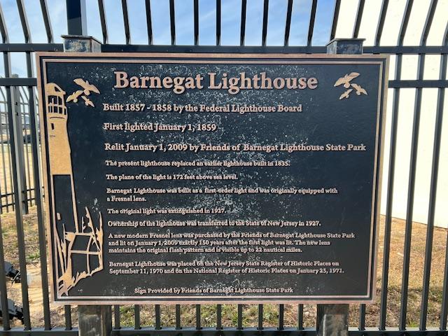
In 1834, the U.S. Congress appropriated $6,000 to establish a lighthouse as Barnegat Inlet. The lighthouse was completed and placed into service in July of 1835. At only 40 feet tall with a non-blinking light, the first lighthouse at Barnegat Inlet was a miserable failure doing little to reduce the number of shipwrecks. In 1856, guided by recommendations from then Lieutenant George G. Meade of the U.S. Army Bureau of Topographical Engineers, Congress appropriated another $60,000 to construct a “first class light” at Barnegat Inlet.
The Lieutenant George Meade statue outside the lighthouse.
Lieutenant Meade drew up the plans and Lieutenant W.S. Raynolds supervised the construction of the new lighthouse. On the night of January 1, 1859, the majestic new Barnegat Lighthouse was lit for the first time. Its first order Fresnel lens, at 175 feet above sea level was so powerful that it could be seen for 19 nautical miles.
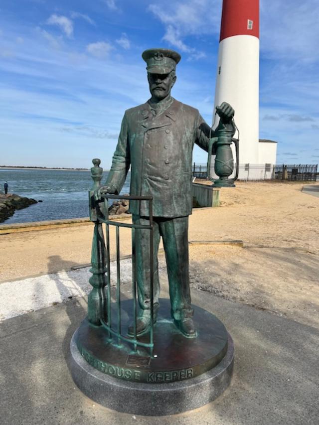
The Lighthouse keeper statute.
The Lighthouse keeper listing
The maritime plaque outside the pathways
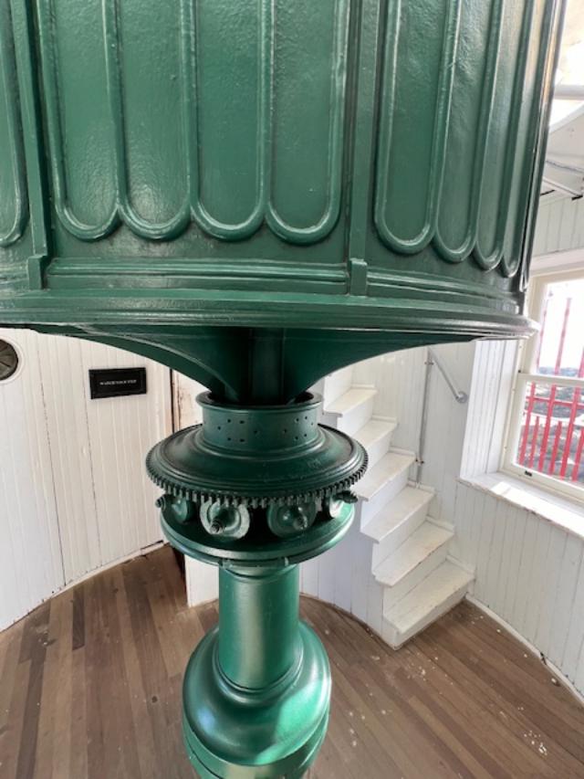
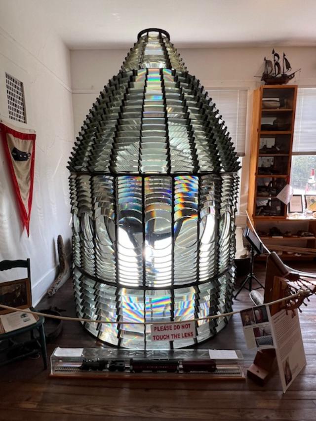
The lens was made in 1856 by Henri Le Paute of Paris, France from glass produced at the famous furnace at St. Gobian. The beehive-shaped Fresnel lens is six feet in diameter, ten feet high and is formed from over 1,000 separate glass prisms and twenty four bull’s eye lenses mounted in a brass frame.
The lens frame at the top of the lighthouse.
It weighs nearly five tons. Today the lens is on display in the Barnegat Light Historical Museum on Central Avenue and 5th Street in Barnegat Light, New Jersey. For hours of operation, please call the museum at (609) 494-8578.
The lens at the Barnegat Light Museum around the corner from the lighthouse.
Turned by a clockwork mechanism, the lens rotated once every four minutes. The speed of the rotation and the 24 individual beams of light from the 24 bull’s eye lens gave Barnegat Lighthouse it’s characteristic” of one flash every ten seconds.
The old light is on display at the Barnegat Light Museum down the road
At the turn of the century, due to the encroaching sea and seemingly inevitable collapse, the Lighthouse Board considered abandoning Barnegat Lighthouse and replacing it with a lightship anchored off the coast. The popularity of the lighthouse as a landmark caused the Lighthouse Board to reconsider their plan and to erect temporary measures to hold back the sea. Later, local residents raised two thousand dollars to construct permanent jetties to protect the lighthouse.
In 1926, Barnegat Lighthouse and surrounding property were transferred from the Federal government to the State of New Jersey… to maintain this reservation for historical purposes and for the preservation of the lighthouse tower. The lighthouse was decommissioned and replaced by the Barnegat Lightship in 1927. Barnegat Lighthouse State Park opened to the public in 1957.
A bust of General George G. Meade was unveiled at the dedication ceremony in honor of his distinguished service during the Civil War as the Commanding General of Federal troops at the Battle of Gettysburg and for his role at Barnegat Lighthouse.
The sign that welcomes you to the park all year round.
Today, the beloved Barnegat Lighthouse is shining again thanks to the Friends of Barnegat Lighthouse State Park who purchased a new lens that casts a single beam visible up to 22 nautical miles. The new light was illuminated at a ceremony on January 1, 2009 exactly 150 years to the day that it was originally lit in 1859 with over 1200 people witnessing the lighthouse becoming an official aid to navigation once again.
The lighthouse and the park in its glory
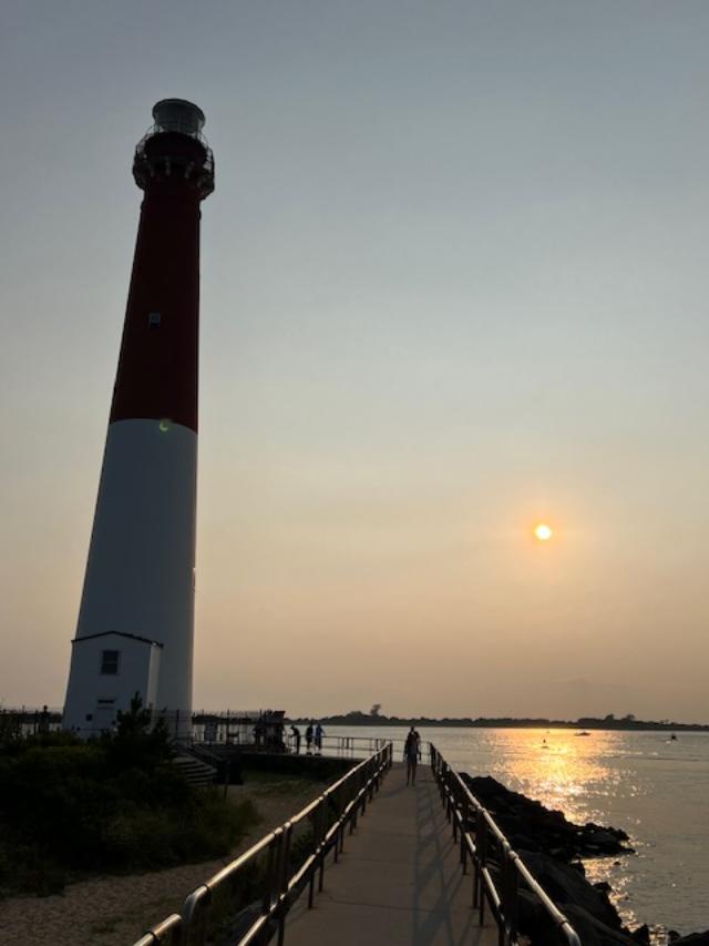
Sunset at the lighthouse
Sunset at the lighthouse
(This information comes from a combination of the Barnegat Lighthouse State Park pamphlet and website/Wiki-I give them full credit for the information provided).