The Sturr Family Cemetery sits on a bend of the driveway of the Chabad Jewish Center of Northwest Bergen County and is a small cemetery that once sat on the edge of the J.H, Sturr farm.
The Sturr Family Cemetery
The farmhouse of the Sturr Family sits on the lot across the street from the cemetery property. This is located on a small buff on what was the edge of the farm.
The Sturr Family cemetery tombstones
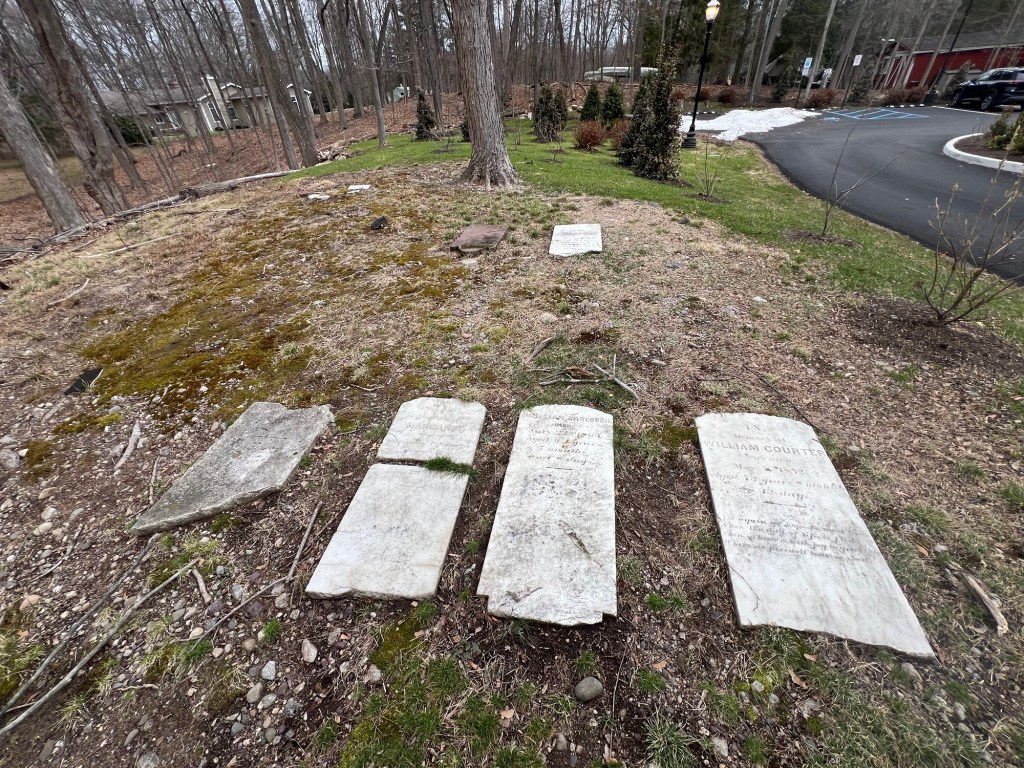
The tombstones of the Courter and Carlouch family members
The grave of William Courter
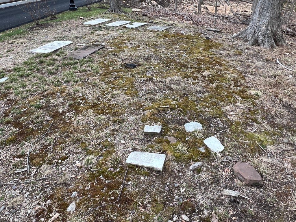
The only visible tombstones that are left in the cemetery are an Ackerman family member, Anny Ackerman and members of the Courter and the Carlouch family’s (who must have married into the family).
The Ackerman family tombstones (the one to the right was unreadable)
The other tombstones are broken and no one is sure who is buried where in the cemetery.
The History of the Cemetery:
(From Find a Grave website)
The cemetery is located in Franklin Township, Bergen County, New Jersey, on what was once the family farm of J.H. Sturr. As of October 1991 only 6 markers were still remaining.
The Sturr Family Cemetery in full view
History of the House:
(From the Franklin Lakes Municipal Website)
H. Sturr House or Blue Meadow Farm Built 1860 378 Pulis Avenue, Block 1510, Lot 8 Franklin Lakes, New Jersey 07417
The Sturr House – also known as Blue Meadow Farm -is a handsome and little altered example of mid 19th century vernacular architecture which incorporates several stylistic elements such as gable returns and frieze area of the early 19th century Greek Revival style. The Borough of Franklin Lakes lists the erection year of the house as 1860.
The façade of this 2 ½ story house consists of clapboard. The front porch has five bays with square posts and a rectangular entrance door with rectangular sidelights. Two tall 1st story windows are on one side of the porch. A single hitching post with iron rings sits in front of the porch stairs. The building has a frieze area with linear design. Semi-circular headed louvered vents are in all gable ends. The rear of the house has a one story wing. There is a detached garage to the west side of the house as well as a round frame well. Further west of the house is a stable which has been extensively remodeled and converted into a residence in recent times. The house combined with associated structures is a significant remnant of the large farmsteads which ones dotted the Borough’s landscape prior to the recent suburban housing boom.
History of the Family:
(From the Franklin Lakes Municipal website)
This Sturr house and the nearby more altered house at 402 Pulis Avenue were duplicate structures and were probably built around the same time by members of the Sturr family. The 19th century Sturr family was descended from Conraedt Sturr who purchased 190 acres of land in this area with John Coeter from Robert Livingston in 1793.
The non-extant homestead and mill was located at present-day 930 Old Mill Road. It is known that Henry Sturr, the son of Conraedt, had a fanning mill at this location in 1850. In a will dated 1852 he bequeathed his property and mill to his grandsons John, Henry, and Daniel (Maria Braun – 1976 page 26 & 27).
The property along Pulis Avenue upon which these houses are situated was probably included in this will since the homes were built around the mid-19th century. Future deed research is recommended to identify the original builder and the construction date of the house (1861: H. Sturr, 1876 Estate of H.M. Sturr). Presently the house is privately owned and occupied.
The front of the library and museum in the Fall of 2025
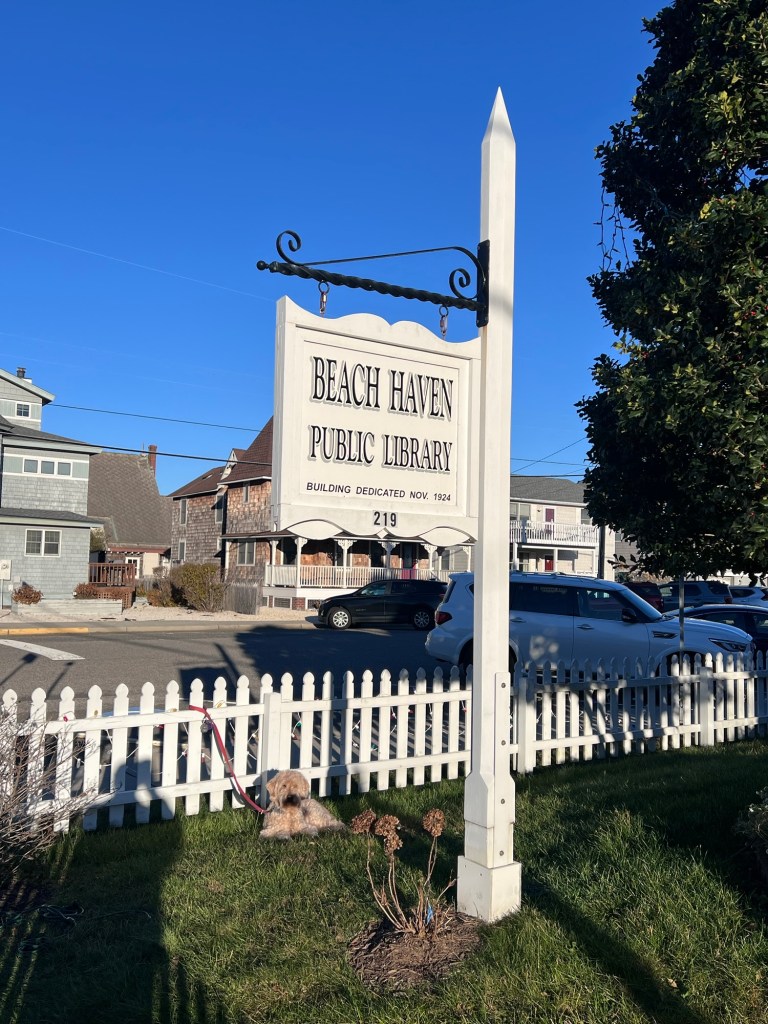
The historic sign
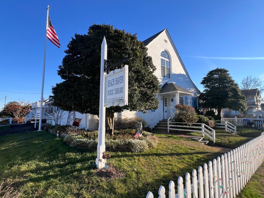
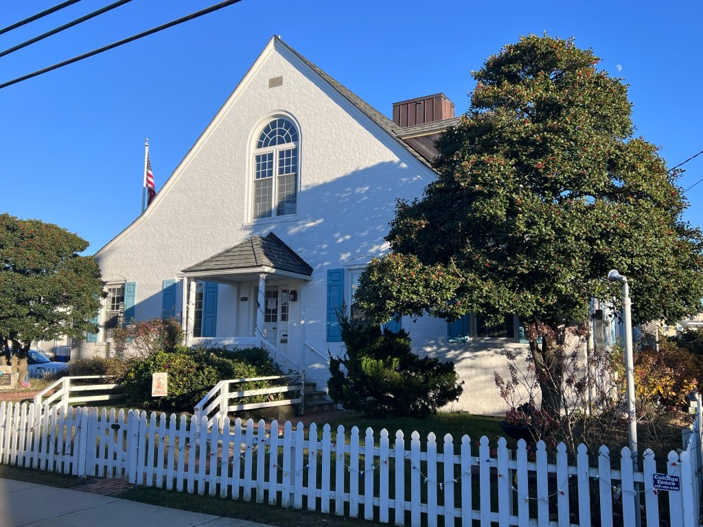
I recently visited the Beach Haven Library and Museum in Beach Haven during the holiday season and discovered a historical library with a rich history in both the community and on Long Beach Island.
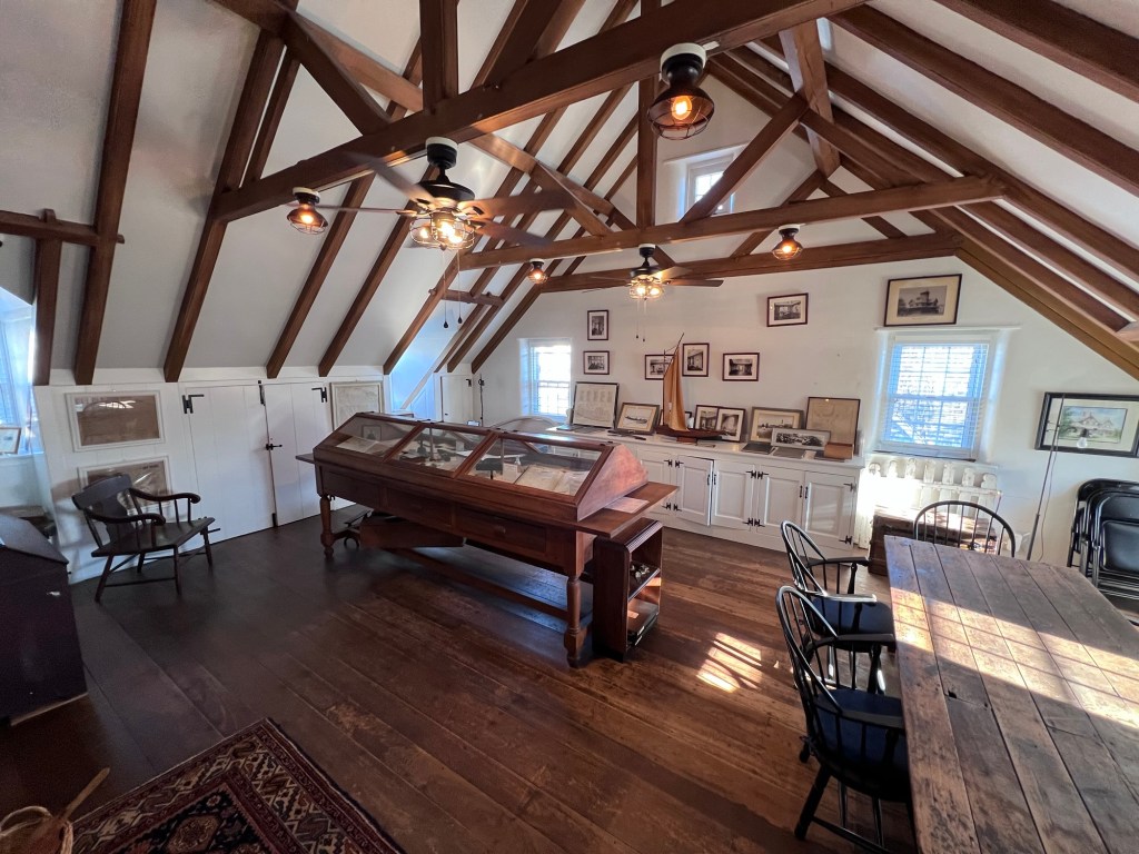
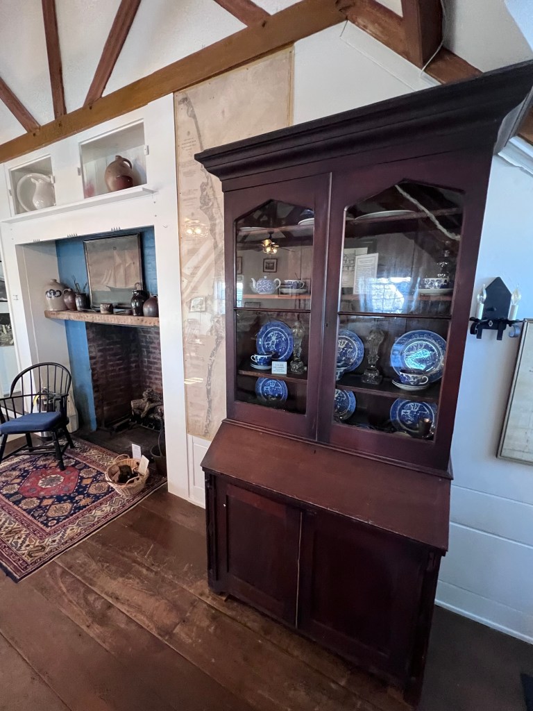
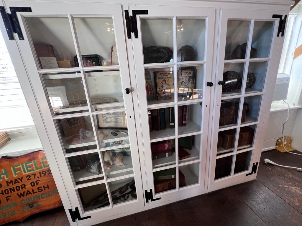
The museum on the second floor
On the second floor of the library is the history room of the Beach Haven Library that contains a collection of historic artifacts and ledgers from hotels and businesses on the island. Each of the case lines tells a different story of the community from the grand hotels that once lined the shore and have since disappeared to the lives of the families that once called the island home. When I talked with one of the librarians, she told me that estates from the area donate these items to the library and this has established their collection.
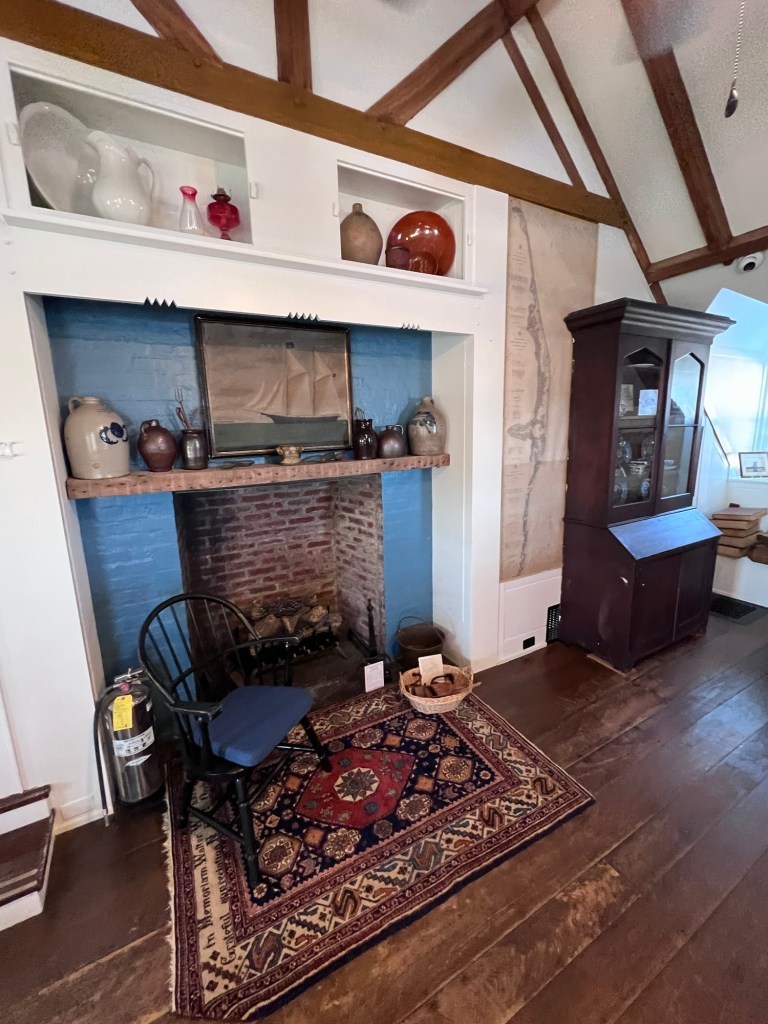
The second floor fireplace
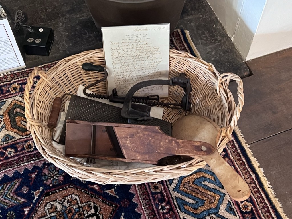
The antique kitchen equipment
The second floor of the library has another fireplace where vintage pottery and kitchen items are on display. There are also decorative pieces of pottery lining the shelves.
Historic China inside the Emily Lloyd Wilson Secretarial desk. Her father designed the Baldwin Hotel in Beach Haven.
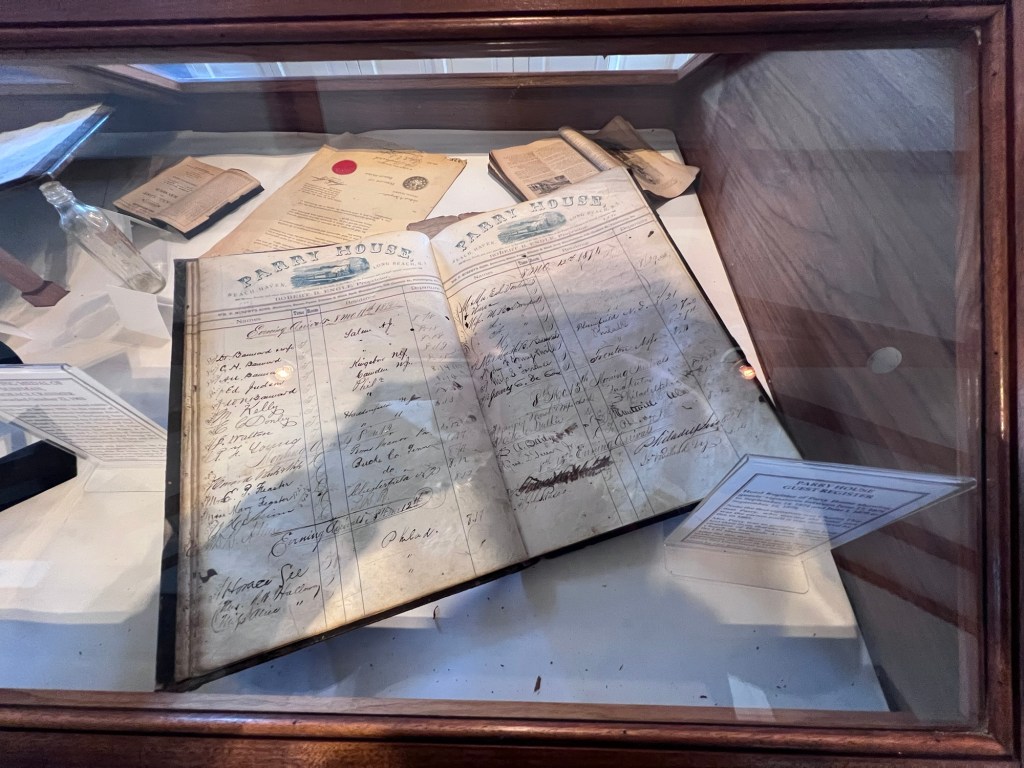
The historic ledger from the Parry Hotel
The library has another fireplace where extensive collection of hotel ledgers and artifacts.
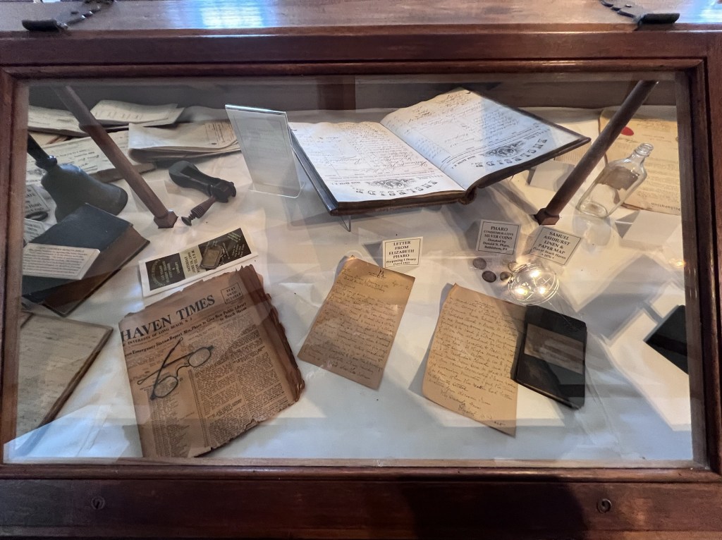
Letters from Elizabeth Pharo proposing the Library in 1923
Short History of the Library:
(From the library pamphlet)
Mrs. Pharo presented to the library board a proposal to build the library entirely at her own expense. She contacted Philadelphia architect, R. Brognard Okie to design the library. He chose the model of a Pennsylvania Farmhouse. The library was completed in the Fall of 1924. The museum is now over a hundred years old.
The dedication to Elizabeth Pharo, who dedicated the museum.
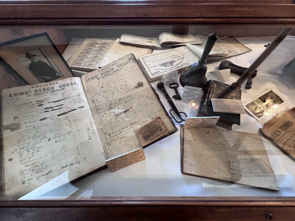
The Long Beach Island House Guest Ledger and historic items from the historic Bond Hotel
The records of the past resort town Long Beach Island used to be with guests coming from New York City, Philadelphia and beyond.
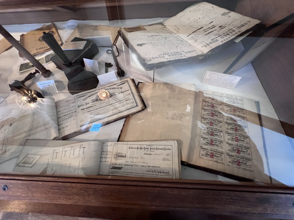
Historic items from the Tuckerton & Long Beach Building Land and Improvement Association
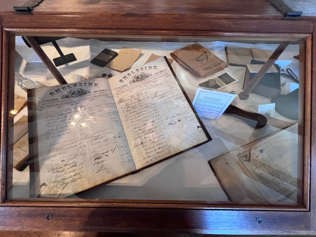
The Engleside Hotel ledger and items from the hotel
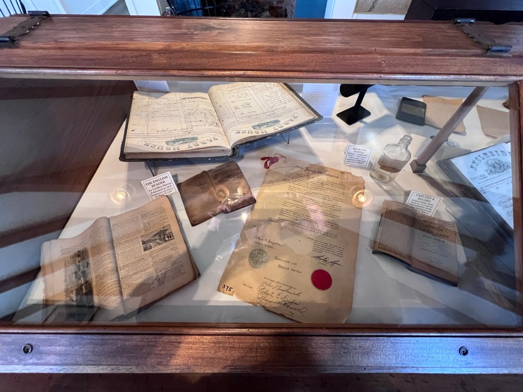
The New Jersey Declaration towards the Declaration of Independence
Historic books and periodicals
The library has an interesting collection of vintage and antique books that have been donated to the collection.
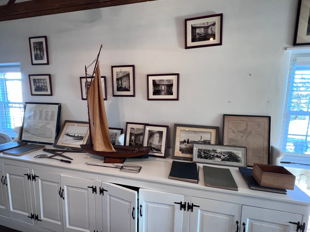
Photo display on historic sites in Beach Haven and pictures of the original library
Some of the pictures are from the old library and the artifacts come from ships ground ashore. The library has a diverse collection of items to view.
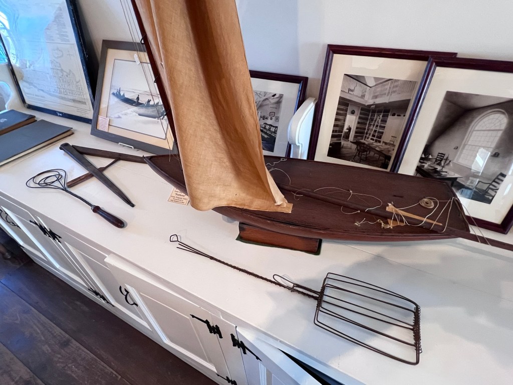
The Compass from the historic shipwreck ‘Fortuna’ that wrecked off Ship Bottom in 1910 and historic boat
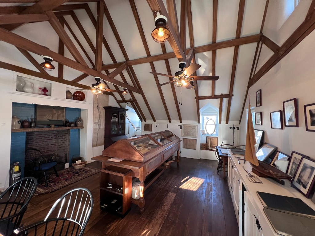
The second floor museum gallery holds the diverse collection of artifacts
The second floor of the 1928 building
The first floor of the library has all sorts of historical artifacts along the walls
The Holiday Kickoff in 2025:
I visited during the library’s Holiday Open House with games, trivia and activities. There was also live music in the afternoon. It was a way that the library gives back to the community. It was a nice family event with good food and nice conversation with people from the community.
The Holiday Open House
The fireplace was going when I was talking to the librarians
It was a very nice family event where patrons families could relax, have something to eat and play games with their children. The Liberians could not have been more friendly and engaging with the public.
The Children’s Room had a holiday challenge
The museum is a rare gem tucked not just on the second floor but along the shelves and tables of the entire historic library giving visitors a chance to see all these historic artifacts mixed in with the library book collection.
The History of the Beach Haven Library:
(from the library website)
Attempts to establish a library in Beach Haven had begun as early as the 1880’s with a gift of books for the town’s children by Dr. Edward Williams. Williams, along with Charles Parry of the Parry House and the Baldwin Hotel, was a partner in the Baldwin Locomotive Works. The library collection was first housed in the home of Samuel Copperthwaite on Engleside Avenue. It was later moved into one of the Sunday School rooms of the Kynett Methodist Church, which had been built in 1890.
After the old Quaker Meeting House was donated to the town by Walter Pharo, the Reverend Alexander Corson of the Methodist Church began work, with the help of his wife, to turn the former Meeting House into a viable library. By the time they left in 1908, it was well on its way.
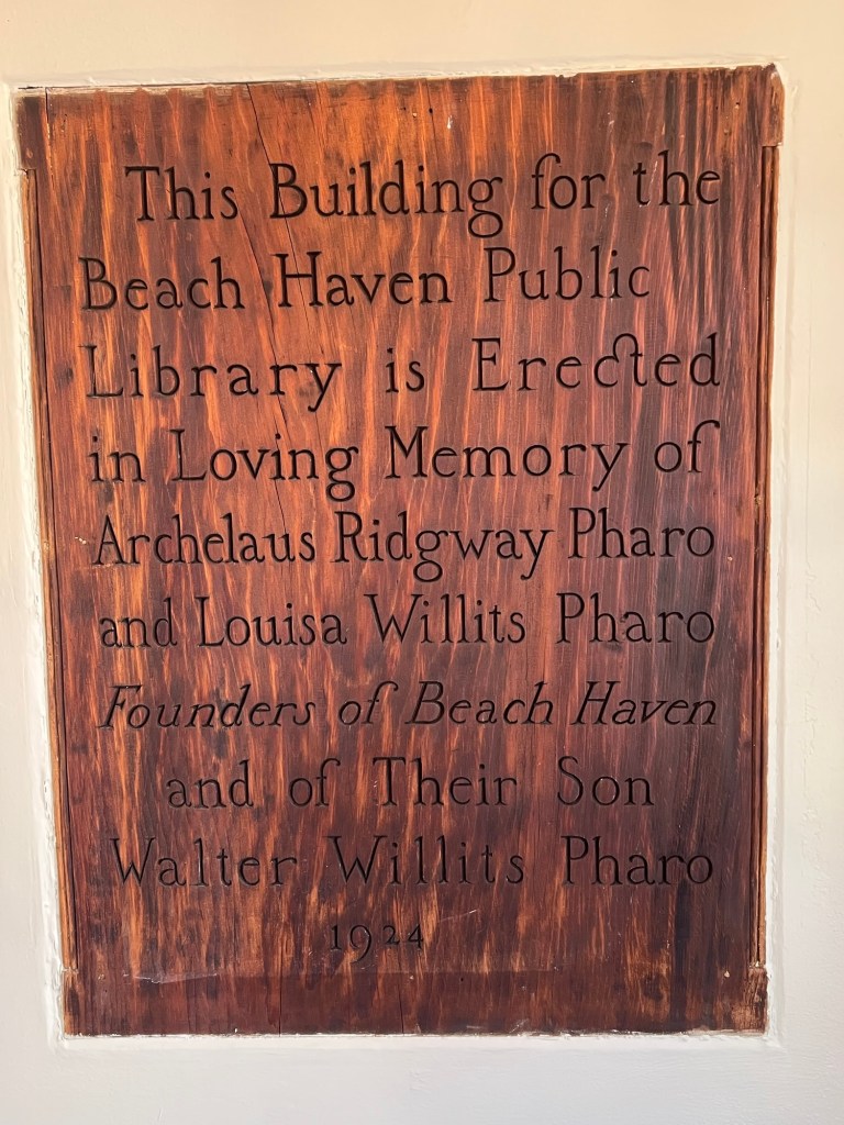
In 1923, Walter’s widow, Elizabeth Pharo, presented the library’s board of trustees with a proposal to build, entirely at her own expense, a new library for the town. It would be sited two blocks away from the Methodist church on a corner lot which she owned at Third Street and Beach Avenue. The library would be dedicated to the memory of her husband’s parents, Archelaus Ridgway Pharo and Louisa Willits Pharo–the founders of Beach Haven–as well as to her late husband Walter.
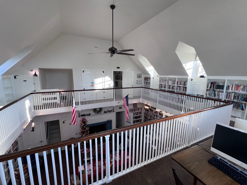
Mrs. Pharo contracted R. Brognard Okie, one of Philadelphia’s finest architects, to design the new library. He chose as his model a Pennsylvania farmhouse–not an early lifesaving station, as some believed. Unlike a traditional farmhouse, however, it would be constructed entirely of brick and steel and include several stunning features: three working fireplaces, a vaulted ceiling, and an interior balcony encircling the first floor.
Tons of concrete were poured and steel girders for the new, two-story structure were already up by the spring of 1924 on the southeast corner of Beach Avenue at Third Street. Okie moved to Beach Haven to supervise every step of the construction, which was all done by local builder Floyd Cranmer. Ten railcar loads of bricks were used to build the solid outer walls and it was soon evident that the town was to have the finest library on the New Jersey coast.
As the library neared completion in the late fall of 1924, its beauty was already drawing praise. Every window in the structure was framed with long shutters of pale green, which gleamed against the white brick exterior. A sweeping, multi-dormered black roof added a grace seldom seen in a public building. Surrounded by a low, white picket fence and later, a well-kept green lawn, it added an incomparable dignity to what, in that time period, was the town’s main street, Beach Avenue.
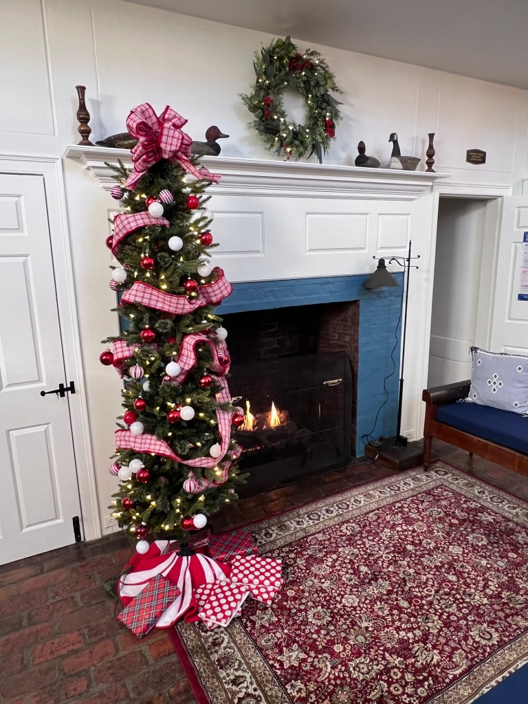
There are two large colonial-style working fireplaces on the first floor. One is in the main room and the other is behind it in the long back room on the ocean side of the library. Today this room houses the Mystery collection and its solid, ten-foot table makes it useful as a meeting room. In the early years, however, it served a different function–it was designated as the men’s reading room, and there male patrons could sit in large comfortable chairs to read magazines and newspapers. It was well lit by two tall French windows and it opened out onto the screened porch on the north side.
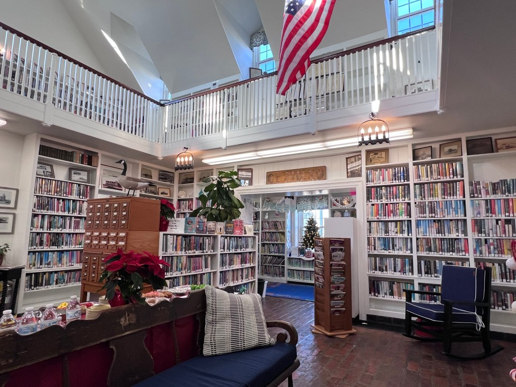
The main reading room with its vaulted ceiling is encircled with a balcony reached by a spiral stone staircase, its steps topped with thick slabs of slate. The balcony flooring is of oak, as are all of the spindles in the railings. The upstairs walls are lined with books. One great window on the west side rises ten feet to the ceiling. The rest are all set into dormers. On the east wall behind the upstairs balcony there is a door where one may step down into a well-furnished little museum with high, beamed ceilings and a huge stone fireplace. It is filled with old hotel registers, deeds, diaries, photographs and other mementos of Beach Haven’s vibrant history.
The Beach Haven Public Library is a prime architectural treasure on Long Beach Island and a direct link to a colorful past that is the town’s most precious heritage. Mrs. Elizabeth Pharo’s gift to the town, itself now almost 100 years old, is as stunning as the day it was built. The taxpayers who support it are proud of its status as the only independent library in Ocean County and have chosen to keep it that way.
Don’t miss all the historical sites and interesting restaurants of this wonderful NJ beach town.
Somers Point, NJ is such a picturesque and historical town with lots of historical sites and delicious restaurants to visit. It is fun to just get in the car and drive the Historic District and see how the town has grown and developed.
I took time out of my walking project in Manhattan after finishing the Chelsea neighborhoods, walking the 13-mile Broadway walk for the sixth time and preparing to do “The Great Saunter” on my own next week to go ‘down the shore’ as we say in New Jersey (it’s never ‘Down to the Shore”, that takes too long).
I had never been to Somers Point, NJ before. It is a small waterfront community across the bay from Ocean City, NJ, which is a popular resort and recreation town. Somers Point is low key with wonderful restaurants and bars, a popular waterfront and beaches on The Great Egg Harbor Bay and beautiful little turn of the century beach homes and a town steeped in history. I read about three historical spots on Shore Drive in the heart of the Historic District and had wanted to visit them.
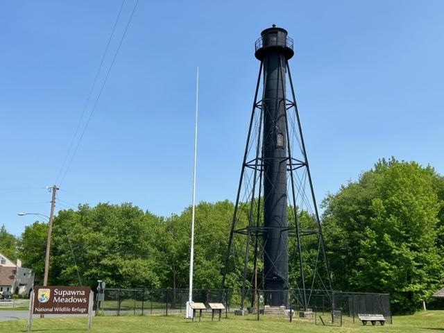
After touring Finns Point Lighthouse in the front of the park, I drove to the back of Fort Mott State Park to tour the rest of the park and explore the old fort. Talk about a real surprise and a a real treat. Talk about views of the Delaware River. On a sunny afternoon, the sun really reflects off the water and makes the most amazing light show.
I walked up the Parapet, the massive concrete wall that used conceal the guns that protected the bay and the river. It was a impressive piece of construction and you could see where the guns had been mounted. You could climb up and down the stairs to get from one part to the other and enjoy the views.
The gunnery
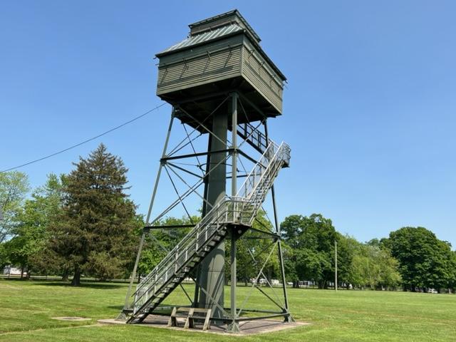
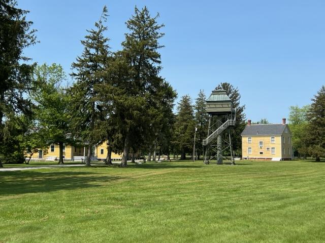
I passed the old Western Fire Control tower that was closed for the day and open by appointment only. That must have offered some spectacular views.
The Western Fire Control Tower
I then toured the Visitors Center and saw all the artifacts from the war, a timeline of the Fort and the history of the fort. Take time to look at each case and you will see how the fort developed, the types of things used at the fort and the people who were stationed here and their stories. It also offers bathrooms.
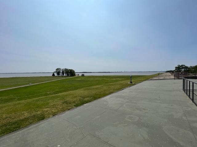
The best part of the Fort Mott State Park is just walking around the lawn and enjoying the sunshine and river breezes on a hot day. The blue skies with the sunshine gives you a sense that it was not just a place of protection but Mother Nature lending her hand to offer a spectacular location to just stop and wonder what would it been like if something happened here during the war. Would it withstood the assault?
The best part of the park is just to walk around the lawns and enjoy the river views.
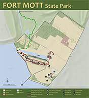
Map of Fort Mott State Park (NJ State Parks.org)
The History of Fort Mott:
(From the Fort Mott State Park Pamphlet-New Jersey Division of Parks and Forestry State Park Division)
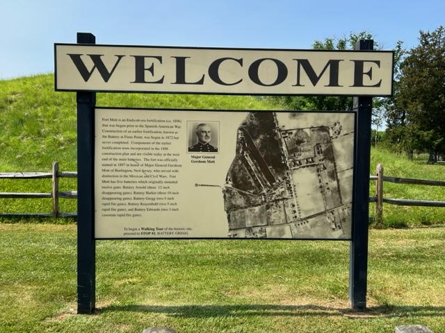
Fort Mott, an Endicott-era fortification was built as part of the federal government’s late 19th century plan to defend the Delaware River. Today it serves as a state park where visitors can tour the remains of the historic fort. The cultural and historic features of this park and its recreational facilities provide a unique blend of activities for the park visitors.
The views from Fort Mott of the Delaware River
Fort Mott State Park is included as a point of interest on the New Jersey Coastal Heritage Trail. A Welcome Center for the trail accommodates displays defining Fort Mott’s place in history and the maritime environment. Fort Mott State Park is on the Delaware River at Finn’s Point in Salem County, New Jersey. This 104-acre park is six miles south of the Delaware River Memorial Bridge, off New Jersey Route 49.
The Finn’s Point Reservation was purchased by the United States Government in the late 1830’s. Originally called “The Battery At Finn’s Point”, the proposed fortification was one of a three-fort plan to protect growing industries and shipping along the Delaware River. Plans for Finn’s Pint specified eleven-gun emplacements with twenty guns and a mortar battery with six complacements. With Fort Delaware on Pea Patch Island in operation since the early 1820’s and the nation involved in the Civil War, the construction of the Battery at Finn’s Point was delayed until 1872. At that time, only two-gun emplacements and five magazines in the mortar battery were completed before construction was halted due to budgetary constraints.
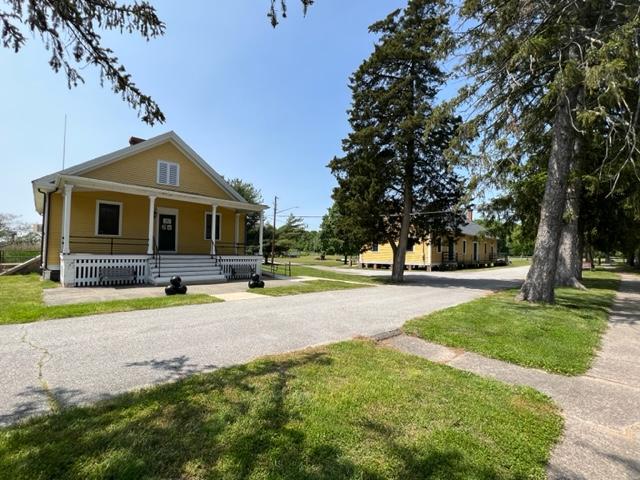
The headquarters buildings
With advancements in military technology made during and after the Civil War, the United States defenses were dangerously inadequate. In 1885, President Grover Cleveland, at the request of Congress, appointed the Endicott Board, named after its Chairman William Endicott, the Secretary of War. The board, which consisted of both military men and private citizens, studied the existing coastal defenses and developed a coastal defense plan for the United States. This plan determined where defenses and developed a coastal defense plan for the United States. This plan determined where defenses should be built or improved, the order in which the work would proceed, the quantity and type of guns that would be placed at each fort and other considerations.
The signage
The main defense concept of the Delaware River was dispersion of armaments into three separate fortifications. The original plan for the Battery at Finn’s Point was abandoned and construction of new fortifications began in 1896 in anticipation of war with Spain, the Spanish-American War. This fortification was officially renamed Fort Mott on December 16th, 1897, to honor Major General Gershom Mott. Mott, a native of Bordentown, NJ was a decorated veteran of the Mexican American and Civil Wars. Fort Delaware was upgraded, and construction of Fort DuPont began during this same time period.
The signage
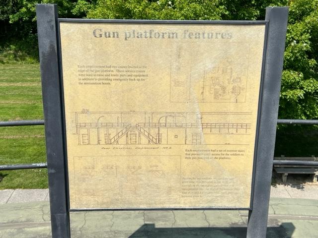
At Fort Mott, large caliber weapons, three 10 inch and three 12-inch guns were installed on disappearing carriages. The gun emplacements were located behind a 750 foot long and 35-foot-thick concrete and earthen embankment, which was sloped to form the ‘parapet’ wall. These guns had an effective range of seven to eight miles and shot projectiles that weighed 617 and 1000 pounds respectively. Beneath the six-gun platforms were powder and shell magazines, ammunition hoists, a telecommunications system and an electric generating station. Two batteries each with 5-inch rapid fire guns and one battery with two 3-inch rapid fire guns were also part of the defenses, designed to counter fast moving smaller warships which might evade the large caliber guns. They also protected the fort from potential land attack. Fort Mott was a completely modern installation for its time period.
The Fort Mott headquarters
Two steel control towers were later built to improve aiming of the guns. Observers stationed in the towers, in conjunction with plotting room personnel, directed the gunfire of the 10 inch and 12 inch guns. The tower near the river on the northern end of the emplacement was built in 1902 and was used to aim the 12 inch guns of Battery Arnold. The tower near the park office was built in 1903 to help aim the 10 inch guns of Battery Harker.
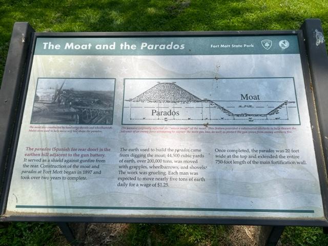
Behind the main emplacement are the parados and the moat. ‘Parados’ is Spanish for rear door. These provided the rear defenses for the fort. The parados was constructed using the fill from the moat. Landscaping around the military reservation helped camouflage Fort Mott from attack by potential enemy ships.
Fort Mott was self-contained military community. The post had over 30 buildings, including two large barracks, non-commissioned and officer’s housing, a hospital, a post exchange, a library, a guard house, a stable, YMCA and a school for the soldier’s children. The Delaware River was the main transporation infrastructure for Fort Mott; munitions, supplies and construction materials arrived at the fort by barge.
WIth the construction of Fort Salisbury near Milford, Delaware shortly before WWI, Fort Mott, Fort Delaware and Fort DuPont became obsolete. The three forts remained active defense installations until after WWII, when they were phased out. Troops were regularly stationed at Fort Mott from 1897 to 1922. The federal government maintained a caretaking detrachment at the fort from 1922 to 1943. During this time, Fort Mott’s guns were dismantled and sent to various locations.
Visiting Fort Mott
Fort Mott was declared “surplus property” in 1943. Finn’s Point National Cemetery (dedicated a National Cemetery on October 3rd, 1873 because of the Confederate prisoners of war buried there) was separated from Fort Mott at that time. In 1947, the State of New Jersey purchased Fort Mott, as a historic site from the federal government. On June 24th, 1951, it was opened to the public as Fort Mott State Park.