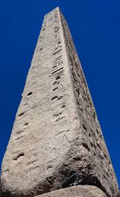
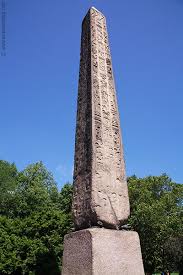
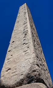
I always admire Cleopatra’s Needle whenever I am touring Central Park West after an afternoon at the Metropolitan Museum of Art. The obelisk sits in back of the Metropolitan Museum of Art on Fifth Avenue and the pathways behind the museum lead to the site.
It is one of the few place where you can see hieroglyphics up close unless you are in Egypt and the sad part is that the natural surroundings are wearing them out. Still it is one of the most interesting outside artifacts that Manhattan and New York City has on display. Take time to observe all four sides of the obelisk and observe the writings.
Sometimes I think the tourists miss this interesting artifact and how it got here from Egypt.
The History of Cleopatra’s Needle:
(From Wiki)
Cleopatra’s Needle (obelisk) was erected in Central Park, just west of the Metropolitan Museum of Art on February 22, 1881. It was secured in May 1877 by Judge Elbert E. Farnam, the then United State Consul General of Cairo as a gift from the Khedive for the United States remaining friendly neutral as the European powers, France and Britain, maneuvered to secure political control of the Egyptian government.
The obelisk is a twin of the obelisk given to London at the same time and come from the ancient city of Alexandria. The name is a misnomer as they have no relationship with the Ptolemaic Queen Cleopatra VII of Egypt and were already over a thousand years old in her lifetime (please see the Wiki link attached to the blog for more information on the obelisk).
The obelisk is free to the public and can be seen by taking the path behind the Metropolitan Museum of Art. It is open all day.
Bloggers Note: Over the holidays we visited this national park in Delaware when we were visiting my mother. We went to see the wild horses. The horses were so used to seeing humans that they just ignored us. On a beautiful day, it is nice to visit the island and just look at the ocean.
Barrier Islands are among the most dynamic land forms on earth. From ocean to bay, Assateague Island is defined by change.
The rhythms of tides and seasons shape the island. The smallest gust of wind or gentlest of waves moves sand in a ceaseless rearrangements of island terrain. While summer waves and long-shore currents may build a wide beach, most of the year sand is scoured from the shore and moved southward leaving a narrow, steep shoreline. Storms can create inlets or fill them in. They can cut away dunes and wash sand across the island. The retreating dunes mark the islands’s westward movement. New habitats are created-old ones are reinvented. Plants and animals shift and adapt in counterpoint to these changes. On Assateague Island, nature’s rhythmic processes are a brilliant display.
Natural zones shaped and reshaped by wind, wave and current characterize Assateague Island. Distinct plant and animal communities have adapted to each zone. This north-facing view depicts these habitats, left to right from bay to ocean.
Coastal Bays:
Chincoteague Bay and two smaller bays separate Assateague from the mainland. They provide an environment rich in aquatic life and vital to ocean ecosystems. The warm, shallow waters create a productive nursery for mussels, crabs, clams, terrapin and fish. Twice a day, tides rejuvenate these areas and ferry aquatic animals out to the ocean or into the relative safety of the bays.
Just beneath the bays’ surface, in the shadowy world of the seagrass meadows, diverse marine life thrives. Blue carbs molt, hidden in the grasses. Young fish find refuge from predators. Seahorses and pipefish, vulnerable in open water, depend on grasses for anchorage and safe haven. Mud-loving creature cluster around roots. These are the secret gardens of the coastal bays.
Salt Marsh:
Once considered worthless, salt marshes are incredibly valuable areas. They are complex ecosystems defined by the constant ebb and flow of salt water. Tides transport nutrients into the marsh and detritus (decaying plants and animals) out into the bay. Scavengers, like snails, amphipods and fiddler crabs, feed on detritus. They in turn are food for high tide visitors to the salt marsh like fish and crabs. When the tide is out, a banquet is exposed in the mudflats where birds feast on the small creatures that inhabit this transitional area. Few plants can thrive in a salt marsh. Cordgrass, salt meadow hay and saltwort are among those that can. These plants create shelter for willet and rail and hunting grounds for Northern harrier and raccoon. Horses can often be seen grazing on marsh grasses.
Maritime Forest:
The forest edge is bordered by a shrub thicket on both bay and ocean sides. This is another transition area between distinct communities. Greenbrier, highbrush blueberry and bayberry thrive here. Trees, stunted and sculptured by salt-laden winds, mingle with shrubs and vines. Guarded by this thicket, the maritime forest is sheltered from much of the wind and provides habitat for some of Assteague’s other residents. While lobolly pine is the dominant tree, southern wax myrtle, American holly and red cedar survive in the shaded understory. The forest is home to white-tailed and sika deer, raccoons and birds like the yellow-rumped warbler and Eastern towhee. Predators like great horned owls and red fox hunt small mammals, birds and reptiles in the woodland.
Dunes and Upper Beach:
The dunes and upper beach are always in motion. Windblown sand and salt dictate the plant and animal life of this stark environment. Less salt-tolerate plants like beach heather and seaside goldenrod hide on the leeward side of dunes, sheltering the small but fierce dune wolf spider as it hunts its insect prey. Plants trap sand, elevate dunes and form a malleable barrier against the assault of wind and water. Where overwash does occur, piping plovers and other birds find prized nestling habitat. The primary beach front dunes are dominated by American beach grass, with its extensive root system and ability to tolerate relentless exposure to the elements. Many creatures visit the beach but ghost crabs enjoy a great view from oceanfront burrows.
The wild horses on the island are a main attraction
Ocean:
So visually compelling are the surf and ocean that it is easy to forget how much happens beneath the surface. Mole crabs, coquina clams and small invertebrates thrive in the inter-tidal zone where crashing waves deliver food and render all homes temporary. Shore-birds dance away from the surf while attempting to dine on creatures concealed in the sand.
The ocean food web starts with phytoplankton. Most other marine life is dependent upon these tiny plant for survival. The oceans support more than half the species on earth, yet 95% of these waters remains unexplored, offering endless possibilities for discovery.
Surf and Seashore Safety:
National Park Service lifeguards cover North Ocean Beach (Maryland) and Tome Cover Beach (Virginia, in the National Wildlife Refuge) in Summer only Assateague State Park also had lifeguards in the summer.
Mats and floats except U.S. Coast Guard-approved personal flotation devices are prohibited at all life-guarded beaches. Surf conditions are posted in multiple locations near the beach. Learn about rip currents (seaward currents) and their danger at http://www.ripcurrents.noaa.gov. Never swim alone.
Prevent overexposure to sunlight with sunscreen or protective clothing. Biting insects are abundant spring through autumn. Insect repellent and/or protective clothing are recommended.
About your visit:
Assateague Island National Seashore is open year-round. Camping is allowed in designated areas only. Campers may not bring firewood from out of state. Firewood must be purchased locally. Assateague Island Visitor Center is open from 9:00am-5:00pm year round except Thanksgiving Day and December 25th. Here you can get information and see aquariums, a touch tank, exhibits, maps and a film about the island’s wild horses. You can register for camping and get permits for the Over Sand Vehicle (OSV) zone at the campground office on the island. Dates and hours vary for Toms Cove Visitor Center. Contact the park for information; phone and website at right.
Chincoteague National Wildlife Refuge, managed by the U.S. Fish and Wildlife Service is open year-round. The Herbert H. Bateman Educational and Administrative Center is open year-round except December 25th and January 1st. Hours vary seasonally. Contact the refuge for information; phone and website at right.
Assateague State Park’s beach and parking lot are open year-round, 9:00am to sunset. Contact the park for camping information; phone and website at right.
Accessibility: Visitor centers, restrooms, bookstores and some trails are wheelchair-accessible. Service animals are welcome. Call each area for more specifics.
Regulations: Call or visit each area’s website for regulations on firearms, pets, personal watercraft and more.
Assateague Island National Seashore is one of over 390 parks in the National Park System. To learn more about national parks, visit http://www.nps.gov.
The Parks:
Assateague State Park: Maryland’s only oceanfront state park has two miles of beach for swimming, surfing and fishing. Lifeguarded areas are available Memorial Day through Labor Day. The campground is open late April through October Campsites include fire rings, picnic tables and bathhouses with warm showers. A small number of electric hookups are available. Reservations are recommended. Alcohol is prohibited in all areas of the state park. A park store is open seasonally, offering food and souvenirs. Pets are permitted with restrictions in designated areas. The marina/boat launch; located on the mainland side of the Verrazano Bridge, is a popular fishing and crabbing spot and features seasonal kayak rentals. Visit the Nature Center in the campground for live animal exhibits, arts and crafts and family fun. Entrance fees apply. Assateague State Park offers something for everyone.
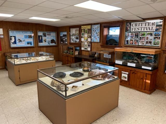
Explore the national seashore and discover the mysteries of a barrier island. Before traveling across the Verrazano Bridge to the Maryland end of the island begin your visit at the Assateague Island Visitor Center. Watch a film about the wild horses. The visitor center also includes restrooms, a gift shop, exhibits, aquariums and staff to provide information and orientation. Touch a sea snail or horseshoe crab. Ask at the information desk for a Junior Ranger booklet and have some family fun.
Enjoy the park roads by bike. Observe wild horses feeding in the salt marsh. During summer, visit the Beach Hut for supplies and beverages and swim at the lifeguarded North Ocean Beach. Camping is available a year-round and reservations are encouraged April 15th through October 15th. Expect rustic conditions, vault toilets and coldwater showers. Electric hookups are not provided. Pets are permitted in designated areas. Avid paddlers and hikers should not miss the countryman camping experience. The Over Sand Vehicle (OSV) zone provides an adventurous getaway (permit required). Nature trails, beach-combing and ranger-led programs will bring back childhood memories, while guided kayak tours and campfire programs will make new ones. Entrance fees apply.
Originally established to protect migratory birds, the refuge today is a destination for birders, beachcombers, anglers and outdoor enthusiasts. Careful management of freshwater pools and marshes provides ideal habitat and feeding areas for migratory waterfowl, shorebirds and other wetland-dependent species. The refuge is a paradise for birders and photographers. Walk or bike the trails to catch a glimpse of the rare Delmarva Peninsula fox squirrel or the Chincoteague ‘ponies’. Drive the Wildlife loop around Snow Goose Pool between 3:00pm and dusk. Expect Toms Cover Hook to be closed during the nesting season of the threatened piping plover. Visit the Refuge-operated Herbert H. Bateman Educational and Administrative Center and the National Seashore-operated Toms Cove Visitor Center for exhibits, programs and assistance. There is no camping in the refuge, so check in the nearby community of Chincoteague. A lifeguarded beach is available Memorial Day to Labor Day. Pets are prohibited Entrance fees apply.
Chincoteague National Wildlife Refuge
8231 Beach Road
Chincoteague, VA 23336
(757) 336-6122
chinco.fws.gov
Disclaimer: This information is taken directly from the National Park Service pamphlet on Assateague Island National Seashore State Park. It is really a fascinating place. It covers both Delaware and Maryland. Please check out the website and call for more information. Don’t miss this interesting ‘gem’.
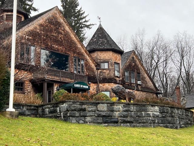
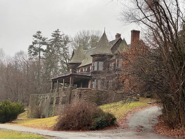
This interesting little ‘gem’ is located up on the hill next to Blauvelt Mansion and is easy to miss. You will see the signs as you drive past it.
Open: Wednesday, Thursday and Friday: 10:00am-4:00pm/Saturday and Sunday: 2:00pm-5:00pm
Fee: Free donations accepted
The Blauvelt Art Museum is funded by the Blauvelt-Demarest Foundation and is a member of the New Jersey Association of Museums, the Mid-Atlantic Association of Museums and the American Association of Museums.
The Blauvelt Art Museum was established in 1957 by the Blauvelt-Demarest Foundation, a legacy of the late Hiram Blauvelt, philanthropist, conservationist and collector. Through the contribution of his private wildlife art and big game collections, he hoped to promote the cultural value of wildlife art and the need for conservation of its subject and their habitats.
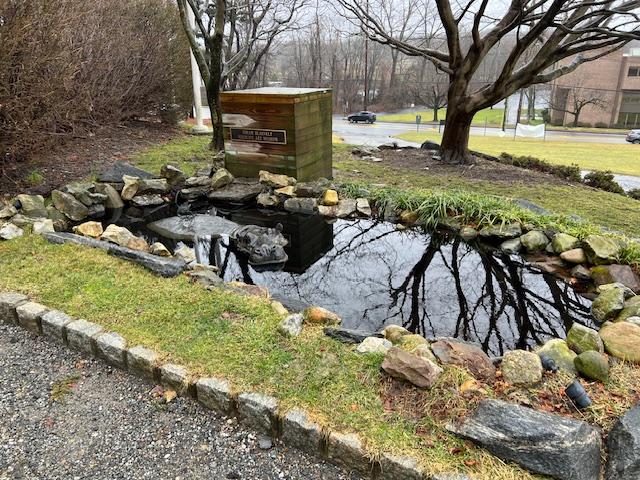
The fountain outside the museum
The entrance to the museum.
During the early part of the 20th Century, wildlife was believe to be abundant. Many dedicated conservationists, notable Theodore Roosevelt, gathered animals from their natural habitats for museums. The beauty of the animals could then be viewed by many.
The entrance to the museum.
Like Roosevelt, Hiram Blauvelt realized the value of his collection and wanted to share it with the public. It was his interest and desire to share his far ranging adventures, his stories of explorations and his collection of these animals. Hiram hoped to educate the coming generations to the diversity and beauty of the wildlife kingdom. He especially wanted to enlighten the public to the challenges we face to preserve the marvels of wildlife and their natural environments.
The interesting artwork by the carriage house of pelicans.
The Pelican art outside the museum.
Founded in 1957 as a natural history museum, it introduced students, scouts and youth groups to the need to support wildlife and habitats conservation. Visiting artists created drawings and paintings from close observations of the specimens.
Embracing Penguins outside the museum dedicated to Wildlife Art.
Twenty-five years later, the Board of Directors of the Blauvelt-Demarest Foundation decided that the original objectives would be best achieved by redesigning the museum to feature the works of contemporary wildlife artists, built on the artistic foundation of the Blauvelt’s early collection of works by Charles Livingston Bull (notably a resident of Oradell at one time), Carl Rungius and a complete Audubon Folio of birds of America.
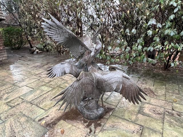
The interesting wildlife artwork just outside the museum.
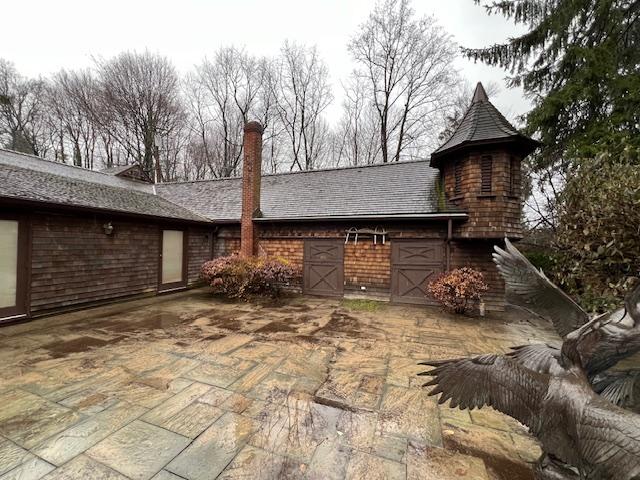
The Blauvelt Museum, located in an 1893 cedar shingle and turret carriage house, underwent extensive renovations to accommodate its new and expanded mission. The original carriage house was re-designed to include a large reception area, 4 mini galleries and museum offices, all with original materials from the historic building and preserving its aura.
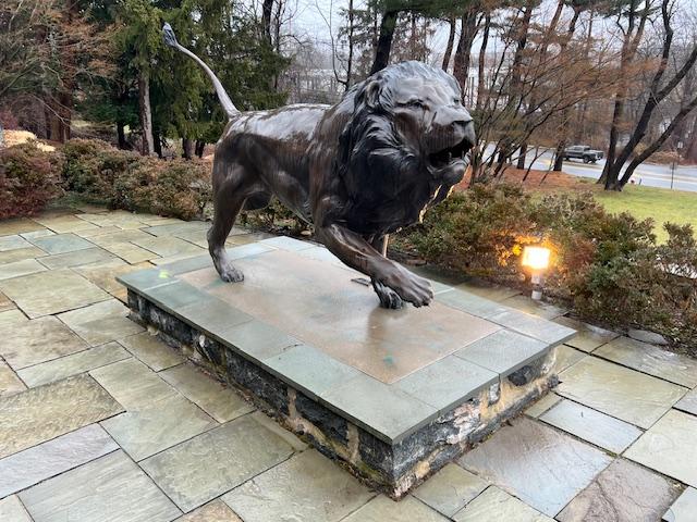
The Blauvelt Art Museum lion statue “Fides et Virtus” by artist Aaron Yount outside the museum.
Four new galleries were added, providing wall space for mounting museum quality flatwork and generous room for pedestals to hold creative sculpture. Substantial artificial lighting is augmented by natural light from the north.
High on a hill overlooking the Hackensack River, the Oradell Reservoir and parklands to the east, the entrance to the museum is through a curving stone and slate terrace, framed by large oak trees and other indigenous foliage, which serves as a natural sculpture garden.
The open air museum just outside the museum itself dedicated to wildlife art.
Many of its visitors today, accompanied by their children, are revisiting the museum which they first visited with their parents in past decades. The Blauvelt treasures their comments remarking on the greater beauties of its collections, while preserving the ambiance of their memories.
The inside galleries of the museum (from their Facebook page).
Artist in Residence:
The Blauvelt Art Museum established an Artist-in-Residence program in 1985. Artists were selected on the basis of their artistic ability and promise and on their commitment to the museum’s mission for the need for conservation to protect wildlife and their habitats. The museum provides a furnished home for the artist on the museum property, including a studio, painting supplies, etc. Artist-in-Residence have given lectures, led round table discussions, visited schools and demonstrated painting and drawing techniques.
The Carriage House from the outside.
The Current Exhibition (2018):
Artist Brian Jarvi’s African Menagerie is showing right now and the collection has some very interesting and detailed pieces on Mr. Jarvi’s visits to Africa. Don’t miss this exhibition!
The Blauvelt Museum is on the Blauvelt-Demarest Estate.
Disclaimer: This information was take directly from the pamphlet provided by the Blauvelt Art Museum. Please call the museum for any changes to their time schedule and don’t miss the current exhibition.
This historic site has been restored and administered by the Mid-Atlantic Center for the Arts & Humanities in conjunction with N.J. Department of Environmental Protection Division of Parks & Forestry.
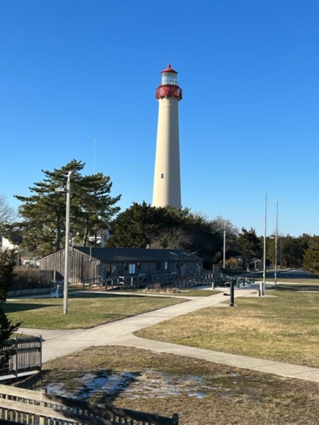
The Cape May Lighthouse: Climb the 199 steps of this 1859 vintage tower for a breathtaking view of the Jersey Cape, where the Delaware Bay meets the Atlantic Ocean.
The History of Lighthouses in New Jersey
Over the past 30 years, MAC has totally restored the Cape May Lighthouse. A fully accessible Visitors Center is located in the adjacent Oil House as well as a Museum Shop stocked with lighthouse and maritime must haves.
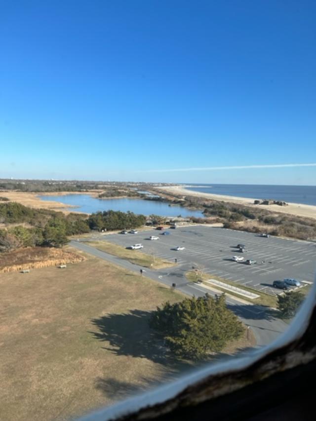
The view of the beach from the lighthouse
The Cape May Lighthouse
Lighthouse information story boards
Lighthouse FAQ
Frequently asked questions about the Cape May Lighthouse
Questions about the structure:
*How Tall is the lighthouse? The lighthouse is 157 feet 6 inches tall from the ground line to the ventilator.
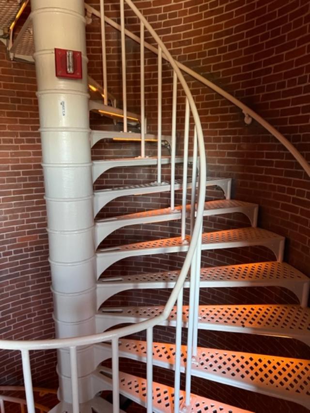
*How many steps are there to the top? There are 217 steps from the ground to the top with 199 steps in the tower’s cast iron spiral staircase.
The staircase going to the lighthouse lens
Looking down the stairs on the way back down
* How old is the Lighthouse? The Cape May Lighthouse was built in 1859 and is the third fully documented lighthouse to be built at Cape May Point. The first was built in 1823; the second in 1847. The exact locations of the first two lighthouses are now underwater due to erosion.
*How thick are the brick walls? The Lighthouse actually has two separate walls. The outside wall is cone-shaped and is 3 feet 10 inches thick at the bottom and 1 foot 6 inches thick at the top. The inside wall is a cylinder with 8.5 inch thick walls which support the spiral staircase. The walls were designed to withstand winds several times above hurricane force.
The view on the way up the lighthouse
*Is the beacon still working? Yes, The Coast Guard continues to operate the light as an active aid to navigation. The light is visible 22 miles out to sea and flashes every 15 seconds. A lighthouse’s flash pattern is called its ‘characteristic’, every lighthouse has its own light characteristic and exterior paint scheme (called a daymark) so that ship captains can tell them apart.
The lighthouse lens
The lighthouse lens
*What were the two small rooms on either side of the entrance hallway used for? They were storage rooms that held tools, implements and fuel for the lantern before the Oil House was built. The keeper also used one as a small office.
The lighthouse office
*Who owns the Lighthouse? The State of New Jersey owns the Lighthouse but the Coast Guard maintains the beacon apparatus. The Mid-Atlantic Center for the Arts & Humanities (MAC) in Cape May leases the Lighthouse from the State with the mission of restoring the structure and operating it as a historic site.
View from the top of the lighthouse
View from the top of the lighthouse
Cape May Lighthouse
*Questions about Lighthouse Keepers and their responsibilities
*Who worked at the Lighthouse? The Lighthouse was staffed by keepers who worked for the U.S. Lighthouse Service. Cape May’s lighthouse generally had one head keeper and two assistants. They carried the oil to the top of the tower every day to power the light and kept the lens apparatus clean and in working order. Keepers’ pay averaged $600.00 a year around the turn of the 20th century.
*Where did the keepers live? There were two houses built right next to the Lighthouse around 1860 for the keepers and their families. One has since burned but the other is still standing on the other side of the fence near the entrance to the tower.
Important Dates: Cape May Lighthouse
1853-First recorded lighthouse constructed. The 1823 tower was 68 feet tall and its location is now underwater due to erosion.
1847-The second lighthouse was built. It was a 78 foot tower located directly in front of the present tower, just beyond the present shoreline. It was replaced by the present lighthouse because it was poorly constructed.
1857-The Army Corps of Engineers began construction on the present tower, which cost $40,000 to build. The first order Fresnel lens, which is now in the Cape May County Museum, cost about $15,000.
1859-The Lighthouse was first lighted on October 31. The next year, two lighthouse keepers dwellings were built. The one remaining is now used by the State Park Service.
1893-The oil house was constructed.
The Oil House
1902-One of the keepers’ dwellings was enlarge to provide more space for housing the keepers’ families. Three keepers and their families. Three keepers and their families lived at the lighthouse site.
1902-An incandescent oil vapor lamp was installed and replaced the Funck multiple wick first order hydraulic float lamp that dated back to 1878.
1933-The light apparatus was electrified.
1936-The light apparatus was automated which eliminated the need for lighthouse keepers being permanently stationed at the tower.
1939-The United States Lighthouse Service was discontinued and its equipment and personnel transferred to the U.S. Coast Guard.
1941-The Lighthouse was darkened until 1945 because of the World War II. The Atlantic coast was on black-out due to the presence of enemy submarines.
1946-A DCB-36 rotating light (like an airport beacon) was installed. The original first order Fresnel lens was placed in the Cape May County Museum.
1986-The Lighthouse was leased to MAC by the State of New Jersey Department of Environmental Protection, Division of Parks and Forestry, who in turn leased the structure from the Coast Guard.
1988-MAC undertook public safety improvements that allowed the public to climb to the top.
1989-A grant from the Bicentennial Lighthouse Fund underwrote the restoration of the Lighthouse’s windows and doors.
1990-The oil house was restored and adapted for use as orientation center and museum shop, with funding from the Bicentennial Lighthouse Fund and the New Jersey Historic Trust.
1992-The ownership of the Lighthouse was transferred from the Coast Guard to the State of New Jersey.
1994-Grants from the New Jersey Historic Trust and the federal ISTEA program administered by the State DOT funded painting of the tower and restoration of the lantern and roof.
1998-Grants from the same agencies funded all remaining restoration of the lighthouse structure.
2000-2001-A grant from the New Jersey Historic Trust funded the grounds restoration project.
2002-The Coast Guard installed a modern light known as a DCB-224. It uses parabolic mirrors to focus the beams rather than lenses.
2010-The Friends of the Cape May Lighthouse group was formed. You are cordially invited to join. Call 609-884-5404 or visit http://www.capemaymac.org.
2016-The Coast Guard installed a new, state of the art beacon known as VRB-25 (Variable Rotating Beacon) replacing the DCB-224 that had suffered irreparable damage due to a lighthouse strike.
2017-Lighthouse Tower was repainted with grants from the Cape May County Open Space Board, the National Maritime Heritage Grant program of the National Park Service and South Jersey Industries, augmented by the fundraising efforts of the Lighthouse Keepers and the Friends of the Lighthouse.
*Is the Lighthouse haunted? Exit Zero Ghost Writer and psychic medium Craig McManus has visited the Lighthouse and detected the ghosts of several former keepers and their families. Perhaps you may encounter them yourself on a Ghosts of the Lighthouse Trolley Tour!
Questions about Lighthouse Restoration
*Why is the Lighthouse leased to the Mid-Atlantic Center for the Arts & Humanities (MAC)?
In the 1980’s , the Coast Guard began a nationwide program of leasing lighthouses to private organizations, like MAC, which are capable of preserving them. In 1986, the Coast Guard leased the Lighthouse to MAC, which assumed the responsibility for its restoration, maintenance and operation as a lighthouse museum. In 1992, ownership of the Lighthouse was transferred from the Coast Guard to the State of New Jersey in order to make the restoration project eligible for state historic preservation funding. The state monitors the historical authenticity of the restoration and also makes available to Lighthouse visitors the parking and restroom facilities of the adjacent state park.
The Museum at the bottom of the lighthouse
*What is MAC?
MAC is a non-profit organization with nearly 4,000 members that was founded in 1970 to save and restore Cape May’s Physick Estate and operate it as a historic house museum. The Physick Estate is also home to the Carroll Gallery with an array of changing exhibitions, a museum shop and the Carriage House Café & Tearoom. MAC has also restored the World War II Lookout Tower (Fire Control Tower Number 23) located nearby on Sunset Boulevard. In addition, MAC promotes Cape May’s Victorian heritage through a year round schedule of special events and trolley, walking and historic house tours. MAC is also one of the area’s leading sponsors of the performing arts with its Cape May Music Festival every May and June. Please call 609-884-5404 for details on MAC’s calendar of events or visit our website at http://www.capemaymac.org.
*How much did it cost to restore the Lighthouse?
Since 1987, closed to two million dollars has been spent to restore the Lighthouse and oil house and allow the public to climb safely to the top.
*Is the Lighthouse open to the public?
Yes, Hours of operation vary throughout the year. The tower is open daily, April through November and on weekends most of the rest of the year. The grounds ground floor, tower and watch room gallery are open to the public. All tours of the tower are self-guided.
Disclaimer: This information was taken directly from a pamphlet from the MAC Cape May Lighthouse Museum. Please call the above number or email address for more information on the site. It is well worth seeing just for the view alone.



 blauveltartmuseum.com