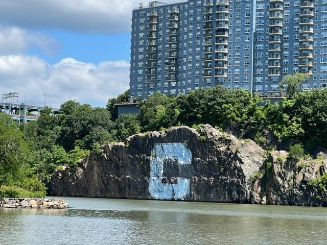
Located in Inwood Hill Park and part of the NYC Parks System. The rock was dedicated on February 2, 1954 by the Peter Minuet Post #1247, American Legion.
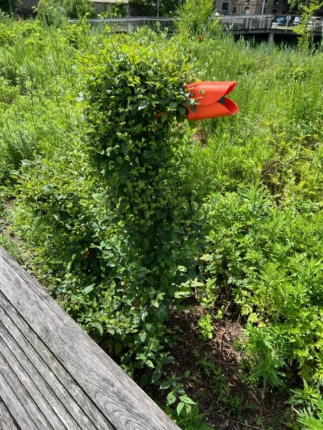
I came across the Shorakkopoch Rock, the noted spot that Peter Minuet has been said to have bought the island of Manhattan from the Indians. No one is too sure where the spot of the ‘transaction’ took place as some feel it may have been closer to downtown by the Bowling Green, where the original Dutch settlement was located or maybe he traveled to them, we will never know. What we do know is that he said the transaction took place under a tulip tree and in this spot used to be a tulip tree that was over 220 years old before it died.
The rock reads:
Shorakkopoch: According to legend, on this site of the rock, principal Manhattan Indian Village, Peter Minuet in 1626, purchased Manhattan Island for trinkets and beads them worth about 60 guilders. This boulder also marks the spot where a tulip tree (Liriodendron Tulipifera) grew to a height of 165 feet and a girth of 20 feet. It was until its death in 1932 at the age of 220 years old, the oldest living link with the Reckgawawang Indians, who lived here. Dedicated as part of New York City’s 300th Anniversary celebration by the Peter Minuet Post 1247 American Legion 1954.
For more information on the rock, please contact the Art & Antiquities at (212) 360-8143.
Disclaimer: This information was taken form the NYC Parks Department website.
Please take time out when visiting Manhattan to see this important piece of the city’s history as the city itself was founded on this very site.
I came across the Muscota Marsh when I was walking the neighborhood of Inwood in 2015 and thought that this is a great site that tourists should see on top of a visit to Inwood Park and the Shorakkopoch Rock where Peter Minuet bought Manhattan from the Indians.
The Shorakkopoch Rock in Inwood Park
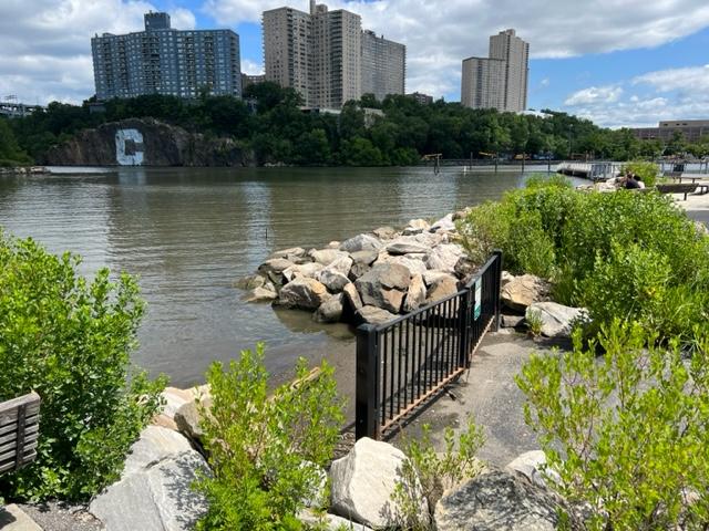
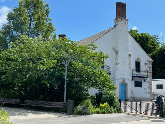
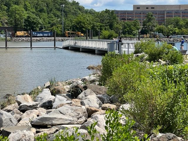
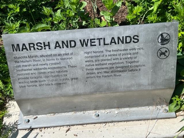
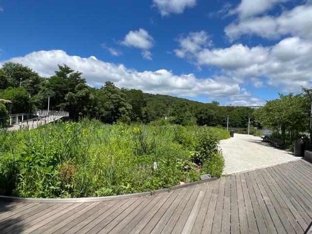
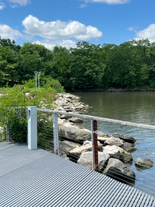
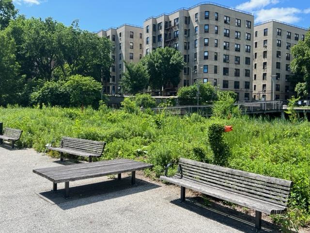
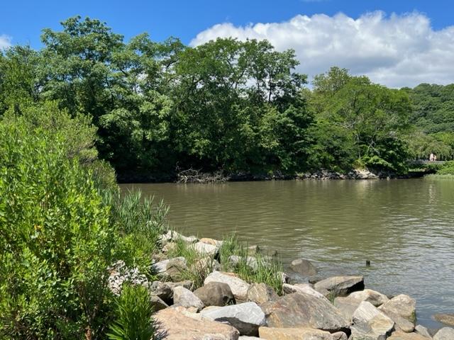
The Muscota Marsh is a one-acre public park in the Inwood section of the borough of Manhattan in New York City, on the shore of Spuyten Duyvil Creek, a section of the Harlem River. It is adjacent to the much larger Inwood Hill Park and Columbia University’s Baker Athletics Complex. The park is notable for its views and for its ecological conservation features.
Muscota Marsh is unusual for having both a freshwater marsh and a salt marsh in such a tiny area. Besides attracting plant and animal life, these wetlands are intended to help filter rainwater runoff and thereby improve the water quality of the river. Other facilities include a dock for kayaks and canoes, benches and walking paths. A wooden deck overlooking the river provides views of Inwood Hill Park, the Henry Hudson Bridge and the New Jersey Palisades.
The Muscato Marsh is right next to the Columbia Boathouse
As this public green space, with a design inspired by tidal flats and mud ways, you can enjoy the educational richness of the marsh from the wildlife observation deck or venture out on to a wooden deck stretching out to the waterway through the native water gardens.
By the boathouse
Because of the close proximity of the salt marsh and the freshwater wetlands, you’ll be able to spot beautiful wading birds like the great blue heron and the snowy egret. You can also see leopard frogs and ribbed among the dramatic colors and textures of the marsh’s native plants.
The Wetlands
Opened to the public in January 2014, the park was constructed by Columbia University as part of a deal to construct the new Campbell Sports Center within its adjacent athletics complex. It was designed by James Corner Field Operations, which is best known for its work on Manhattan’s High Line. It is cooperatively administered by the New York City Department of Parks and Recreation and Columbia, with the university providing maintenance and security.
The wetlands
The park is open all year round and is free to enter. It is right next to the Columbia Stadium.
It is a nice part of the Inwood Park
The Muscato Marsh facing Inwood Hill Park
The clever duck
Disclaimer: This information was taken from the NYC Parks information guide and Wikipedia. Please check this small pocket park out for its beauty and for its importance in the environment.
The marsh during the beginning of the summer of 2023
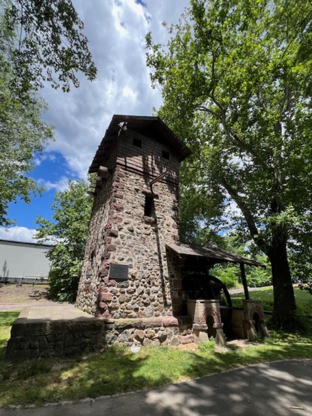
I recently visited the Easton Tower on a beautiful sunny day and it really is a treat to see. It is located on the Saddle River Bike Path, so you can access it from the other side of the park and park on that side of the road for easy access. After seeing the tower, take a walk up and down the Saddle River Bike Path. It is really beautiful to follow the river on a nice day. It is really picturesque and a wonderful place to take pictures and enjoy nature.
The historic Red Mill Marker
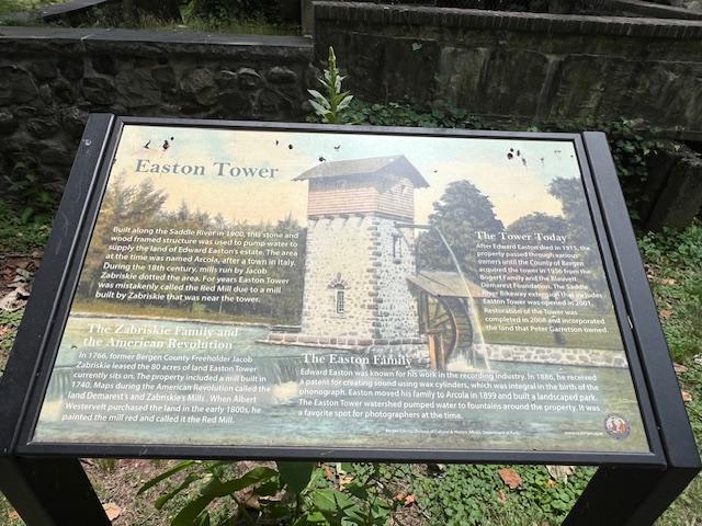
This information is provided by the Bergen County Division of Cultural and Historic Affairs:
The Easton Tower is a unique historic site in Bergen County, NJ. This stone and wood frame structure was built along the Saddle River in 1900 as part of a private landscaped park in the Arcola area Paramus. Surrounded by busy NJ roadways, it is now adjacent to the County’s Saddle River Bikeway.
The front of the tower on the bike path
The tower sits near the Saddle River in the Saddle River Park
Once used to pump water to irrigate and provide a scenic setting for the estate of Edward Easton, it is a 20 foot rectangular, stone-masonry tower topped with a wood-frame structure and a wood-shingle, gabled roof. On the side is a large wood water wheel, which is under a wood-shingle roof. The architect Henry Ihnen designed it.
Easton Tower historical information sign
In the 18th century, this area along the Saddle River and near the heavily used Albany Post Road, was the location of many mills. Jacob Zabriskie, a Bergen County Freeholder during the Revolutionary War had leased the 80 acre mill site around 1766 and in 1771 acquired the mill that had been built in the 1740’s. Revolutionary maps identify it as “Demarest’s and Zabriskie’s Mills.”
The Easton Tower in Saddle River Park
Over time it was rebuilt or expanded and in the early 1800’s painted red by its owner Albert Westervelt. It is at this time it acquired the “Red Mill” name often mistakenly applied to Easton Tower. By the 1800’s, the mill had fallen into disrepair and was demolished circa 1894.
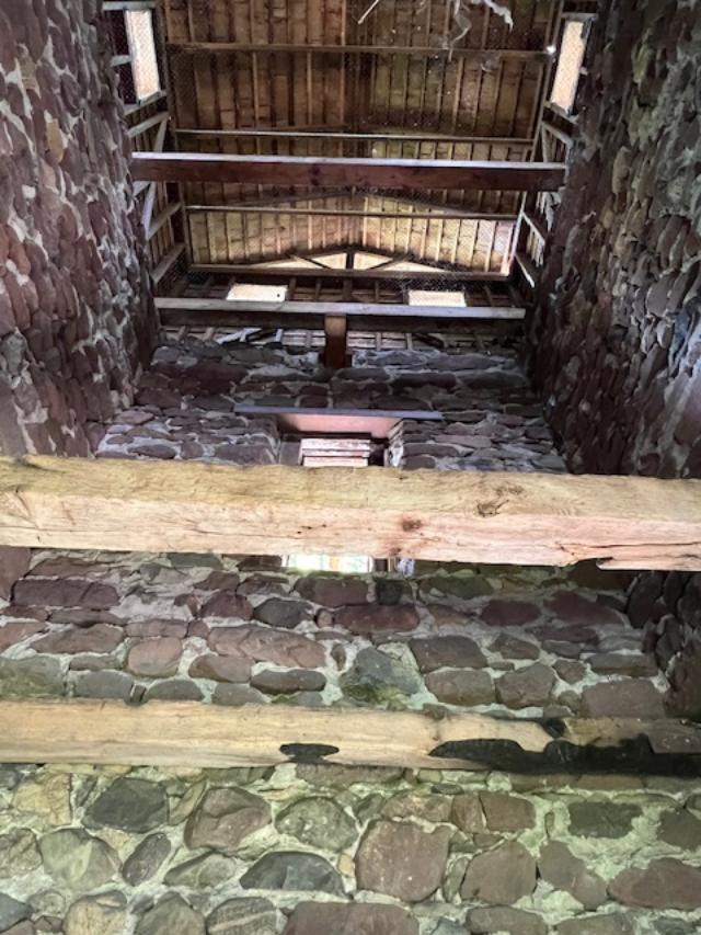
The inside of the tower
The Easton Tower inside
In 1899, Edward D. Easton (1856-1915), bought this almost 48 acre site, which included the mill pond and dam. The area was called “Arcola”. Easton’s father, a teacher, had originally brought his young family to this area and suggested the name for the new settlement after a town in Italy. Edward Easton was a notable figure in American technological history. He started out as a stenographer, reporter and then a court stenographer In Washington DC, covering many famous trials in the 1880’s. After the 1886 patent was granted for the method of engraving sound by incising wax cylinders, Easton went on to make his fortune in the recording industry. He was a founder and eventually president of the Columbia Phonograph Company, which became one of the three major recording companies at the turn of the twentieth century.
The Easton Tower from the back
After opening an office in New York City, Eaton relocated his family from Washington DC to Arcola. He had a large house built on his property and commissioned the design of a landscaped park. The tower, to be built neat the site of the old Red Mill was a functioning structure pumping water to several fountains. There were also rustic bridges, lakes and expansive lawns. The tower was a favorite of photographers and appears in many contemporary postcards. People came from miles around to this beautiful spot to take boat rides and walks and in the winter, ice skate near the tower. Sources list the Easton home and park as having been used in early silent films.
After Easton’s death in 1915, the property went through various owners. In 1931, construction of the Route 208 connection with Route 4 at “the Old Mill at Arcola” provided access to the recently opened George Washington Bridge. This destroyed sections of the landscaped park and isolated the tower. In 1940, the 1.26 acres site was sold at a sheriff’s sale to Clyde A. Bogert. The County acquired the tower from the Bogerts and the Blauvelt-Demarest Foundation in 1956. In 1967, the Bergen County Park Commission dedicated the tower. Easton Tower was placed on the State and National Register of Historic Places and in 2008 was completely restored by the County. It can be viewed from the Saddle River Bikeway and visited year round.
Disclaimer: This information is taken from the Bergen County Division of Cultural and Historic Affairs (C) 2015 pamphlet. The Bergen County Division of Cultural & Historic Affairs received an operating support grant from the New Jersey Historical Commission, a division of the Department of State.
Special Note: I visited the site recently and it is hard to get to by car. It is located right off Saddle River Road and it is off on a odd bend in the road. It is a quick turn to the right so pay attention to the directions.
*Call about touring the facility when court is in session.
The Historic Courthouse at 10 Court Street in Hackensack, NJ.
The Bergen County Justice Complex (including the Bergen County Court House) was placed on the New Jersey and National Registers of Historic placed on November 22, 1982 and January 11, 1983 respectively. The Register nomination referred to the building’s significance as “important to the judicial of the Bergen County Justice Complex-the Court House, the Jail (now called the ‘Old Jail’), and the Administration Building-were the work of important architects and all possessed architectural quality and interesting examples of early 20th century technology.
The Historic marker
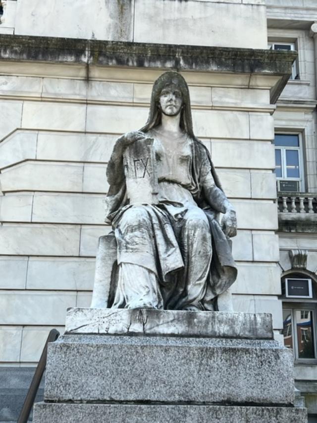
Designed by James Riely Gordon, in the Beaux Art style reflecting monuments of classical Rome and Italian Renaissance, the Court House incorporated rich materials including marble and bronze. With a dome modeled on the U.S. Capital, it incorporated other art forms including painting, sculpture and stained glass. The exterior contains many sculptures including the female statue of “Enlightenment Giving Power” on the dome’s cupola. The dome’s interior is decorated with Tiffany stained glass panels. Three of the courtrooms have elaborate stained glass skylights fabricated by the famous Lamb Studios. Some of the courtrooms also contain large murals painted in the 1930’s by artists working for the Federal Art Project of the Works Project Administration.
The Hackensack Green, Courthouse and Dutch Reformed Church and Cemetery.
The other side of The Green from the Courthouse.
The symbolic value of the Court House was recognized when it was built in 1910-1912. A local newspaper, The Hackensack Republican, wrote on July 7, 1910 that the courts “stand for the protection of rights, for the redressing of wrongs and for the punishment of crime. There are the great safeguards of the freedom of the people…Hence we build these courthouses as temples of justice-substantial, ornate and commodious as the appropriate form for the great duties which are here to exercised”.
Bergen County Court House 1715-1912 with the historic cemetery in the distance.
First Court House 1715: The Court House was combined jail and courthouse built on the site of three blocks south of the present County Administration Building. It was located in an area known as Quacksack, later becoming part of the southern portion of Hackensack. It was built of stone laid up by two of the freeholders, John Stagg and Ryer Ryerson.
Second Court House 1734: This Court House, built on “land near the Dutch Church by Hackensack River.” was probably on or adjacent to the Green in Hackensack and closer to the river than the site of the current courthouse. It burned in 1780 during the Revolutionary War in the British raid of Hackensack.
Third Court House 1780: The 1780 Court House was something of a temporary structure built during the Revolutionary War away from Hackensack. It was a log building with the courthouse and jail housed under one roof, erected at “The Ponds” (Present day Oakland) in northwest Bergen County.
Fourth Court House 1786: The fourth Court House was built on a site “about 100 feet east of Main Street,” Hackensack where present day Bridge Street connects with Main Street (southern side of Bridge Street) fronting on the river. It was built on land bought from Peter Zabriskie, who lived in the magnificent Mansion House which faced the Green.
The unique statues that flank the front of the courthouse.
Fifth Court House 1819: The Fifth Court House was a brick structure built on the site of the present courthouse on land deeded to the county by Robert Campbell, a prominent Hackensack attorney and son of Archibald Campbell, whose tavern on the west side of Main Street faced the Green. Campbell specified that the land was deeded for the use of the county. If used for any other purpose, it was to revert to Campbell’s heirs. It was torn down in January 1912 when the present courthouse building had been completed on the side behind it and to its west.
The other statue that flanks the Green.
Sixth Court House 1912: The present Court House was designed by James Riely Gordon (1863-1937), a prominent architect responsible for the design of about 70 courthouses and two state capitals. The cornerstone was laid July 6, 1910 and was built by John T. Brady & Company of New York. Completed in February 1912 at the cost of $1,617,000, it was the subject of considerable investigation and lawsuits due to charges that there was over-payment of funds as well as added costs, which became the basis for political battles.
2015 Bergen County Division of Cultural and Historic Affairs
The Bergen County Division of Cultural & Historic Affairs received an operating support grant from the New Jersey Historical Commission, a division of the Department of State.
*Disclaimer: This information was taken directly from the Bergen County Division of Cultural & Historical Affairs pamphlet. Please refer to the website for tours and other information on visiting the site as it is a working courthouse. Please check the website and email or call before you visit.