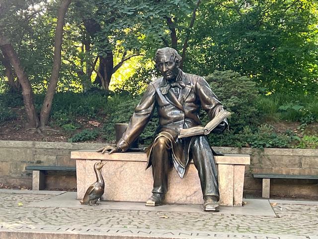
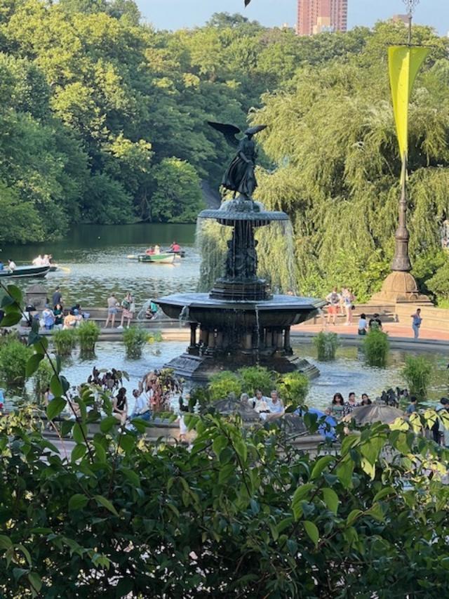
I had a five week break from the college when my first Summer class was cancelled. So I concentrated on traveling through New Jersey and New York, both the City and Upstate for my blog. I wanted to revisit many historical sites that I had seen during the holiday season (was Christmas six months ago?) or in the past. There were places like Central Park, where I had not seen certain sections in the Spring. This lead to me being part of many walking tours of gardens during the month of June.
With all the wet weather we had in the Spring, the gardens in June were lush with flowers and flowering trees and plants. Pathways lined with color and walled gardens beautifully laid out. It was interesting to see how these were planted, designed and maintained.

The entrance to the Brooklyn Botanic Garden in June 2026
All the rain we had in April and May and the warm days of early June had awakened the Cherry Blossoms and I visited as many locations to see them in full bloom.
Please read my blog on visiting the Cherry Blossoms:
Again in the Spring of 2026:
https://mywalkinmanhattan.com/category/exploring-newark-nj
Once they were finished, gardens came to life all over the tri-state area and many historical homes and parks came to life in a sea of color and smells that showed the power of Mother Nature to make things beautiful. I was impressed with the work of many volunteer staffs and their dedication in taking care of these sites for all of us to enjoy.
Visiting to Amour-Steiner House for the Spring Garden Tour:

The Amour-Steiner House the day of the Garden Tour
https://en.wikipedia.org/wiki/Armour%E2%80%93Stiner_House
My review on TripAdvisor:
My review on VisitingaMuseum.com:
https://visitingamuseum.com/tag/armour-stiner-octagon-house

Walking in front of the formal gardens

The formal gardens on the Spring of 2026

The fountain in the center of the gardens

The beds were in full bloom when we toured the gardens

The colors of the flowers were patriotic red, white and blue
In between the hedges, there was elegant statuary and potted urns with colorful flowers blooming with bright hues.

The urns were filled with bright colors of the season

Statuary representing the arts and music lined the hedges

The flowers were so brilliant that afternoon

I enjoyed looking at the statuary

The gardens were so beautiful with the house in the background

As we left the gardens, I admired the ornate Fox and the Glove gate on the way out
We then crossed the lawn to tour the greenhouse, where many of the flowers were and still are grown for decorating the house both inside and out.

The landscaping has a romantic spin on it as the property was planted to accent not just the property but the house as well giving it a natural but balanced look to it.

Touring the formal greenhouse

Even the working greenhouse had a romanticized look about it that reflected the house

The inside of the greenhouse. Each side of the counters seasonal flowers are grown for the property. This greenhouse is used all year long supplying the house with a steady stream of flowers.

In the middle of the greenhouse was a beautiful Victorian aquarium that was lined with more flowers. There were no fish at this time.

I loved the beautiful flowers that lined the counters

The Spring colors were breathtaking

We then started the tour of the house starting with the outside veranda that held more urns and planters of fresh flowers

The beautiful veranda lines the entire house

The beautiful colors from the potted and hanging plants

The veranda decorated for the upcoming ‘250th Anniversary of the United States

The hanging plants

The potted plants

We even admired the birdhouse that matched the house
We then went inside to tour the house. It would be interesting to see the house without all the Christmas decorations that I saw the last time I toured the house.

The triangle room off the foyer once used as the Receiving Room

The beautiful foyer to the second floor

The main Parlor/Living Room used for entertaining

The formal Dining Room

The decorative sideboard

The other decorative sideboard

The Dining Room table set for a Spring dinner
We then started the tour of the second floor which started in the game room at the top of there landing. I remember the big Christmas tree being here when the house was decorated for the holidays.

I liked the room was the way it is here
Then we toured the bedrooms which were not that elaborate but functional and comfortable as they are today.

One of several bedrooms on the second floor

The bathroom which is considered normal today was ahead of its time with flushing toilets and hot and cold running water

The office off the side in one of the Octagon corners

The Egyptian Room was the height of fashion with travel and new discovers in Egypt at the time.

The ceiling and decorations of Egyptian Room

The decor of the Egypt

The beautiful porcelain in the room
Then we toured the Curio Room. I thought the room was a lot of fun with small objects that people would have collected from their journeys at that time.

The shelves, counters and walls were filled with all sorts of interesting objects

Many types of object’s

The Victorian Terrarium that was becoming fashionable at the time

The fold out desk with small objects in each slot

A Victrola and Terrarium
The last part of the tour was of the newly renovated kitchen. The shelves were lined with a collection of shiny pots and pans.

The ‘modern’ Victorian kitchen
When the tour was over, I visited the gift shop and looked over the kitchen once more. It is interesting to see how ‘modern’ back then is ‘contemporary’ today. Victorians set the tone for the modern American home of today and the expectations of the American dream.
Before I left the grounds, I visited the gardens once more. It was such perfect weather to walk around and I enjoyed the beauty of these gardens. Mother Nature creates this all this.

Walking around the grounds of the home

I enjoyed walking around the gardens that day
I found this tour one of the most relaxing I have taken in a long time. The beauty of both the house and the gardens was wonderful. Just sitting on the veranda and looking over the grounds was the perfect way to spend the afternoon.
Taking the Clermont Garden Walking Tour 2026:
I returned in the Spring of 2026 for the an updated walking tour of the gardens “Gardens and Grounds: Evolving Landscaping of Clermont”, where the State of New York horticulturalist who had just been hired to maintain the gardens, explained to us the developments and goals that the State wanted for the direction of the landscaping on the property. They wanted it brought back to the 1930’s blueprint of what Alice Livingston had originally envisioned for the estate when she returned from Europe.

Arriving to the Clermont estate at 1 Clermont Avenue in Germantown, NY
https://www.friendsofclermont.org
https://parks.ny.gov/visit/historic-sites/clermont-state-historic-site
https://en.wikipedia.org/wiki/Clermont_State_Historic_Site
My review on TripAdvisor:
My review on VisitingaMuseum.com:

We started the tour with a history of the house and Alice Livingston’s return from Europe to create her famous gardens

The front of the mansion in the Spring of 2026
We started the tour at the Walled Garden which was just finished being restored. The back wall had just been finished and the site’s main horticulturalist explained that she was working with a group of volunteers to maintain the gardens.

The Walled Garden designed by Alice Livingston

The Walled Garden in the Spring of 2026

The inside to the entrance of the Walled Garden

The back part of the Walled Garden
The next garden we toured was the Wilderness Garden which included wildflowers and a fish pond

The Wilderness Garden sign

The back part of the Walled Garden leads to the Wilderness Garden

The entrance to the Wilderness Gardens

The lecture on the design and plantings of the Wilderness Garden

The colorful wildflowers that line the grass paths

The fish pond in the Wilderness Garden
We then followed the path and walked up and toured the Cutting and Children’s Garden. These colorful gardens once supplied the house with an assortment of fresh flowers. It also taught the Livingston girls the attributes of gardening.

The Cutting Garden and Greenhouse sign

The main Cutting Garden

The Cutting garden

The Cutting Garden in the late Spring

The in season flowers in the Cutting Garden

The Children’s Playhouse and Garden is next to the Cutting Garden

The Children’s Garden in the Spring

Touring past the old Greenhouses

Part of the former greenhouse

The tour through the grounds with my group

The pathway back to Clermont

Touring along the river

The former roadway between the house and the river

The South Spring Garden
Our last garden toured was the one closest to the house and that was the South Spring Garden of which Alice could see from her window. When the porch was removed from the home and Alice developed plans for other gardens, this garden went ‘native’.

The South Garden

The South Garden in bloom

The views from the South Garden

The flower planters near the South Garden

The planters filled with Spring geraniums

Walking back after the tour was over and looking at the beautiful grounds

Ending the tour that day with a walk along the river
It was a beautiful day to walk the gardens and the perfect way to spend the afternoon. Each time I take a tour of the gardens, I am amazed how different they seem. I love the different times of the year and how it changes these gardens.
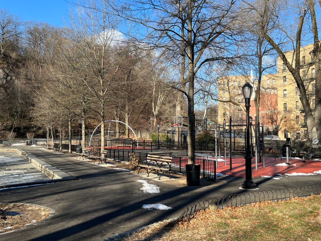
I returned to Manhattan the next week and as I was working in Inwood and Washington Heights neighborhoods, I took a tour of Isham Park with the Bruce Reynolds Gardens and Fort Tyron Park with the Heather Gardens, when they were in full bloom. It was breathtaking with the back drop of the Hudson River on a sunny afternoon.

Isham Park at Isham Street
https://www.nycgovparks.org/parks/isham-park
https://en.wikipedia.org/wiki/Isham_Park
My TripAdvisor:

Isham Park in the Spring of 2026

The Isham Park oval in the Spring

The oval during the Spring

The oval with the roses in bloom

The roses in bloom

Isham Park in the Spring
In Isham Park, I toured the Bruce Reynolds Gardens, which is in the center of the park. They were in full bloom when I walked around the gardens and relaxed under the shade trees.

The Bruce Reynolds Garden
https://www.nycgovparks.org/parks/isham-park/highlights/14066
My review on TripAdvisor:

The Garden in the Spring

The gardens in bloom

The gardens in the Spring

The roses were in full bloom

The gardens were in full bloom

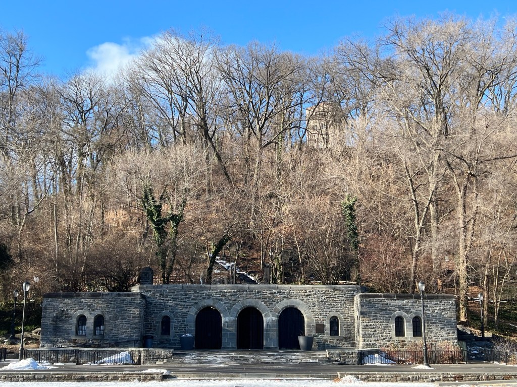
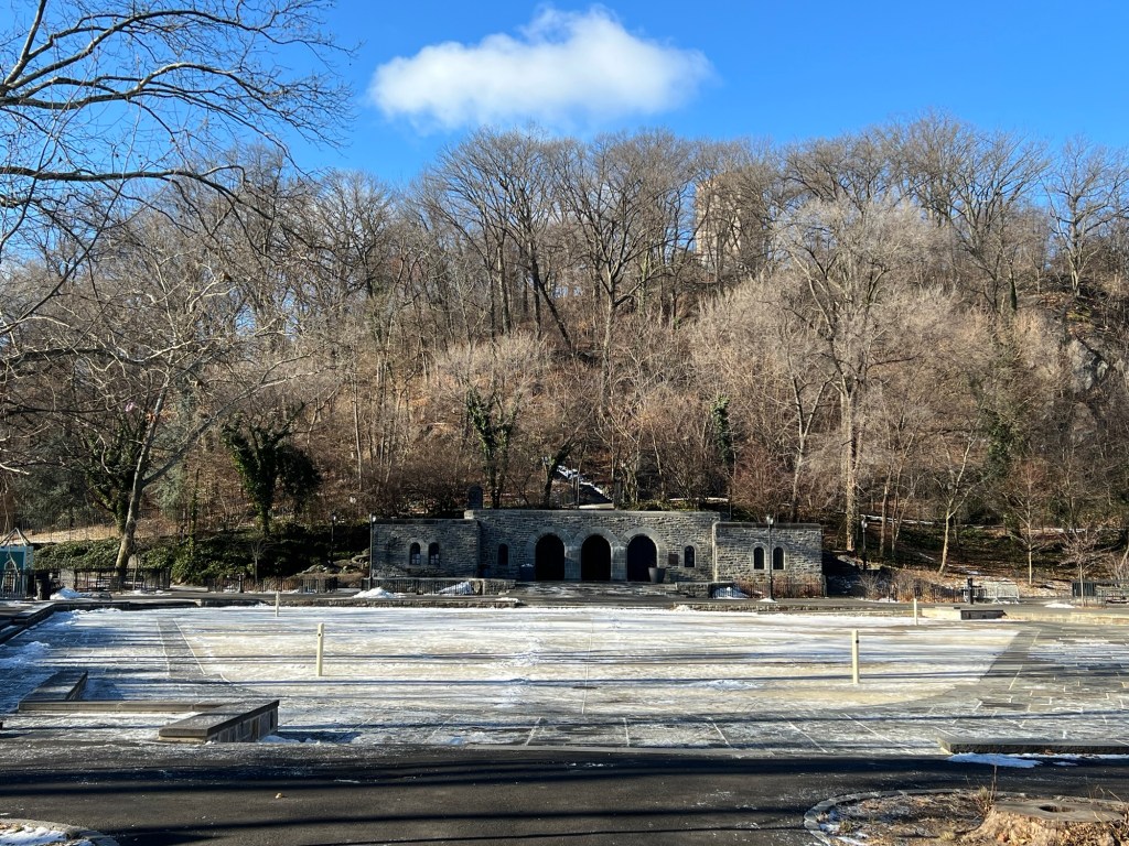
Fort Tryon Park:
https://www.nycgovparks.org/parks/fort-tryon-park
My review on TripAdvisor:

Fort Tryon Park

Fort Tryon Park

The entrance to Fort Tryon Park

Fort Tryon Park

Entrance to the park

The pathways through the Heather Gardens

Walking through the Heather Garden
Inside the park a new restaurant has replaced the former New Leaf Cafe, Le Bonnefont, a Modern French restaurant.

The Bonnefont Restaurant replaced the New Leaf Cafe
https://www.facebook.com/groups/432657521042383/posts/1318136805827779
My review on TripAdvisor:

The new Bonnefont Restaurant is open for lunch and brunch
The restaurant was closed that afternoon but I was able to look at the menu online and it is an interesting menu. The cuisine is a mixture of French and Contemporary cooking.

The Heather Gardens

Walking through The Heather Garden
https://www.nycgovparks.org/parks/fort-tryon-park/highlights/12337
My review on TripAdvisor:

Walking through the Heather Garden

The other side to Heather Park

Walking through the Gardens

Walking through the pathways of the gardens

Walking around the gardens

Walking back through the gardens to the Fort Tryon location

Walking to the Fort Tryon site

The Fort Tryon site
Visiting the Brooklyn Botanic Garden before Rose Night in 2026:
I got an email from the Brooklyn Botanic Garden saying that the Cranford Rose Garden was at its peak of blooming and that I should see it while it was at its prime. I was busy at work and was able to travel down to down to the gardens a few days later. Talk about perfect timing as the petals just started to fall.
The Cranford Rose Garden at peak is one of the most beautiful sites. The colors and the fragrances are just amazing. I could not attend “Rose Night” in 2026 because of a prior commitment plus it would be a gloomy night with the threat of rain. So I went the Friday afternoon before the event, which would be held the next Wednesday. By that point, the flowers would be out of peak.

The Cranford Rose Garden in bloom at the Brooklyn Botanic Garden
My review on TripAdvisor:
My review on VisitingaMuseum.com:
The Cranford Rose Garden is amazing from every angle and the views from the top of the hill overlooking the garden shows the extensive amounts of roses planted and the array of colors.

The beds of roses of all colors and species

The entrance to the Cranford Rose Garden is full of an array of different types of colorful flowers

The beautiful and diverse flowers in the Cranford Rose Garden

The beauty of flowers up close

All sorts of roses line the trellis borders of the Rose Garden
What I love about walking around is that you can see the diversity of the roses. The garden is planted with different species so they bloom at different times giving the beds an array of colors at different times. Along the beds and trellis everything bloomed so vibrantly.

The beautiful orange roses that lined the trellis

The colorful trellis pathways

The reds and pinks in full bloom

Roses lining the lamppost

Admiring the beds of roses at the Cranford Rose Garden

Purple reins supreme

Walking through the trellis pathways of red

The beauty of the trellis

The back part of the garden

The back terrace of the Cranford Rose Garden

The elegant statuary of the rose garden and the sun dial

The back Terrace area
The back of the Cranford Rose Garden is lined with all sorts of flowering plants having a rainbow of colors.

Walking through the terrace gardens

The beautiful roses in the back of the garden

The roses in the back of the Cranford Gardens

Walking out the back of the gardens

The back path of the Cranford Rose Garden

The fountain in the back of the Cranford Garden
Visiting the Cranford Rose Garden when it flowering is one of the most interesting collection of colors and scents. This is why I try to time my visits around the blooming of the flowers.
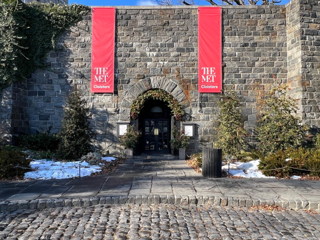
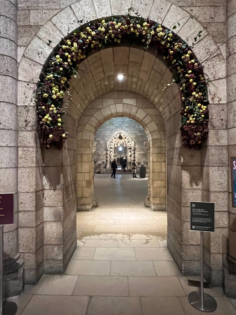
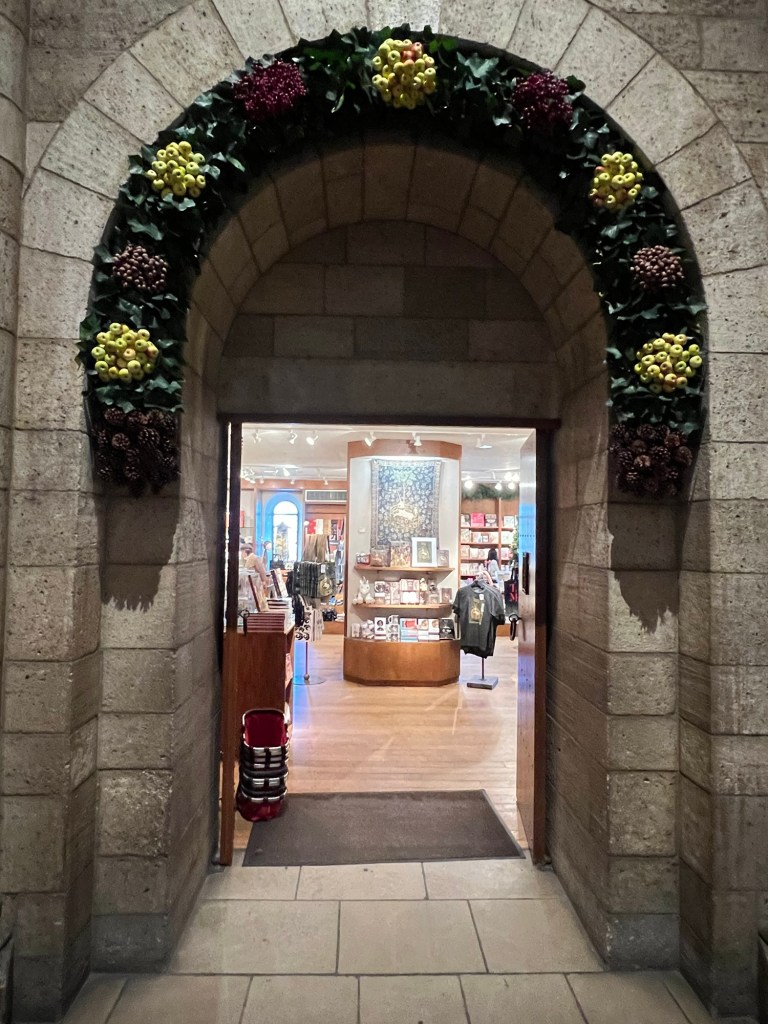
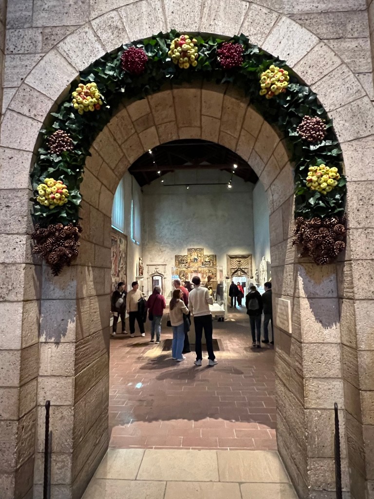
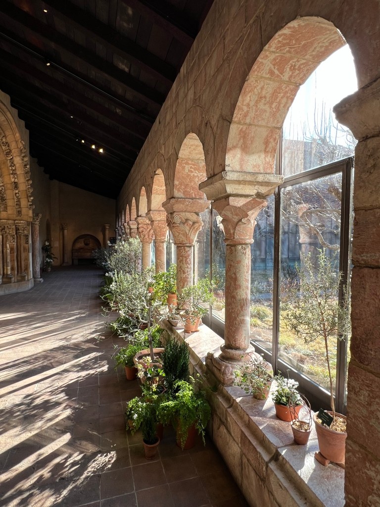
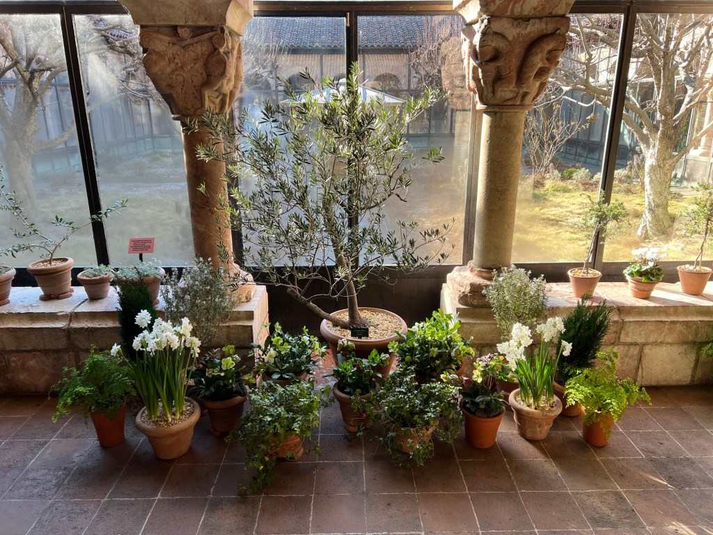
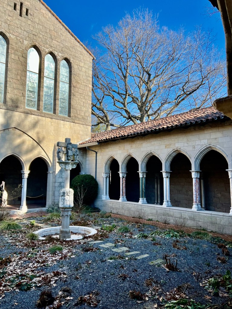
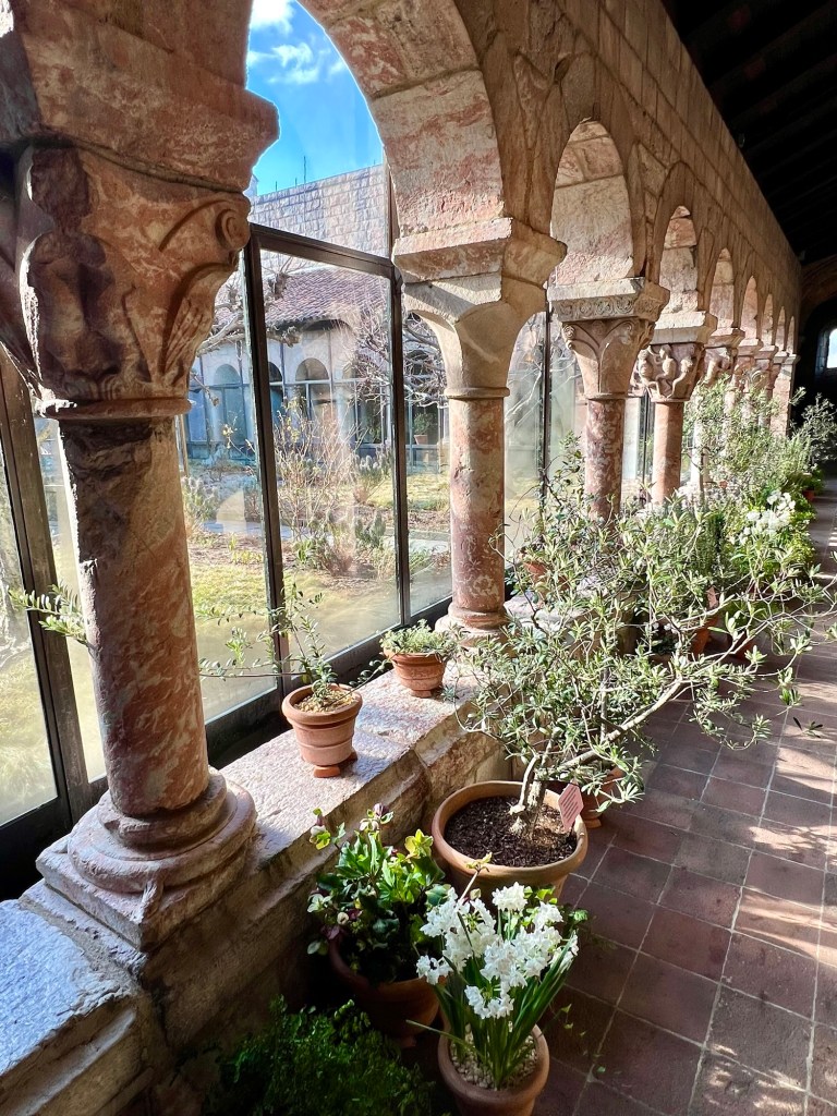
The Tour of the Gardens at The Cloisters in the Spring 2026:
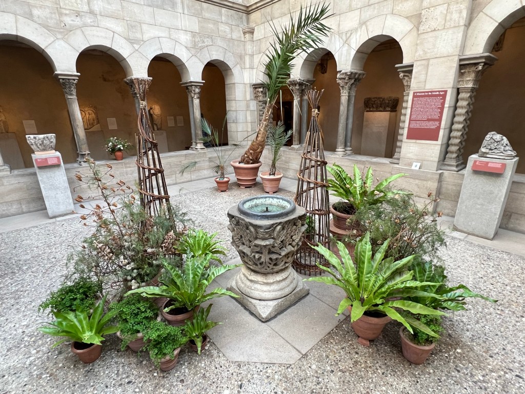
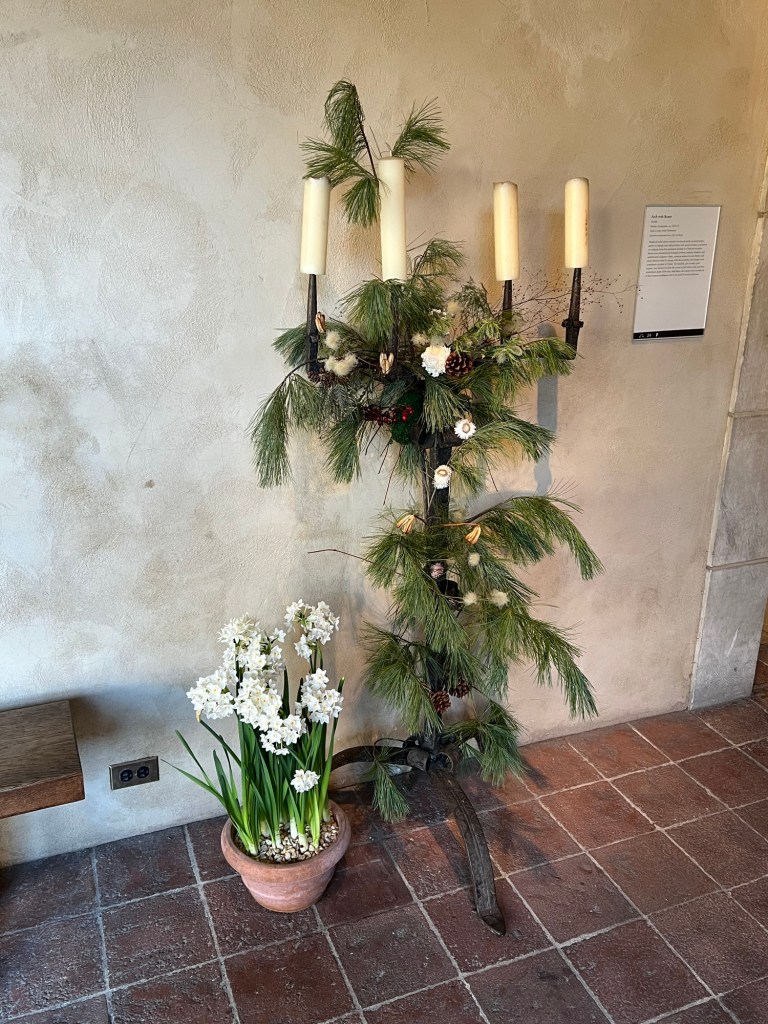
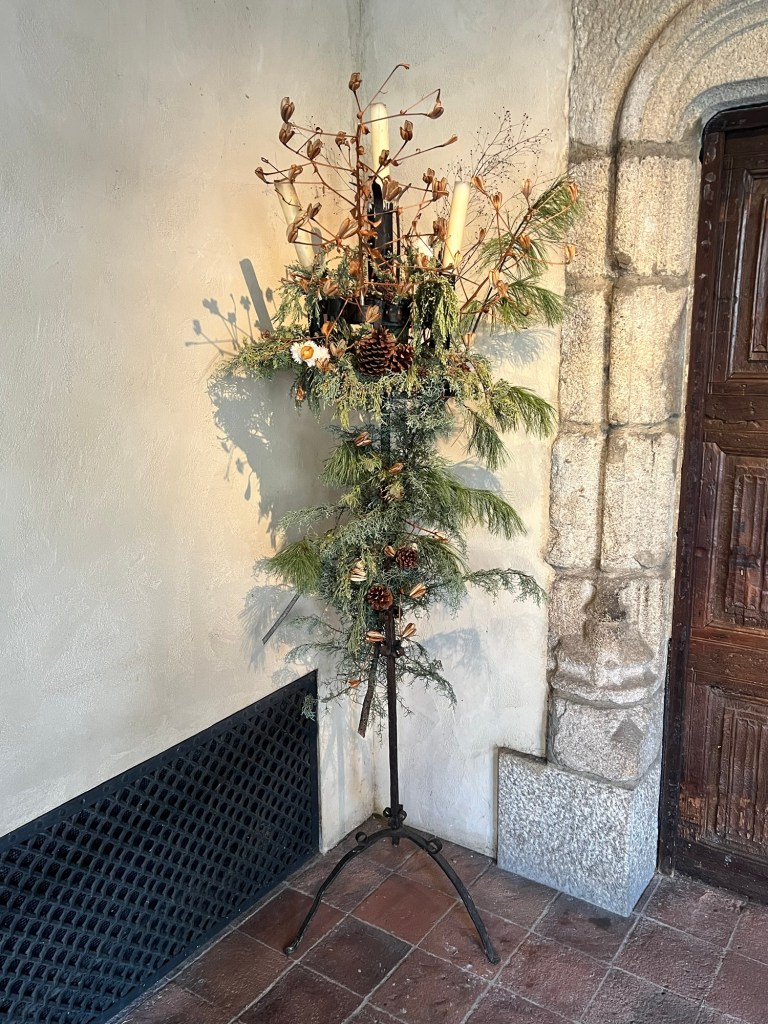
One of my favorite places with in the Metropolitan Museum of Art to visit is The Cloisters in any season. One of my favorite places when it is decorated for the Christmas holiday season, the Spring and Summer offer such beautiful displays of historical plants that try to match the theme of each Cloister and its historical background.
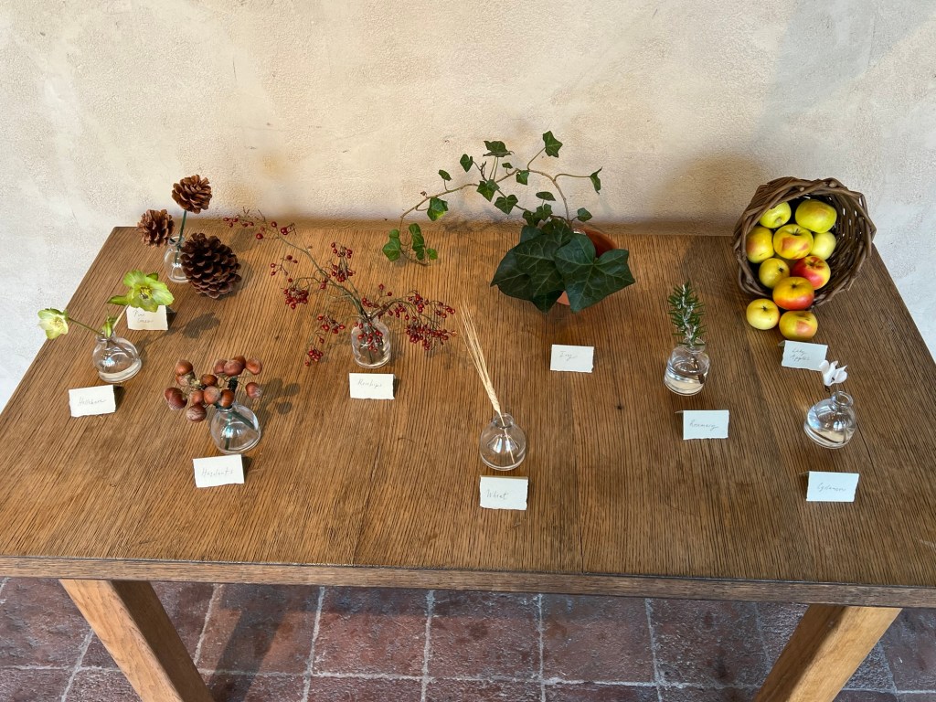
The docent led a very large group of us through each Cloister and told us of the way the curators plant the gardens to represent what may have been planted during the Medieval era for medical and nutritional functions of those peoples lives.
(From the Museum website)
The gardens of the Middle Ages included both real and ideal gardens. Poets and artists delighted in the depiction of fantasy gardens like the Garden of Love or of Paradise, but no real garden of the time remains to us. Historical records are rare and incomplete; the ninth-century plan for the monastery of St. Gall, with its carefully drawn and labeled garden beds, is unique. Archaeological excavations are yielding valuable new evidence, but we still know more about infirmary gardens of medicinal plants and aristocratic pleasure gardens than we do about humble kitchen plots of potherbs and vegetables (Met.org).
The gardens of the Museum, planted in reconstructed Romanesque and Gothic cloisters, evoke those that provided sustenance and spiritual refreshment within the medieval monastery. Designed as an integral feature of the Museum, the gardens have been a major attraction of The Cloisters since its opening in 1938, enhancing both the setting in which the Museum’s collection of medieval art is displayed and the visitor’s understanding of medieval life. The gardens are designed and maintained by a horticultural staff actively engaged in researching and developing the living collection (Met.org).

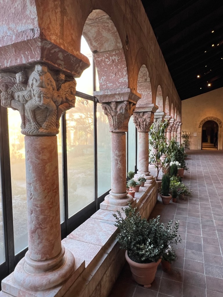
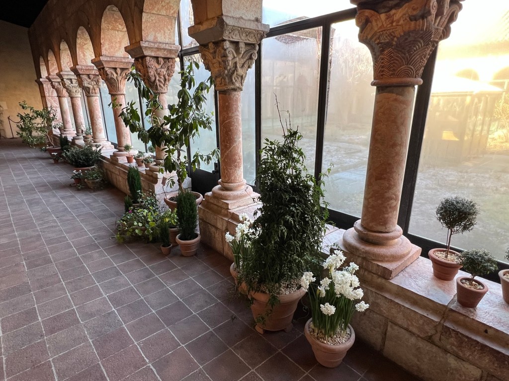
The Cloisters at 99 Margaret Corbin Drive in Fort Tryon blooming in the late Spring
https://www.metmuseum.org/plan-your-visit/met-cloisters
https://en.wikipedia.org/wiki/The_Cloisters
My review on TripAdvisor:
My review on VisitingaMuseum.com:
https://visitingamuseum.com/tag/the-cloisters-museum

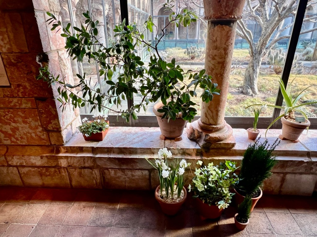
We walked through the Cloister discussing how plantings were determined by medical and religious purposes

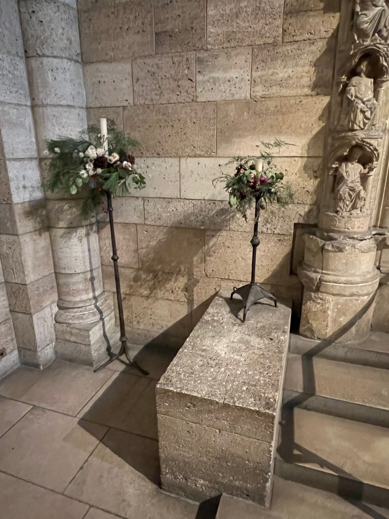
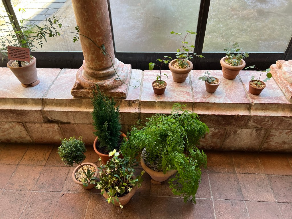
The flower beds in the Cloister

The view of the Hudson River was amazing

The flowers in bloom

Flowers in bloom

Flowers in bloom

Flowers in bloom

We moved the next Cloister looking over the medical plants and flowers

The Cloister in bloom

Walking around the Cloister

The plants around the sills of the Cloisters

Touring the Cloisters and admiring the flowers

Everything in bloom

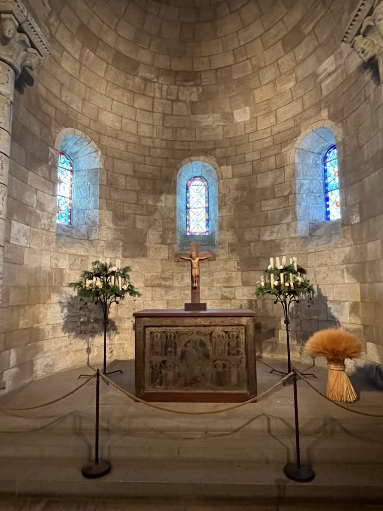
We toured the last Cloister while the tour guide explained the plantings

The last Cloister we toured

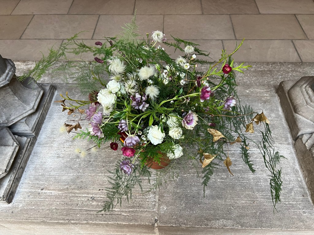
The garden in full bloom

The growth of the hops growing on a trellis

The hops planting up close

The flowers in bloom in the Cloister
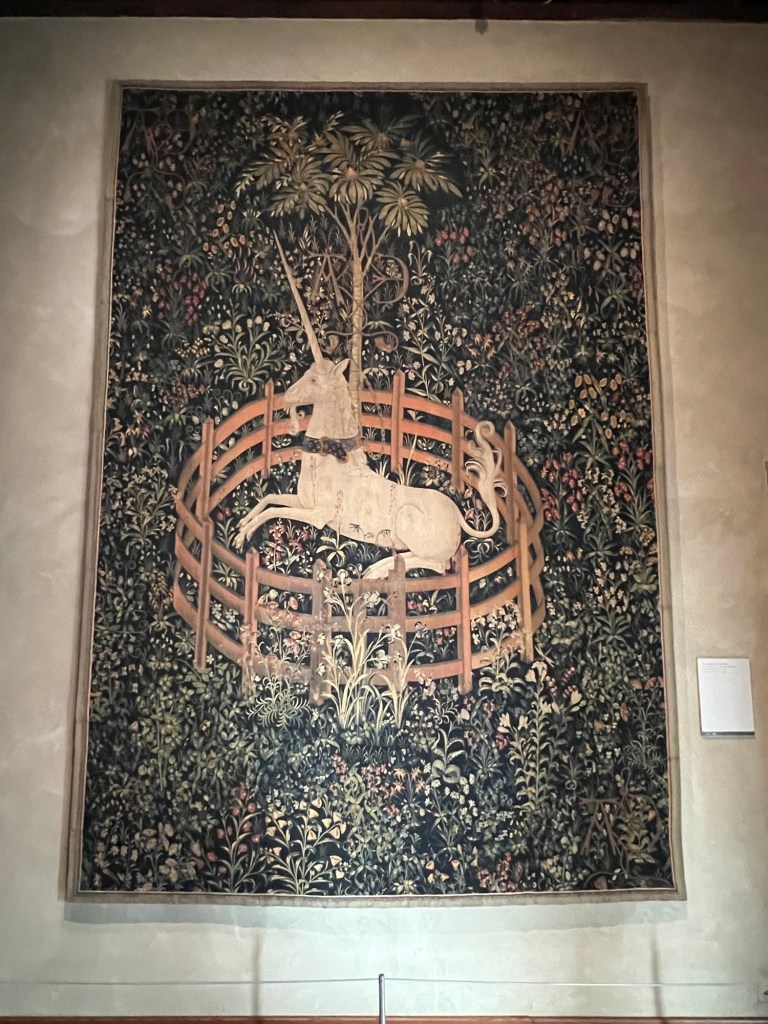
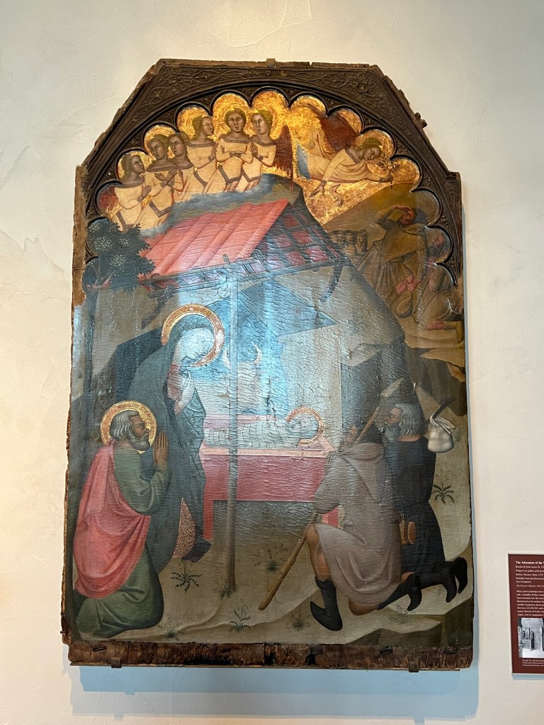
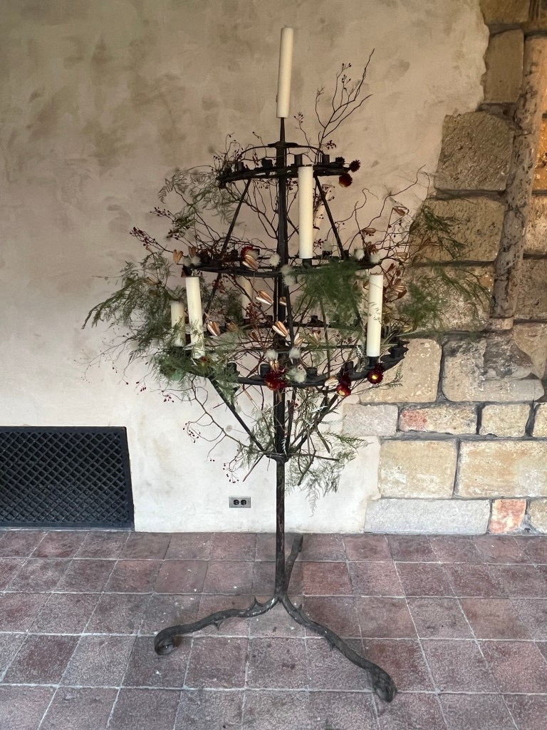
We ended the tour admiring the art in the Tapestry Room and having a discussion about the use of plants and flowers in Medieval art.

‘The Hunt of the Unicorn’ tapestry discussion
I then visited the ‘Creatures of Myth and Imagination-European and the Americas’ exhibition.
This exhibition was an interesting look at mythical beasts of the era of great exploration from European to the Americas. It reminded me of the book “In Search of Ancient Astronauts” with many golden creatures that look like they are visitors from another planet, Ancient Gods to worship and one civilization’s outlook on the unknown. The artwork was a cross between mysticism and respect.

The exhibition sign for “Creatures of Myth and Imagination: Europe and the Americas”
https://www.metmuseum.org/exhibitions/creatures-of-myth-and-imagination-europe-and-the-americas
(From the museum’s website)
Set in the evocative atmosphere of The Met Cloisters, Creatures of Myth and Imagination: Europe and the Americas sheds light on a selection of works created on either side of the Atlantic Ocean between 500 and 1500 CE. The exhibition’s exploration of hybrid creatures deepens our understanding of their apparent necessity among diverse peoples. In the Americas, a complex gold pendant by a Tairona artist of northern Colombia, depicting a confrontational figure with hands on hips, a crocodile-like head, and an enormous headdress, would have reflected and expressed the wearer’s status and power. In Europe, ferocious dragons such as the one depicted on a monumental fresco from the monastery of San Pedro de Arlanza, Spain, took center stage to convey a multiplicity of meanings both sacred and profane (Met.org).

The exhibition gallery

Unusual mythical creature
(From the museum website)
For as long as humans have told stories, we’ve imagined creatures that transcend the natural world. Fantastical beings combining the features of animals, humans, and even plants appear across cultures, emerging in the most ancient myths and enduring in contemporary epics. The widespread presence of these supernatural beings, possessing the power to transform and be transformed, reflects a global impulse to make sense of both known and unknown worlds. Visual artists have given form to these imaginary creatures, resulting in some of the most fearsome, beloved, and extraordinary works of art ever made (Met.org).

Small gold ancient Gods

Ritual Knives

Double pendants

Earth Deity
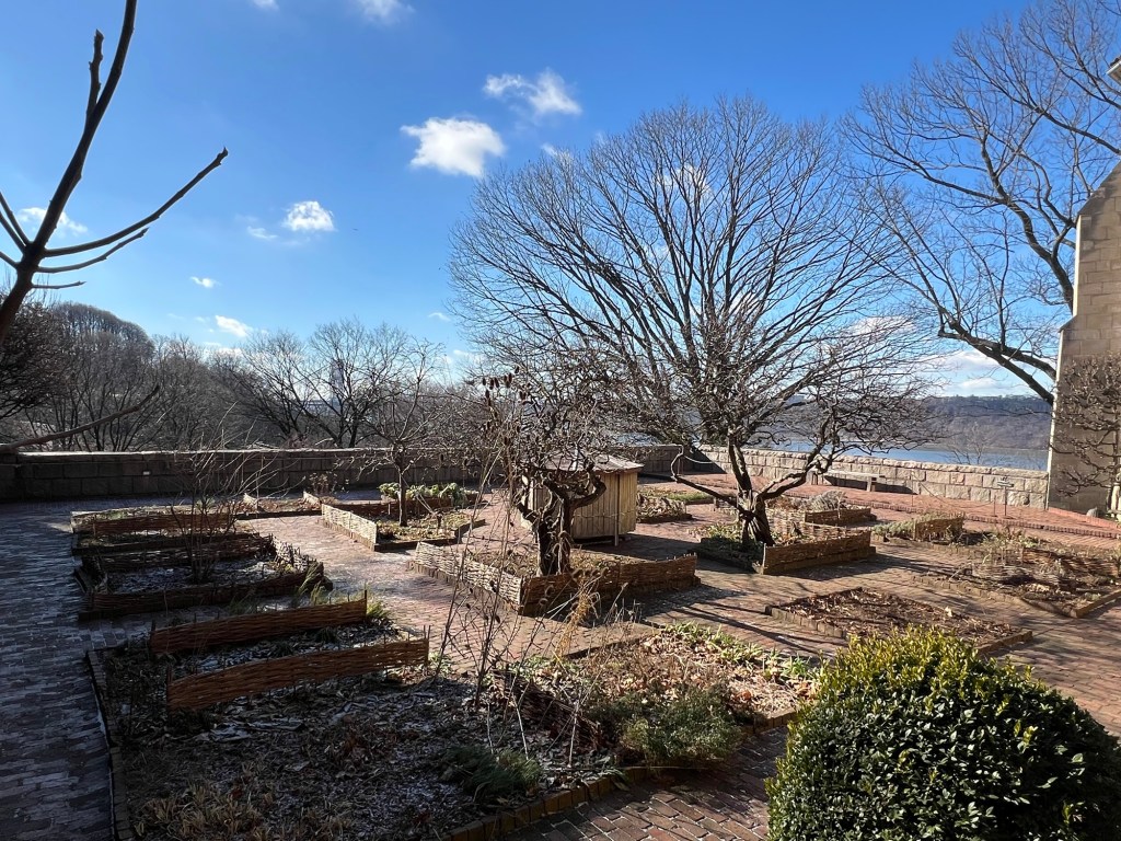
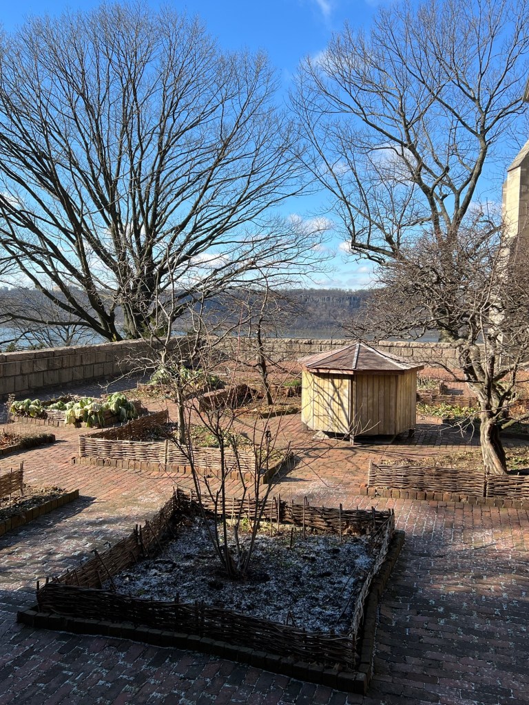
I took one last tour of the museum gardens before I left for the afternoon. On the balcony overlooking the Hudson River offered beautiful views and beautiful potted plants.

Walking out of the back Cloister

The back Cloister

The beautiful white flowers

The balcony overlooking the Hudson River

The potted plants by the doorway

The view of the Hudson River

Looking north up the Hudson River
The tour of the Gardens was amazing and the exhibition on the Pre-Columbian art interesting. It was a wonderful tour of the Cloisters.
The Central Park Conservatory Gardens:
https://www.centralparknyc.org/locations/conservatory-garden
My review on TripAdvisor:
My review on VisitingaMuseum.com:
I had a private function at the Museum of the City of New York across the street from the Central Park Conservatory Gardens. When the event was over, I took a walk around the gardens when they were in full bloom.
The gardens just went through a major renovation and each of the paths had rows of colorful flowers that were beautifully taken care of and designed to bloom at different stages of the growing season so there was always color in the gardens. The effect was amazing.

The entrance of the Central Park Conservatory lawn and fountain

The fountain and the geometric garden

Central Park Conservatory gardens at the entrance

The entrance of the gardens from the Harlem Meer area

The entrance to the flower gardens from the Central Park Conservatory lawn

The Central Park Conservatory garden beds

The gardens in full bloom in the Summer of 2026

The flower beds in the central of the gardens

The Central Park Conservatory Fountain and Lotus pools

The Fountain statues

The flowers beds around the paths

The orange flowers that line the paths

The vibrant purple flowers

The gardens that line the paths

The beautiful flowers that line the paths

The flowers are lining the paths

The flowers lining the paths

The flowers were so vibrant in the Summer of 2026
The 91st Street Garden in Central Park:
https://www.thegardenpeople.org
https://www.nycgovparks.org/park-features/riverside-park/virtual-tour/91-garden
My review on TripAdvisor:
I walked behind Hippo Park in Central Park one afternoon to discover a beautiful floral garden that was the 91st Street Garden that I had missed on previous walks in the park. The Garden did not look like this in the Fall.

The 91st Street Garden in the Summer of 2026
Then I remembered the scene in “You Got Mail” and remembered that this was the garden where they met. I always thought it was closer to Riverside Drive than it was here in the park.

The sign for the garden
As I passed the garden, I remember this was the garden in the last scene of the movie, “You Got Mail” when Meg Ryan realizes that her secret email pal is Tom Hanks. It was such a great scene and the perfect end to a great Rom-Com.
The end of the movie “You Got Mail” with Meg Ryan and Tom Hanks

The Gardens from the front

The flowers in full bloom

The flowers in full bloom in July 2026
All I could think about was this scene as I walked around the garden. The funny part is this was the first time I had ever visited this garden as I did not know where it was located. I knew it was on 91st Street but could never figure out where. You have to walk on the path behind the Hippo Playground and follow it to the other path.

The gardens from the front

Walking back up through Riverside park from the Hippo Playground

Walking in Riverside Park in the 90’s
You have to find your way through Riverside Park to find the garden but in the Spring and Summer it is worth the walk up and down the hill.
These are just some of the places that I am still visiting as the Summer season begins and there are more historical sites to see and more smaller gardens to visit. Let’s see what the rains produce in the coming months.
Places to Visit:
*Bloggers Note: the prices of these sites vary from season to season and can change from year to year. This is the same with the hours depending on what season you visit.
The Armour-Stiner Octagon House
45 West Clinton Avenue
Irvington, NY 10533
(914) 817-5763
https://en.wikipedia.org/wiki/Armour%E2%80%93Stiner_House
Hours: Sunday-Saturday Seasonal please check their website
Admission: Depends on the Tour/Times of the year-Please check the website
My review on TripAdvisor:
My review on VisitingaMuseum.com:
Clermont State Historic Site-New York Parks & Recreation
Route 6 (Off Route 9G)
Germantown, NY 12526
(518) 537-6622
https://www.friendsofclermont.org/
Open: April 11-October 31 Wednesday-Sunday 10:30am-4:00pm/November 1-
December 22/Saturday & Sunday 10:30am-3:00pm
Please call in advance due to seasons and weather conditions
Fee: Adults $7.00/Seniors and Adults $6.00/Children Under 12 and Members Free
My review on TripAdvisor:
My review on VisitingaMuseum.com:
Brooklyn Botanic Garden
990 Washington Avenue
Brooklyn, NY 11225
(718) 623-7210
Open: Sunday and Saturday 10:00am-6:00pm/Monday Closed/Tuesday-Friday 8:00am-6:00pm
Admission: Depending on the time of year/please check the website
My review on TripAdvisor:
My review on VisitingaMuseum.com:
https://visitingamuseum.com/tag/brooklyn-botanic-garden
Fort Tyron Park
Riverside Drive to Broadway
New York, NY 10040
https://www.nycgovparks.org/parks/fort-tryon-park
https://www.nycgovparks.org/parks/fort-tryon-park/history
Open: Sunday-Saturday 6:00am-1:00am
My review on TripAdvisor:
My review on TripAdvisor:
Heather Garden
Center Path-Fort Tryon Park
New York, NY 10040
(212) 795-1388
Open: Dawn to Dusk
Admission: No Fee
My review on TripAdvisor:
The Cloisters Museum & Gardens: A Branch of The Metropolitan Museum of Art
99 Margaret Corbin Drive/Fort Tryon Park
New York, NY 10040
(212) 923-3700
Open: March-October 10:00am-5:15pm/November-February-10:00am-4:45pm
https://www.metmuseum.org/visit/plan-your-visit/met-cloisters
Fee: Adults $30.00/Seniors $17.00/Children $12.00/Members & Patrons and Children under 12 are free (prices do fluctuate). NY, NJ and CT students and NY residents Pay as you wish.
Museum Hours:
Hours: Open 7 days a week
March-October 10:00am-5:15pm
November-February 10:00am- 4:45pm
Closed Thanksgiving Day, December 25th and January 1st.
*Some galleries may be closed for construction or maintenance.
My review on TripAdvisor:
My review on VisitingaMuseum.com:
https://visitingamuseum.com/tag/the-cloisters-museum
Isham Park
11 Park Terrace East
New York, NY 10034
(212) 639-9675
https://www.nycgovparks.org/parks/isham-park
https://en.wikipedia.org/wiki/Isham_Park
Open: Seasonal
My review on TripAdvisor:
Bruce Reynolds Garden
11 Park Terrace East
New York, NY 10034
https://www.nycgovparks.org/parks/isham-park/highlights/14066
Open: Seasonal
My review on TripAdvisor:
The Central Park Conservatory Garden
Located between 104th and 106th Streets off Fifth Avenue
New York, NY 10029
https://www.centralparknyc.org/
https://www.centralpark.com/visitor-info/central-park-conservancy/
Hours: Depends on the season and the Dawn to Dusk rule
Hours of Operation:
November-February (8:00am-5:00pm)
March (8:00am-6:00pm)
April (8:00am-7:00pm)
May (August 14th 8:00am-8:00pm)
August 15-31 (8:00am-7:30pm)
September (8:00am-7:30pm)
http://www.centralparknyc.org/things-to-see-and-do/#what_lawns-and-landscapes
Fee: Free
TripAdvisor Review:
My review on VisitingaMuseum.com:
The 91st Street Garden-Central Park
Riverside Drive
New York, NY 10025
https://www.thegardenpeople.org
https://www.nycgovparks.org/park-features/riverside-park/virtual-tour/91-garden
Open: 24 Hours
My review on TripAdvisor: