Don’t miss all the historical sites and interesting restaurants of this wonderful NJ beach town.
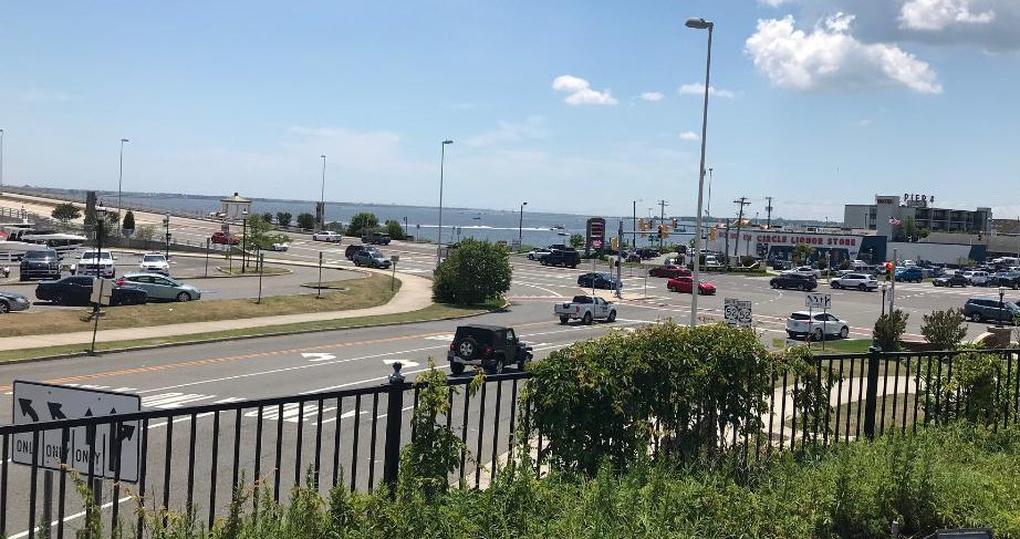
Somers Point, NJ is such a picturesque and historical town with lots of historical sites and delicious restaurants to visit. It is fun to just get in the car and drive the Historic District and see how the town has grown and developed.
I took time out of my walking project in Manhattan after finishing the Chelsea neighborhoods, walking the 13-mile Broadway walk for the sixth time and preparing to do “The Great Saunter” on my own next week to go ‘down the shore’ as we say in New Jersey (it’s never ‘Down to the Shore”, that takes too long).
I had never been to Somers Point, NJ before. It is a small waterfront community across the bay from Ocean City, NJ, which is a popular resort and recreation town. Somers Point is low key with wonderful restaurants and bars, a popular waterfront and beaches on The Great Egg Harbor Bay and beautiful little turn of the century beach homes and a town steeped in history. I read about three historical spots on Shore Drive in the heart of the Historic District and had wanted to visit them.
After touring Finns Point Lighthouse in the front of the park, I drove to the back of Fort Mott State Park to tour the rest of the park and explore the old fort. Talk about a real surprise and a a real treat. Talk about views of the Delaware River. On a sunny afternoon, the sun really reflects off the water and makes the most amazing light show.
I walked up the Parapet, the massive concrete wall that used conceal the guns that protected the bay and the river. It was a impressive piece of construction and you could see where the guns had been mounted. You could climb up and down the stairs to get from one part to the other and enjoy the views.
The gunnery
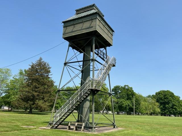
I passed the old Western Fire Control tower that was closed for the day and open by appointment only. That must have offered some spectacular views.
The Western Fire Control Tower
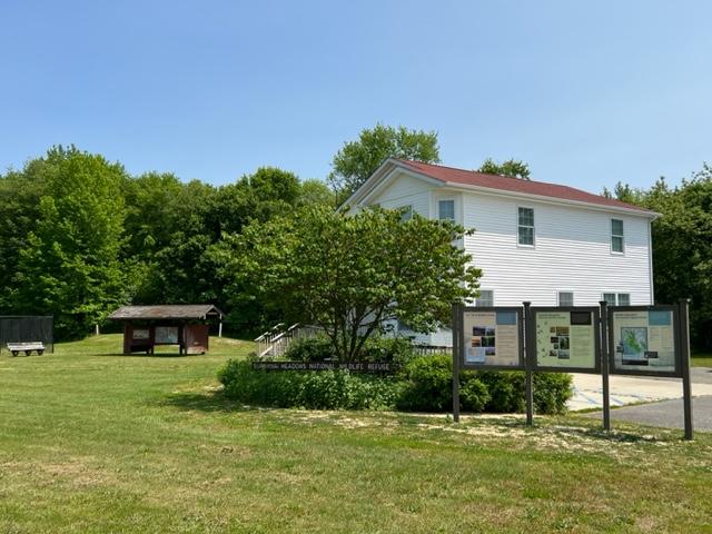
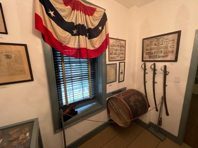
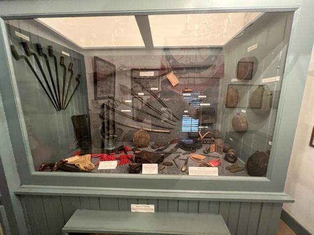
I then toured the Visitors Center and saw all the artifacts from the war, a timeline of the Fort and the history of the fort. Take time to look at each case and you will see how the fort developed, the types of things used at the fort and the people who were stationed here and their stories. It also offers bathrooms.
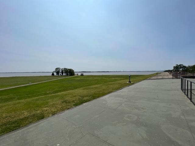
The best part of the Fort Mott State Park is just walking around the lawn and enjoying the sunshine and river breezes on a hot day. The blue skies with the sunshine gives you a sense that it was not just a place of protection but Mother Nature lending her hand to offer a spectacular location to just stop and wonder what would it been like if something happened here during the war. Would it withstood the assault?
The best part of the park is just to walk around the lawns and enjoy the river views.
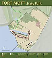
Map of Fort Mott State Park (NJ State Parks.org)
The History of Fort Mott:
(From the Fort Mott State Park Pamphlet-New Jersey Division of Parks and Forestry State Park Division)
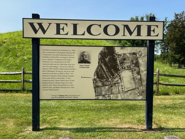
Fort Mott, an Endicott-era fortification was built as part of the federal government’s late 19th century plan to defend the Delaware River. Today it serves as a state park where visitors can tour the remains of the historic fort. The cultural and historic features of this park and its recreational facilities provide a unique blend of activities for the park visitors.
The views from Fort Mott of the Delaware River
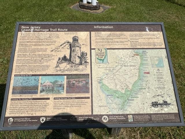
Fort Mott State Park is included as a point of interest on the New Jersey Coastal Heritage Trail. A Welcome Center for the trail accommodates displays defining Fort Mott’s place in history and the maritime environment. Fort Mott State Park is on the Delaware River at Finn’s Point in Salem County, New Jersey. This 104-acre park is six miles south of the Delaware River Memorial Bridge, off New Jersey Route 49.
The Finn’s Point Reservation was purchased by the United States Government in the late 1830’s. Originally called “The Battery At Finn’s Point”, the proposed fortification was one of a three-fort plan to protect growing industries and shipping along the Delaware River. Plans for Finn’s Pint specified eleven-gun emplacements with twenty guns and a mortar battery with six complacements. With Fort Delaware on Pea Patch Island in operation since the early 1820’s and the nation involved in the Civil War, the construction of the Battery at Finn’s Point was delayed until 1872. At that time, only two-gun emplacements and five magazines in the mortar battery were completed before construction was halted due to budgetary constraints.
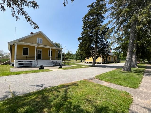
The headquarters buildings
With advancements in military technology made during and after the Civil War, the United States defenses were dangerously inadequate. In 1885, President Grover Cleveland, at the request of Congress, appointed the Endicott Board, named after its Chairman William Endicott, the Secretary of War. The board, which consisted of both military men and private citizens, studied the existing coastal defenses and developed a coastal defense plan for the United States. This plan determined where defenses and developed a coastal defense plan for the United States. This plan determined where defenses should be built or improved, the order in which the work would proceed, the quantity and type of guns that would be placed at each fort and other considerations.
The signage
The main defense concept of the Delaware River was dispersion of armaments into three separate fortifications. The original plan for the Battery at Finn’s Point was abandoned and construction of new fortifications began in 1896 in anticipation of war with Spain, the Spanish-American War. This fortification was officially renamed Fort Mott on December 16th, 1897, to honor Major General Gershom Mott. Mott, a native of Bordentown, NJ was a decorated veteran of the Mexican American and Civil Wars. Fort Delaware was upgraded, and construction of Fort DuPont began during this same time period.
The signage
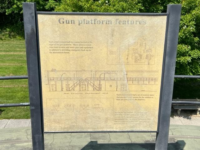
At Fort Mott, large caliber weapons, three 10 inch and three 12-inch guns were installed on disappearing carriages. The gun emplacements were located behind a 750 foot long and 35-foot-thick concrete and earthen embankment, which was sloped to form the ‘parapet’ wall. These guns had an effective range of seven to eight miles and shot projectiles that weighed 617 and 1000 pounds respectively. Beneath the six-gun platforms were powder and shell magazines, ammunition hoists, a telecommunications system and an electric generating station. Two batteries each with 5-inch rapid fire guns and one battery with two 3-inch rapid fire guns were also part of the defenses, designed to counter fast moving smaller warships which might evade the large caliber guns. They also protected the fort from potential land attack. Fort Mott was a completely modern installation for its time period.
The Fort Mott headquarters
Two steel control towers were later built to improve aiming of the guns. Observers stationed in the towers, in conjunction with plotting room personnel, directed the gunfire of the 10 inch and 12 inch guns. The tower near the river on the northern end of the emplacement was built in 1902 and was used to aim the 12 inch guns of Battery Arnold. The tower near the park office was built in 1903 to help aim the 10 inch guns of Battery Harker.
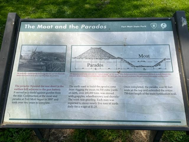
Behind the main emplacement are the parados and the moat. ‘Parados’ is Spanish for rear door. These provided the rear defenses for the fort. The parados was constructed using the fill from the moat. Landscaping around the military reservation helped camouflage Fort Mott from attack by potential enemy ships.
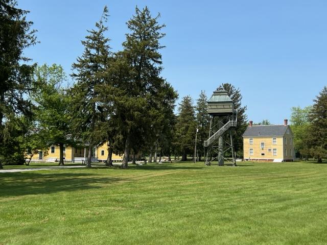
Fort Mott was self-contained military community. The post had over 30 buildings, including two large barracks, non-commissioned and officer’s housing, a hospital, a post exchange, a library, a guard house, a stable, YMCA and a school for the soldier’s children. The Delaware River was the main transporation infrastructure for Fort Mott; munitions, supplies and construction materials arrived at the fort by barge.
WIth the construction of Fort Salisbury near Milford, Delaware shortly before WWI, Fort Mott, Fort Delaware and Fort DuPont became obsolete. The three forts remained active defense installations until after WWII, when they were phased out. Troops were regularly stationed at Fort Mott from 1897 to 1922. The federal government maintained a caretaking detrachment at the fort from 1922 to 1943. During this time, Fort Mott’s guns were dismantled and sent to various locations.
Visiting Fort Mott
Fort Mott was declared “surplus property” in 1943. Finn’s Point National Cemetery (dedicated a National Cemetery on October 3rd, 1873 because of the Confederate prisoners of war buried there) was separated from Fort Mott at that time. In 1947, the State of New Jersey purchased Fort Mott, as a historic site from the federal government. On June 24th, 1951, it was opened to the public as Fort Mott State Park.
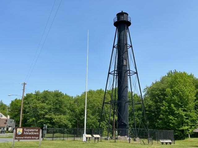
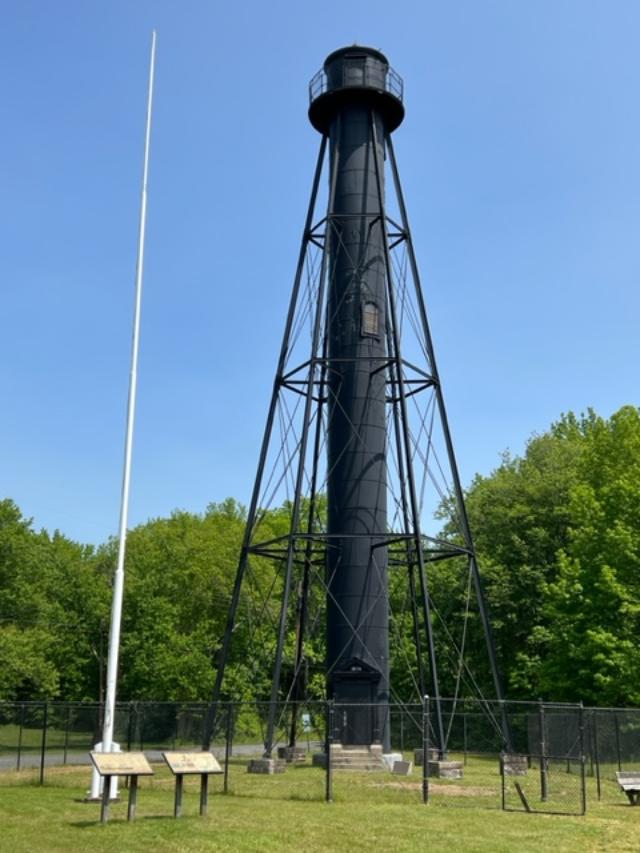
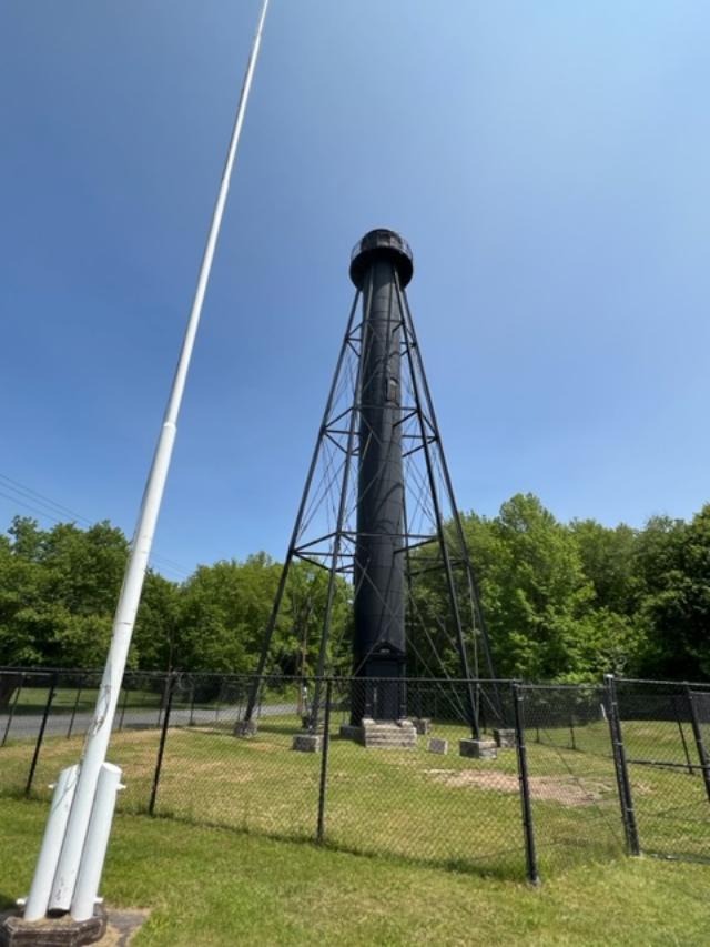
The Finns Point Lighthouse is located in the Fort Mott State Park and the afternoon that I was there which was the third Sunday of the month of June, it was not open. In fact, it looked like it had never opened for the day.
The gift shop/information center had a sign from 2019 with the hours of operation and the steps were not well cared for and the gardens around the building were over-grown. The lighthouse itself is behind a fence that you can look at but not enter and from what I read online is not open even when it should be if it is too hot or too cold because conditions inside can be impossible. The lighthouse and the Visitors Center will reopen for the 2023 season.
The Finns Lighthouse Visitors Center is now open in 2023
Still, the lighthouse has a majestic look to it and must have some views when it is open. If it is not open, take time to visit Fort Mott and the State Park, which offers spectacular views of Delaware Bay and the surrounding grounds. Take time to explore the fort and the where the guns were mounted. Very interesting.
Fort Mott also has a very good Visitors Center and small museum inside to see the history of the fort, artifacts from the fort and from the war years and all sorts of interesting information on the area.
The Finns Point Lighthouse
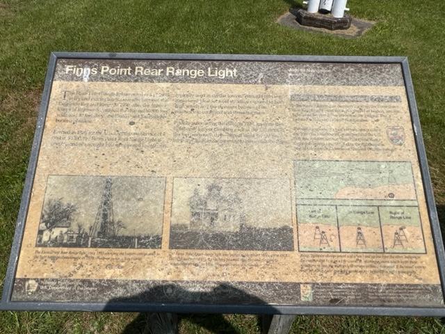
The History of the Finns Point Lighthouse”
(From the Friends of the Finns Point Lighthouse website-modified):
(Please read the above Friends Website for the complete history in detail of the ligthouse)
Soon after the 1638 landing of the Finnish colonists near the present site of Wilmington, DE, a small group of settlers crossed over to the east bank of Delaware River, where the land was though to be more fertile and established farms. One group selected land near the sweeping turn in the Delaware River and this area remains known to this day as Finns Point.
By an act of Congress in 1875, $55,000 was set apart for two pairs of range lights to help vessels transition from Delaware Bay into the Delaware River. Port Penn Range, located in Delaware, would guide traffic along the shipping channel from Ship John Shoal to Ready Island, while Finns Point Range would help vessels continue upriver, passing between Reedy Island and Baker Shoal.
Lt. Colonel William F. Reynolds of the U.S. Corps of Engineers oversaw construction of the front and rear range lights at Finns Point. The front light was located near the banks of the Delaware River and was displayed from a frame dwelling of the following description: “one and one half stories high with shingle roof, double weather-boarded on outside and lathed and plastered inside. Its rests on stone walls founded on wooden piles. The first story is divided into three rooms with the hall and stairways to the second floor and cellar and shed over the back door, porch and bay window in the front. The second story is divided similarly to the first, with a step ladder to lantern on the third floor, a gallery supported by brackets surrounds the lantern on front and sides.”
The illuminating apparatus for the front light was a fourth order range lens manufactured by Barbier & Fenestre in Paris, which focused the light from a fourth-order Funk Heap Lamp with one wick. In 1882, a “wooden screen painted white, with open spaces so as to show horizontal stripes” was placed atop the front lighthouse’s red tavern room to make the structure more conspicuous during the day. The daymark was removed in 1897.
The lighthouse sign
Three acres of land, roughly one and a half miles inland from the front light, were purchased from Joshua and Mary Dickinson on April 20th, 1876, as the site for the rear range light. To provide a focal plane higher than that of the front light, the project plans called for a tall, wrought iron tower to be used for displaying the rear light. The Kellogg Bridge Company of Buffalo, NY was contracted to manufacture the components of the wrought tower, which were then transported to Salem, NJ by railcar. From Salem, teams of mules pulled large wagons loaded with pieces of the iron tower to the construction site.
A frame keeper’s dwelling was built just west of the tower, along with a wood-framed privy and an oil house. The first keeper of Finns Point Rear Range Light was Edward Dickerson, who started serving on December 8th, 1876, even though the light was not lit until April 2nd, 1877.
The lighthouse sign
Fast forward to the 1970’s when the old dwelling was razed because it was unsafe, but locals showed an interesting in the lighthouse and having it moved. Resident Betty Husarik formed the “Save the Lighthouse Committee”. They faulted in moving the lighthouse but placed it on the National Register of Historic Sites in 1978.
In 1981, the committee set out to Washington DC to meet with their local congressman and the drive resulted in a contract for $33,600 being signed between the US Fish and Wildlife Service, on whose land the tower now stood and K & K Painting Company of Baltimore to have the tower repairs, sandblasted and painted. An open house was held at the tower on October 14th, 1984 to honor the determined effort shown by the “Save the Lighthouse Committee” and others in restoring the tower.
Today it is opened for limited tours and special events.
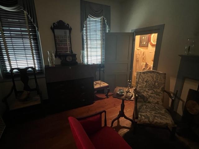
I was very impressed by the Nicholas Gibbon House when I took a tour one Saturday afternoon. There were no large crowds to deal with and the parking is perfect with plenty of room to move around. The grounds are beautifully landscaped with all sorts of seasonal flowers surrounding the house. When I visited, I thought I was mistaken, and it was someone’s home. There was a lot of care put into both the exterior and interior of this home.
The fields around the Gibbon House.
Nicolas Gibbon was a local merchant who moved to Greenwich in 1730 and continued to live here until the 1760’s. The tour guide explained to me that the townspeople would not let him build a church here (it was a Quaker region) so he and his wife decided to move out of the area. Richard Wood and his family moved into the house in 1760 and lived in the house until the 1920’s. Over that time, parts of the house were modernized and rebuilt. The Wood family later in the generations founded the WaWa store chain.
With the exception of the Nicolas Gibbon’s nephew and his wife’s portraits, all of the furnishings are not originally from the house. The downstairs is set up with a formal dining room and parlor area fully furnished in Victorian era furniture, paintings, rugs and silver. The silver collection of the house is very elaborate and some of the pieces came from the Hershey family of Pennsylvania.
The family portraits of the Gibbon nephew and his wife.
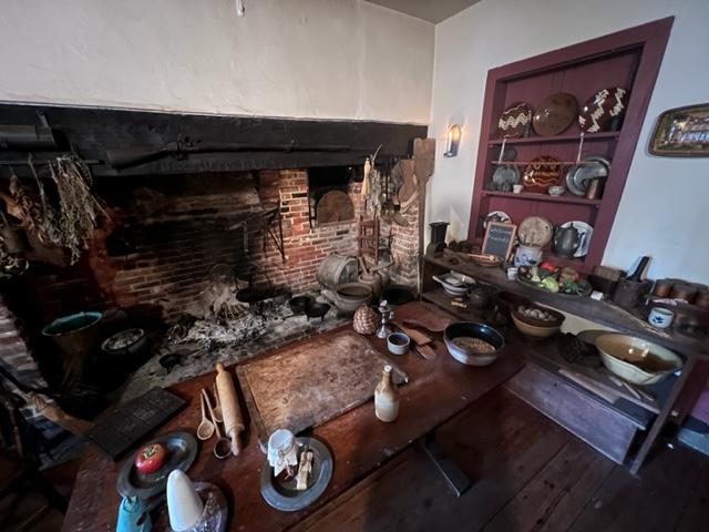
The library and study have rare books that were used for research as well as a working fireplace that was used for both light and heat. Downstairs is the kitchen with a large hearth and all the equipment and serving items for kitchen and dining use for the home.
The Parlor of the Gibbon House.
The Library at the Gibbon House.
The tour guide explained to me that during some of the past fundraisers, the hearth was used to cook foods of the time period that were served for events.
The Kitchen of the Gibbon House was used for cooking fundraisers.
The Kitchen Hearth is quite large.
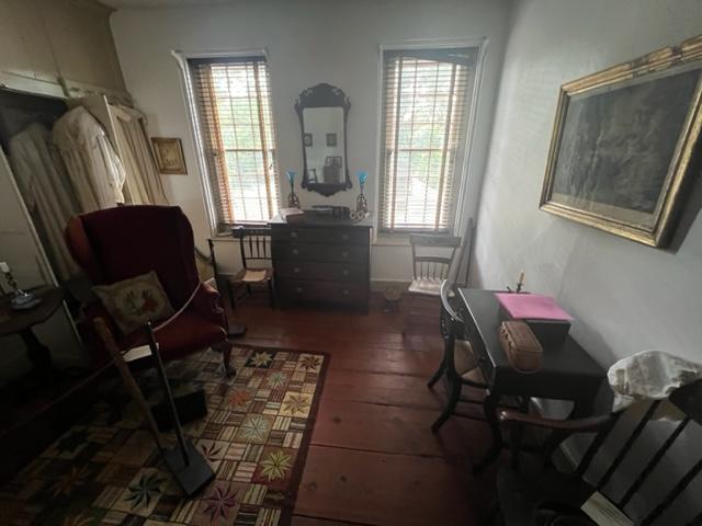
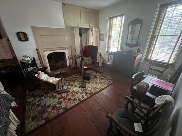
Upstairs you have an elaborate master bedroom with all sorts of formal furnishings for an upper middle-class family living in the area.
The Upstairs bedroom
The Master Bedroom upstairs at the Gibbon House.
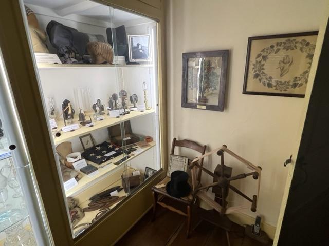
What was the interesting part of the second floor of the home was the “Everything Room”, which contained an extensive collection of toys and dolls, Civil War historic items, period clothing, bonnets, top hats and parasols, an extensive collection of quilts and Hair Art which was a Victorian tradition of making art from the hair of the dead.
The Everything Room at the Gibbon House has all sorts of Victorian artifacts.
There was a collection of ‘Sewing Samplers’, which is how young women learned how to perfect their sewing skills which was part of their domestic training for being a housewife.
The Everything Room on the second floor of the Gibbon House.
The collection of the house really gave a glimpse into the lives of people from the 1840’s until almost WWI. How much life has changed but not too much.
The Everything Room at the Gibbon House.
History of the Gibbon House:
In 1730, Nicholas Gibbon who had inherited more than 3000 acres of land nearby, bought a 16-acre lot in Greenwich on which he built a replica of a London Townhouse he had admired. The brick, fired on the property, was laid in the Flemish Bond pattern brought from Kent, England: this design is achieved by using a red stretcher and blue header producing a definite and attractive pattern. Rubbed brick is a further architectural feature, outlining each door and window opening as well as being used to emphasize the four corners of the house.
The Upstairs bedroom at the Gibbon House
The home, appropriately furnished with products of 18th and 19th century artisans contains a reception hall, a paneled dining room, a formal drawing room and a kitchen dominated by a huge walk-in fireplace in which demonstration of colonial open-fire cooking are conducted.
The walk-in fireplace at the Gibbon House.
There is a small store on the back porch where post cards, gifts and a fine collection of books and pamphlets on the history of the area may be purchased.
The Master Bedroom.
On second floor, in addition to a bedroom, are exhibits of 19th century locally made, rush seated. “Ware” chairs, children’s toys, dolls and clothing as well as Civil War artifacts donated by local families.