Franklin Mineral Museum
32 Evans Street
Franklin, NJ 07416
(973) 827-3481
franklinmineralmuseum.com
Open: Sunday 11:00am-5:00pm/Monday-Friday 10:00am-4:00pm/Saturday 10:00am-5:00pm
Fee: Combination Rock Collecting & Museum: Adults $15.00/Children 3-16 $10.00/Seniors (65+) and Veterans $12.00; Museum Only: Adults $10.00/Children 3-16 $8.00/Seniors & Veterans $9.00. See packages on the website.
My review on TripAdvisor:
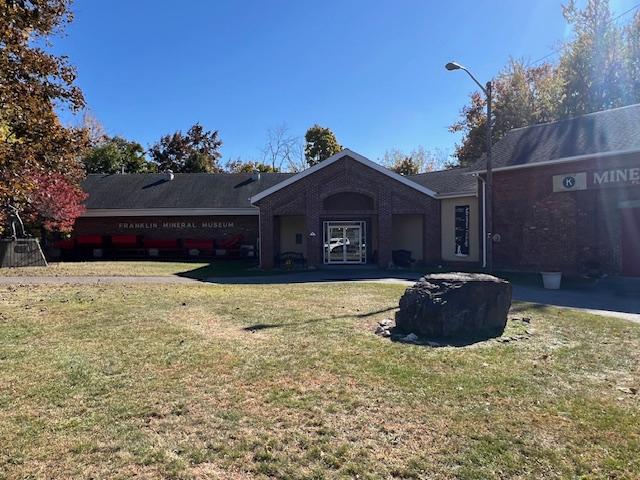
The front of the Franklin Mineral Museum
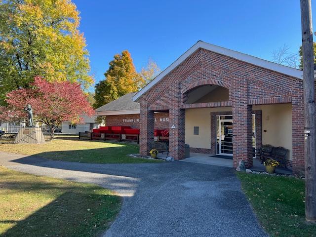
The front of the Franklin Mineral Museum
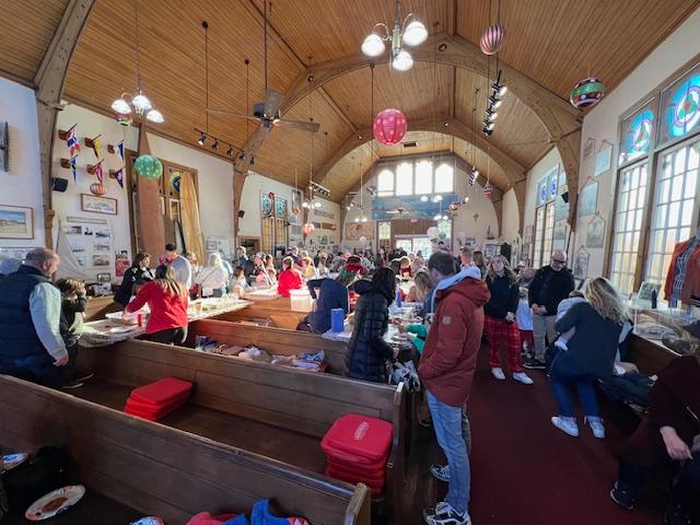
I recently visited the Franklin Mineral Museum on a trip to Sussex County wanting to learn more of the mining history of New Jersey. I never realized that the mines were so close to my home in Bergen County. I have to admit though that the museum is a little dated with the typed signs and no video information on the exhibits. What is lacks in modern QR codes and Virtual Reality it makes up in depth of collection and historical artifacts.

The historical sign outside the museum
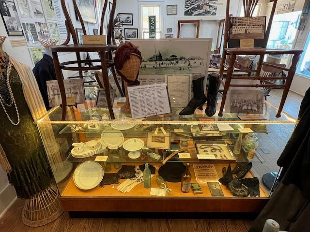
Where the museum shines though is in its depth of display, the interesting artifacts that the museum contains with both fossils and Native American pieces. It really shows the extent of Paleontology in the State of New Jersey and how the make up of the Earth and its history is shown in the displays. Many of the fossils have been found all over the State. The Native American pieces were from both North and South American with a impressive selection of Pre-Columbian art.
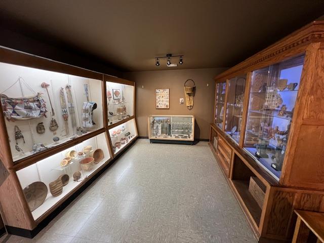
The Native American Gallery with pieces from all over the Americas
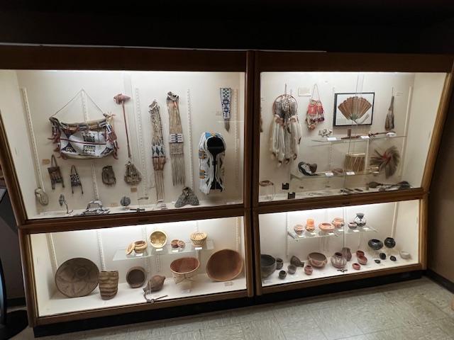
The Native American collection
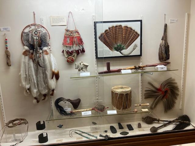
The beauty of some of the artifacts
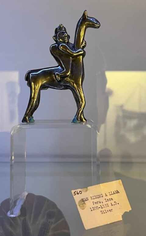
This piece of Inca silver impressed me as most of these artifacts were melted down for the minerals by the Spanish
Two of the exhibits that I thought stood out that you must see is the “Fluorescent Room”, which when left alone when the lights go out is an illumination of colors due to the fluorescent make up of the minerals in the rocks. It displays all the colors of the rainbow. When the lights go back on they just look like ordinary rocks. Take time when the lights are out to really look at the colors of the stones. I was told that the blue or violet ones are the rarest.

The Fluorescent Room before the lights got out
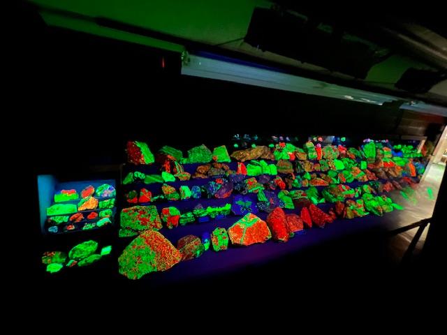
The gallery with the lights off when the magic happens
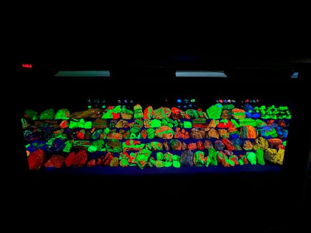
The Collection in full view
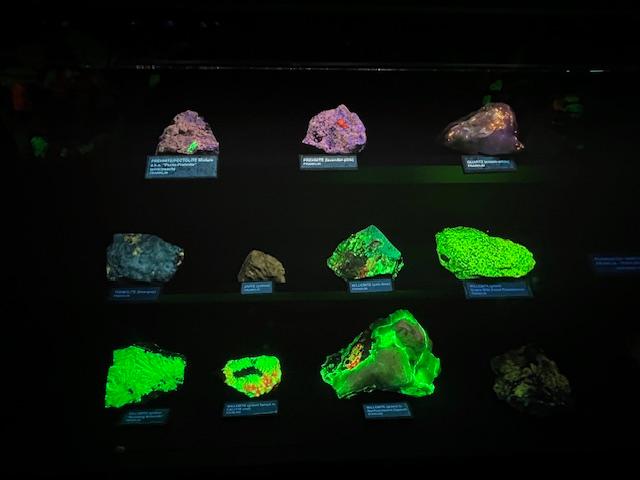
Samples of the mineral’s as they glow
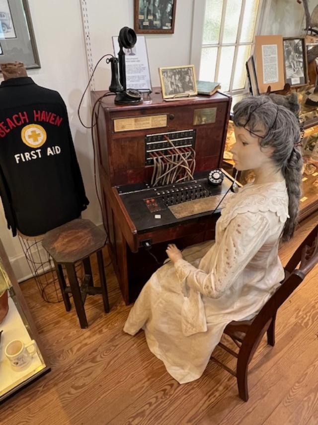
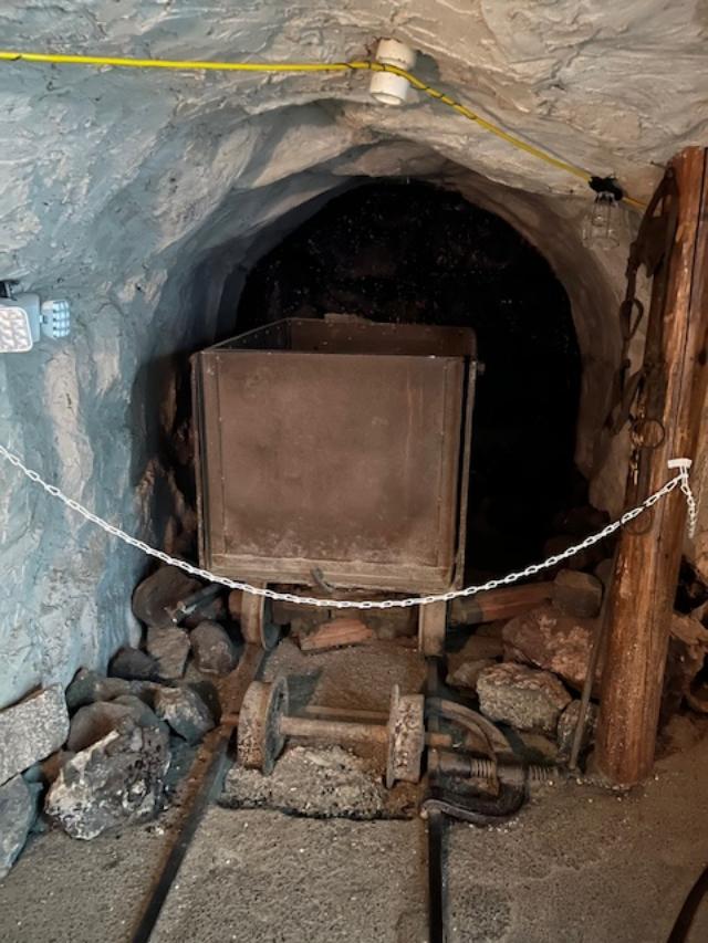
Another stand out display is the simulated “Mine Replica” that takes you in a tunnel and then maze of the make up of working in a mine complete with ladders down the lower tunnels, a working office of the foreman, the mine car tracts and displays on how miners went about there business. It shows how hard and dangerous the mining industry is and was back then to today. Try to see this display first as it takes time to tour.
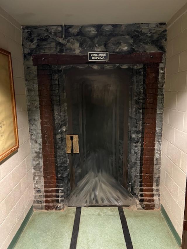
The Mine entrance
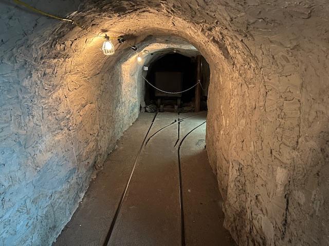
The simulated mine walk through
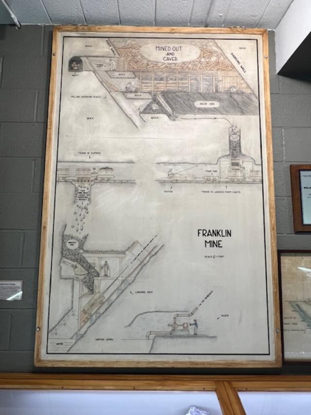
The Franklin Mine sign
The simulated mine walk
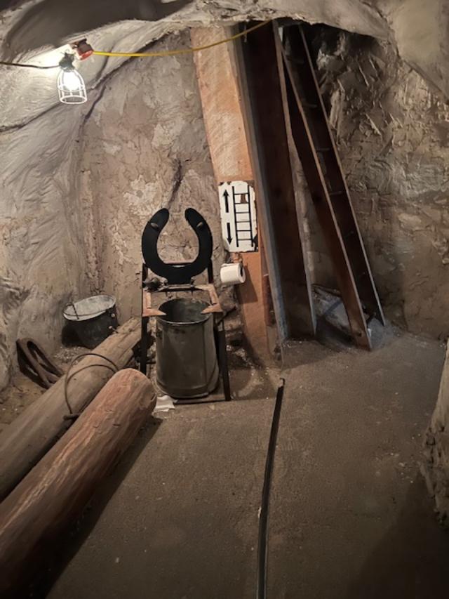
The toilet area of the mine
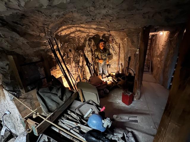
The miners at work in the mine simulation
Before you go inside to the museum, take some time to look through the quarry for rocks and minerals. You are given a bag to keep your specimens and there is a fluorescence light to check if you found anything. At first I thought this was just for little kids but later discovered that I found some ‘glowing rocks’ that I could take home and I found this fascinating. I never knew these types of rocks existed in New Jersey.
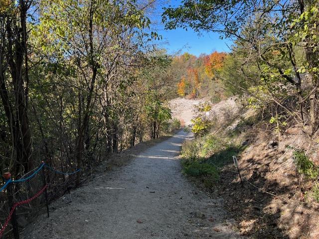
The Path to the Quarry area where the minerals were located
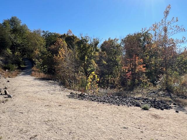
The path to the quarry area
The quarry area where you can collect specimens of minerals
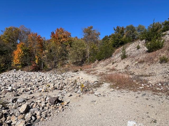
The quarry was busy in the afternoon
The beauty of the quarry in the Fall of 2024
Give yourself about three hours to really explore these rooms and it will give you a clear indication of how New Jersey formed as a State and its role in the evolution of the Earth. There are some really interesting displays to see and read about.
History of the Museum & Mines:
(This information was provided by the Franklin Mineral Museum pamphlet)
Due to the depletion of zinc and other ores the Franklin Mine closed operations in 1954. In preservation of the mining heritage the local Kiwanis Club started an annual mineral show donating the funds to charitable causes. Popularity of the show lead to the formation of the Franklin Mineral Museum, a non-profit educational museum, incorporated July 1, 1963, which is governed by a board of trustees and powered by a dedicated staff. Of note: Although the Kiwanis Club is no longer involved with the museum, the original sign still hangs over the outside door to the mine replica.
The former Buckwheat engine house, thought to be the hoist house that supplied the power to lift the mined ore from the Buckwheat open pit was donated to the museum in 1963. The mine replica was installed and made a permanent display inside the hoist house. Of note: Around 1940, the original replica was a modular unit displayed at the local community center “Neighborhood House” and was used to show the miners’ families how they worked inside the mine. Prior to being reconstructed inside the engine house the modular replica was used at the NJ Zinc Company for the purpose of training mine rescue workers.
A mineral repository was also added in 1963 to the museum. The first mineral exhibit was donated by the NJ Zinc Company to the Kiwanis Club for display in the then permanent mine replica. The collection consisted of 71 specimens and mill samplings, including 11 fluorescents. The first mineral exhibit was later used as a traveling exhibit is displayed in the “Local Mining District Mineral” room of the museum. (Of note: The collection was originally on display in 1920 at the local high school and then moved around to several other locations, then the Neighborhood House in 1940.
On October 9, 1965, the Franklin Mineral Museum opened to the public. On June 20, 1968, the State of New Jersey declared the Borough of Franklin, NJ “The Fluorescent Mineral Capital of the World”. The discovery of more than 200 varieties of minerals from the working mines brought forth the great phenomena of mineral wonders from this area, particularly brilliant fluorescent minerals. On September 24, 1971, the State of New Jersey declared the Franklin Mineral Museum an Historic Site. Today this museum houses the most comprehensive display of local fluorescent minerals in the world.
The Museum is broken down into several rooms and displays:
World Minerals “Welsh Hall”:
*There are approximately 6000 world-wide specimens and some from outer space.
*The three rock types are displayed. Igneous, metamorphic and sedimentary.
*Displays include meteorites, solidified lava, a volcanic bomb, pumice the floating rock, gold and birthstones in natural and gem forms.
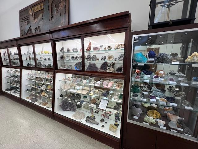
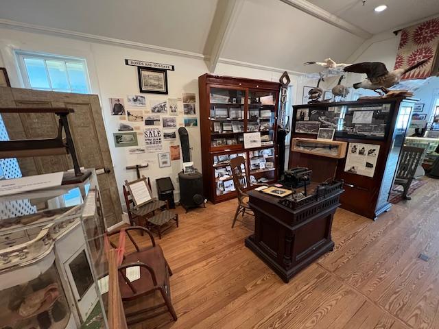
The Mineral Room
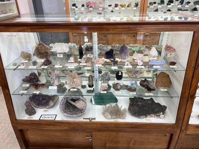
The Mineral Room
*The hollow rocks called geodes are formed from air bubbles in lava and often contain crystals. (Wilfred Welsh, a former teacher from Saddle River, NJ and his wife, Mary, collected and donated the majority of specimens in this room. This collection represents the passion they had for minerals. New specimens are continually added to this exhibit).
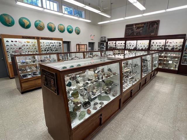
The Mineral Room
“Mine Replica”:
*In the lower level, left tunnel, the can in the alcove represents the miners’ “bathroom”. If a miner showed up late for work it was his job to carry the cans at the end of the shift (Where the expression “Going to the Can” comes from).
‘Hitting the can’
*This area contains the “Wall of Zinc”. The exhibit demonstrates the layers of various zinc ores that may have been visible in the mine.
*The original ore cars were pulled by mules.
*The miners of the 1800’s used candles & oil wick lamps on top of their helmets. Later in the 1900’s the carbide light was used to do away with candles. Water dripping on carbide produced acetylene gas which provided better light.
*Rats were prevalent in the mines. They stole lunches out of the metal lunch boxes if not locked. Most importantly they were very good indicators of cave-ins and provided early warning signs.
*The office exhibit represents that of a NJ Zinc scientist. This exhibit and open display area with “Sam” show mining artifacts. “Sam” is the original miner statue that stood outside of the museum, now replaced by a bronze statue sculptured by Carey Boone Nelson.
*Upstairs show the stope and pillar mining used in the 1900’s
*The large drill weighed 300 pounds and took two men to operate.
*The man cage (mine elevator) delivered men to their work levels inside the mine. A signal bell was rung to alert the operator.
Artifacts:
The artifacts of Native American, Artic & Aztec tribes, representing various regions are displaying in this exhibit.
“Fossils & Artifacts”:
*Petrified wood, the large circles along the wall are slices of fossilized tree trunk. The wood has been replaced with mineral over a long period of time. The tree rounds are estimated to date back to the Triassic Age 230 million years ago.
*The dinosaur footprint is from a Grallator, that roamed NJ. Grallator means “stilt walker”. This was a herding dinosaur known only from its fossilized footprints. Grallator-type footprints have been found in formations dating from the late Triassic through to the early Cretaceous periods. It is said to have up to five toes.
*The large bone is from a Mastodon. Mastodons are an extinct group of mammal; species related to elephants. They inhabited North and Central America during the late Miocene or late Pliocene up to their extinction at the end of the Pleistocene 10,000 to 11,000 years ago. Their genus name is Mammut and they are members of the order Proboscidea. They lived in herds and were predominately forest dwelling animals.
*Coprolite is fossilized dinosaur dung.
*The giant shark tooth is from the Megalodon one of the largest most powerful predators. It is an extinct species of shark that lived approximately 28 to 1.5 million years ago, during the Cenozoic Era. Fossil remains suggest that this giant shark reached a maximum length of 46-59 feet. Some believe that the Megalodon still swims in the deep waters today and are larger in size than originally thought.
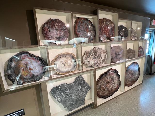
The Fossil Room

The Fossil Room

The Fossil Room

The Fossil Room
The Fossil Room
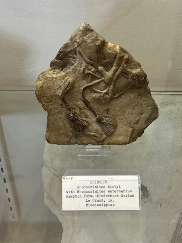
The Fossil Room
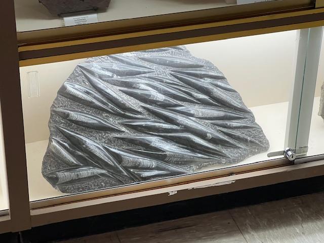
*Trilobites are extinct arthropods, distant relatives of modern lobsters, horseshoe crabs and spiders. Trilobites existed for approximately 300 million years. They lived from the Lower Cambrian Period (521 million years ago) to the end of the Permian (240 million years ago). Trilobites were probably the first life forms with complex eyes with some species having hundreds of individual lenses per eye.
“Fluorescent Room”:
The Fluorescence of the Franklin ores was discovered accidentally in the early 1900’s. Sparks from primitive electrical equipment in the mines caused the rocks to glow. Sparking equipment in the mines caused the rocks to glow. Sparking equipment was built and the fluorescents were used to follow ore zones and to monitor the quality of mill concentrates. Later, fluorescence was used to determine if exploratory drill holes were close to the ore body. If the holes would glow red. Calcite further from the holes had no fluorescence.
The Fluorescent Room
The reason why some minerals fluoresce is because of the impurities in the mineral. The ultraviolet light rays dislodge and excite electrons from their orbits in a molecular structure of the mineral and in their efforts to get back in the orbit, the electrons give off energy in the form of light.
Fluorescence refers to the emission of visible light from a substance being irradiated by ultraviolet light which the human eye can not see.
In the displays:
The large exhibit displays some of the finest fluorescent minerals from the local mining district, shown under shortwave ultraviolet light. Most local fluorescent minerals look fairly ordinary in natural light and only fluoresce under shortwave ultraviolet light. The exhibit on the opposite wall identifies local specimens in alphabetical order under shortwave ultraviolet light. Only a few local minerals fluoresce under long wave ultraviolet light, some of which are displayed in the first case you enter.
“Local Mining District Mineral Room”:
*Every mineral on display is from the local mining district of Franklin or Sterling-Hill.
*Several geological events produced the wealth of mineral species found in this area.
*The first one mined in Franklin was magnetite iron ore. Searching for more magnetite, zinc was discovered.
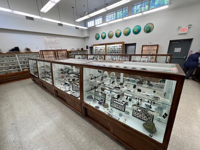
The Mineral Room
The discovery of zinc in the minerals franklinite, willemite and zincite brought on a new era of mining. Between 1848 and 1897 several small companies began underground zinc mining and continued to do so until the great consolidation of 1897.
In 1897, these smaller companies consolidate to from the New Jersey Zinc Company which operated in Franklin until 1954 and then closed after exhausting the mineral resources available.
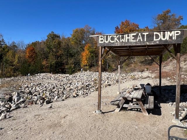
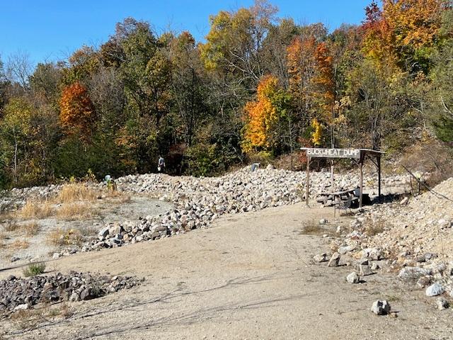
The Franklin open cut “surface mining” with an underground opening to the mine is across the street and currently under water. The open cut was originally named the “Buckwheat Mine”. The “buckwheat dump” is the collecting area of the museum, comprised of discarded rock from that mine.
*The mine produced 22 million tons of ore worth 500 million dollars.
*Many uses for Zinc include sunscreen, pennies, paint, batteries…
*Solid zinc bars are on display in this room.
In this exhibits:
*The left side of the room as you walk in, displays various species of local minerals. The primary economic ores mined were willemite, franklinite and zincite. See a sample that contains all of these minerals in “High Grade Franklin Ore” located on the floor next to the Franklinite Crystal model.
Willemite: Colorless to white, gray, flesh-red, dark brown, honey-yellow, apple-green, blue, Fluorescent (green) under shortwave ultraviolet light.
Franklinite: is an oxide mineral. Commonly occurs with willemite, calcite and red zincite forming small black octahedral crystals. Franklinite was only found here in the local mining district until recently.
Zincite: A mineral form of zinc oxide. Its crystal form is rare in nature except at the Franklin and Sterling Hill Mines. The hexagonal crystal is red-colored (mostly due to iron and manganese) and associated with willemite and franklinite. Some zincite fluoresces yellow under long wave light.
*You can collect for these mineral species on the “buckwheat dump” located on the property of the museum.
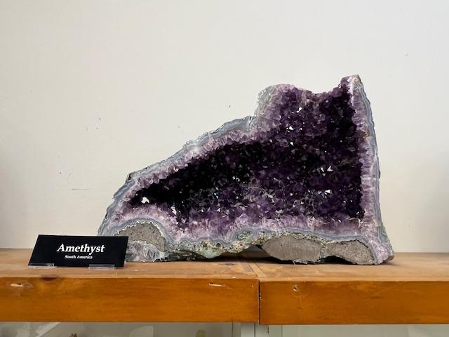
Amethyst on display
*On display are small amounts of gold found here.
*The corner floor display consists of local common rocks and minerals some of which contain iron. There was an iron furnace located at the now Police station at the edge of the Franklin pond. Most of the iron mined here was called magnetite. Magnetite is highly magnetic.
Some minerals on display are on loan from various institutions and major universities. We have out minerals on display in museums all over the world. The majority of the specimens are acquired through donations or purchased for the betterment of the museum.

The Mineral Room
As of this publication, the Franklin-Sterling ore deposits have produced 359 different mineral species about 10% of all those known to man. More mineral species than anywhere else on earth, 19 of these are unique to the area, 92 of which are fluorescent.
(This information on the museum and on their displays is taken from the Franklin Mineral Museum pamphlet and I give the museum full credit for the information. Please check the website for more information about programs at the museum.)