Category: Historic Forts of New York State

Stony Point Battlefield State Historic Park            44 Battlefield Road                                           Stony Point, NY 10980

Stony Point Battlefield State Historic Park 44 Battlefield Road Stony Point, NY 10980

Stony Point Battlefield State Historic Park

44 Battlefield Road

Stony Point, NY 10980

(845) 786-2521

https://parks.ny.gov/historic-sites/stonypointbattlefield/maps.aspx

https://en.wikipedia.org/wiki/Stony_Point_Battlefield

Open: Sunday (Grounds) 12:00pm-5:00pm (Museum) 12:00pm-4:30pm /Monday-Tuesday Closed/Wednesday-Saturday (Grounds) 9:00am-5:00pm/(Museum) 10:00am-4:30pm

Admission: Free but donations are accepted. Groups, Scouts and Organizations are $5.00 individuals per person and $7.00 for special events per person. Please call to make arrangements on this.

My review on TripAdvisor:

https://www.tripadvisor.com/Attraction_Review-g48694-d263715-Reviews-The_Stony_Point_Battlefield_Lighthouse-Stony_Point_New_York.html

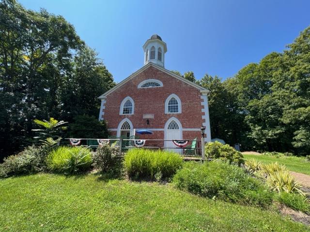
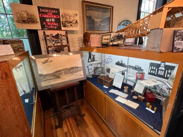
The Stony Point Battlefield Museum

The General’s tent on the battlefield.

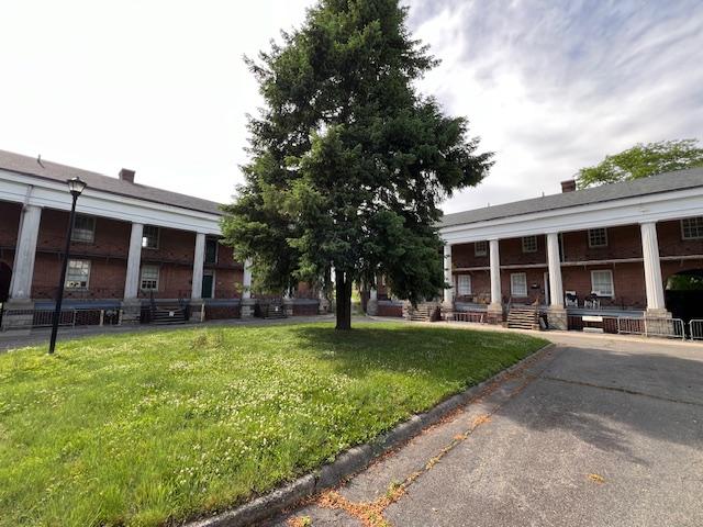
We visited the Stony Point Battlefield one afternoon and it is a very interesting and historical fort in the Hudson River Valley. We were able to tour the battle site and explore the grounds of this historical site. Then we toured the museum which gave us a view of the battle and what happened that night through a series of displays of the artifacts.
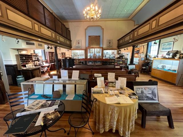
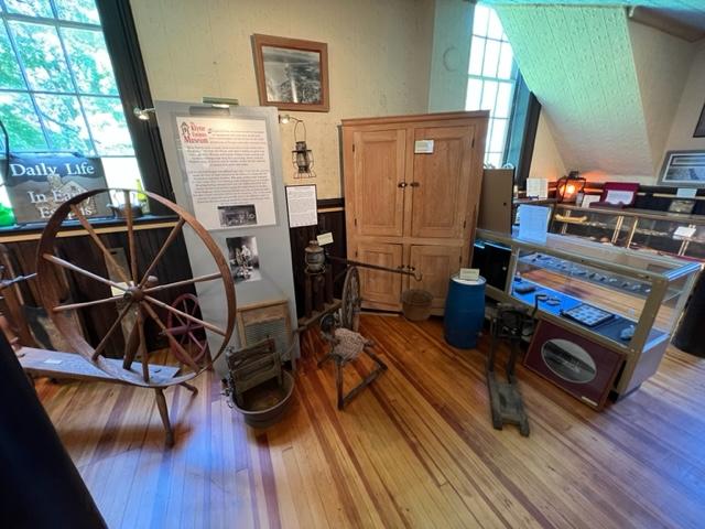
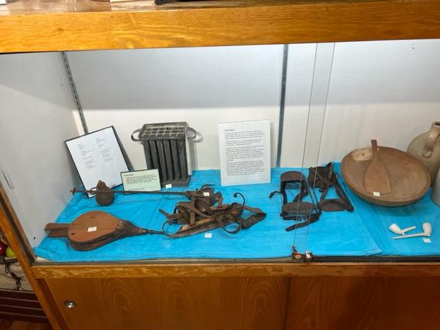
The Gallery

The Gallery

The gallery was filled with all sorts of weaponry and items needed by the troops for battle.

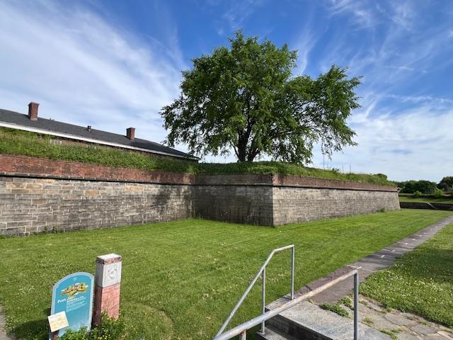
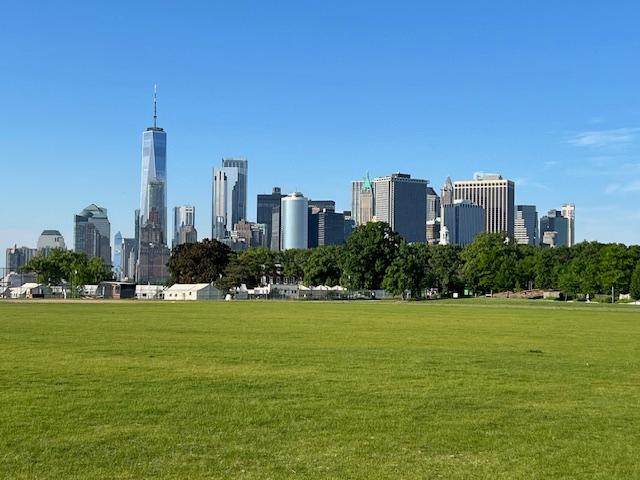
The battlefield site.

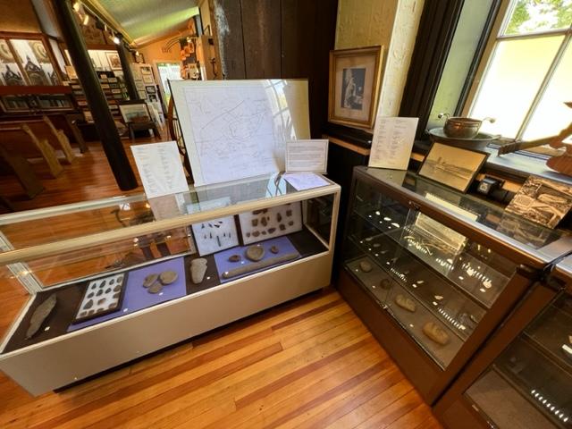
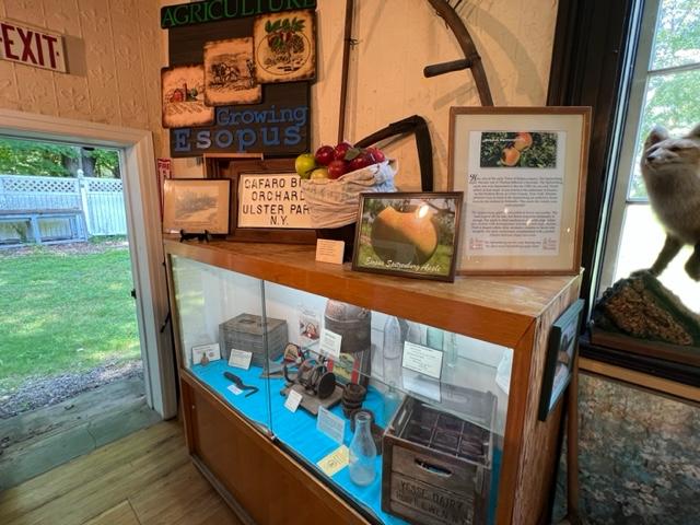
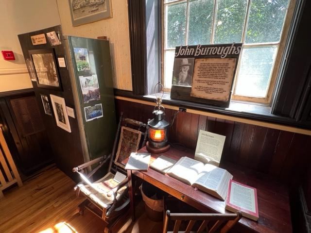
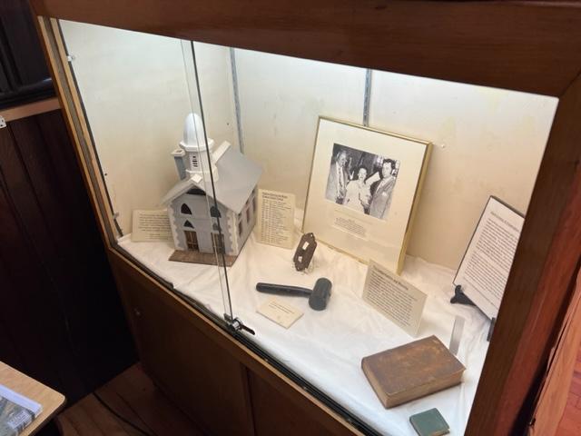
The museum has displays of the weapons used, the structure of the fort, utensils used the time that the troops were defending this area and what life was like on a day-to-day basis. The museum also offers a glimpse of artifacts of both the fort and of the battle with docents assisting you in telling the story of what happened at that time and after the battle and the war were over.

The Stoney Point Battlefield tent set up.

Outside the fort, there was a set-up of tents to show what the troops life was like in battle as well as General Wallace’s tent that he lived in and used during the battle. At the end of the day, the park does a demonstration of lighting the cannon that would have been used in battle. That was interesting. It was a lot more work than people think.

The cannon set up.

There is lot to do and see along the pathways of the fort and its grounds with amazing views of the Hudson River.

The story of the battle.

The History of the park and battlegrounds:

(from the NYS Parks Division website)

Visit the site of the Battle of Stony Point, one of the last Revolutionary War battles in the northeastern colonies. This is where Brigadier General Anthony Wayne led his corps of Continental Light Infantry in a daring midnight attack on the British, seizing the site’s fortifications and taking the soldiers and camp followers at the British garrison as prisoners on July 16, 1779.

The map of the fort at Stony Point, NY.

By May 1779 the war had been raging for four years and both sides were eager for a conclusion. Sir Henry Clinton, Commander-In-Chief of the British forces in America, attempted to coerce General George Washington into one decisive battle to control the Hudson River. As part of his strategy, Clinton fortified Stony Point. Washington devised a plan for Wayne to lead an attack on the garrison. Armed with bayonets only, the infantry captured the fort in short order, ending British control of the river.

The weapons of battle on display at the museum.

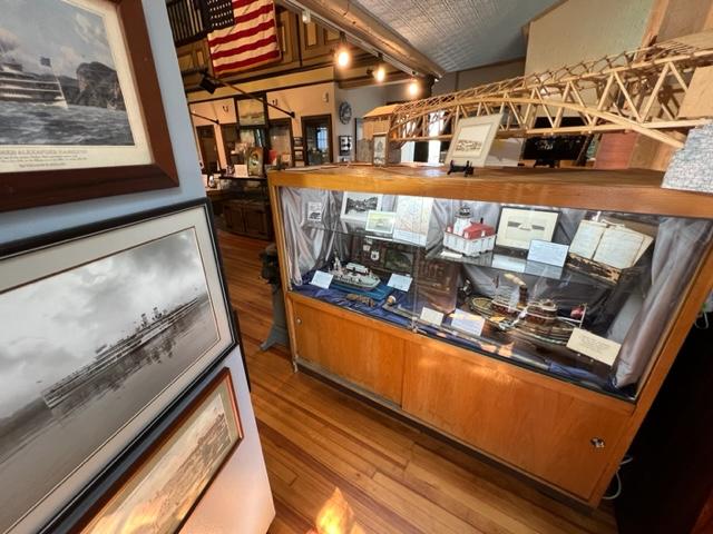
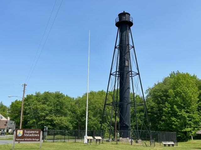
The Stony Point Lighthouse, built in 1826, is the oldest lighthouse on the Hudson River. De-commissioned in 1925, it now stands as a historical reminder of the importance of lighthouses to commerce on the Hudson River. The opening of the Erie Canal in 1825 unleashed a surge of commercial navigation along the Hudson River, by linking New York city to America’s heartland.

Within a year, the first of the Hudson’s fourteen lights shone at Stony Point and others soon followed, designed to safely guide maritime travel along the river. Many light keepers, including several remarkable women such as Nancy and Melinda Rose at Stony Point, made their homes in the lighthouse complexes, and ensured that these important navigational signals never failed to shine.

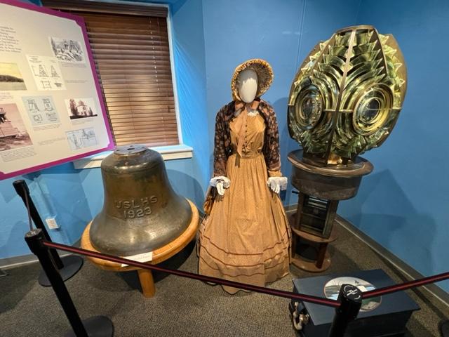
The lighthouse light on display at the museum.

The site features a museum, which offers exhibits on the battle and the Stony Point Lighthouse, as well as interpretive programs, such as reenactments highlighting 18th century military life, cannon and musket firings, cooking demonstrations, and children’s activities and blacksmith demonstrations.

The cannon demonstration that we saw at the end of our visit to the battlefields.

Klyne Esopus Museum                                         764 Route 9 West                                             Ulster Park, NY 12487

Klyne Esopus Museum 764 Route 9 West Ulster Park, NY 12487

Klyne Esopus Museum

764 Route 9 West

Ulster Park, NY 12487

(845) 338-8109

https://www.esopushistorymuseum.org/

https://www.facebook.com/EsopusHistoryMuseum/

Open: Sunday-Monday 11:00am-4:00pm/Tuesday-Thursday Closed/Friday-Saturday 11:00am-4:00pm

Admission: Free but donations are taken to offset costs

My review on TripAdvisor:

https://www.tripadvisor.com/ShowUserReviews-g48749-d26495761-r908410891-Klyne_Esopus_Museum-Ulster_Park_Catskill_Region_New_York.html?m=19905

The Klyne Esopus Museum is the home of the Town of Esopus Historical Society and is a treasure trove of information of early life in the Hudson River Valley and the role this small town played in the shaping of American society in this region. There are all sorts of displays on early American life, cottage industries that made the community grow and its role in the modern age.

The Klyne Esopus Museum at 764 Route 9 West

The sign welcoming visitors to the museum.

The Main Gallery at the Museum

The museum’s main gallery is surrounded by cases displaying the story of the area depicting the various aspects of industry, commerce, agriculture and domestic activities of the town’s residents. Former residents of note that are featured are Sojourner Truth, John Burroughs and Alton Parker to name a few. year a curated exhibition focusing on a special theme is centrally featured. These are some of the exhibits that are showcased at the museum:

The Native American exhibit:

The exhibit has an interesting collection of arrowheads, fishing and household items that were used by the local tribes who once lived in the area.

The display of arrowheads and fishing items

The extensive display of Native American fishing and household items.

The Apple industry:

The local Apple industry was a major part of the economy in the late 1800’s and early 1900’s. The apple, the “Esopus Spitzenburg” was developed in Esopus. The Dutch had developed the agricultural industry of the area that supplied New York City with seasonal fruits and vegetables.

The Dutch Farming Industry and the development of local harvests

With the community based by the Hudson River and transportation being such a big part of the local economy, the displays on shipping and the local lighthouses were prominent at the museum. The display has all sorts of pictures and artifacts from the era of steamboat transportation down the Hudson River.

The Lighthouse and Shipping Industry

There were displays on famous residents such as Sojourner Truth and John Burroughs and their role in the community.

The artifacts and display on Sojourner Truth

https://en.wikipedia.org/wiki/Sojourner_Truth

The artifacts and display on John Burroughs

https://en.wikipedia.org/wiki/John_Burroughs

The church is also featured pictures of clergy and their families, the history of the church and the decor of items that used to adorn the church when it was a place of worship. There is a large display on church history in the back of the museum.

The Church display of its history

The local veterans are prominently displayed at the museum as was showing the spirit and support of the wars and battle. It also shows the townspeople participation and dedication in the war effort.

The World War II exhibition

Recreation and leisure are a big part of the Hudson River Valley society and items such as ice skates, swimming and boating show how people enjoyed their free time. This still plays out today. Household items were also displayed as well showing life at that time.

Household and Recreation items on display

The History of the museum:

(From the website and pamphlet)

The Klyne Esopus Museum that is located in Ulster Park, NY is housed in the former Dutch Reformed Church, which is a charming country church built in 1827. It served the community for over 175 years and replaced a smaller building built in 1792 originally located 1000 ft. to the north.  The church closed in 1965. The governing body of the church scheduled the building for demolition.

Faced with this reality, the former members of the congregation and the larger community rallied to preserve the building.  In 1969, a group known as the Klyne Esopus Historic Preservation Committee formed. Formal incorporation of the group took place in 1970.  After 17 years of fundraisers, repairs to the building, preserving and collecting, the museum finally opened to the public. In 2002, the building became designated a State and National Historic Landmark. 

The historical society museum opened to the public in 1984, offering a variety of exhibits about the culture, commerce and history of the Town of Esopus. The town is typical of rural America but it unique in many ways. Its geographic location and topography have spawned a variety of industries, resulting in a rich history and a diverse population.

The Klyn Esopus Museum is the Historical Society of the Town of Esopus. Its goal is to preserve, interpret and disseminate the history of the town. By fostering an awareness of the past and providing a repository for the artifacts and memorabilia of its former residents, it enables present and future generations to identify and appreciate times gone by. Today, a small, committed group of volunteers is working to make history meaningful and relevant to visitors of all ages. 

Finns Point Lighthouse                                                          Fort Mott & Lighthouse Roads                                   Pennsville, NJ 08070

Finns Point Lighthouse Fort Mott & Lighthouse Roads Pennsville, NJ 08070

Finns Point Lighthouse

Fort Mott & Lighthouse Roads

Pennsville, NJ 08070

(856) 935-3218

https://www.lighthousefriends.com/light.asp?ID=374

https://en.wikipedia.org/wiki/Finns_Point_Range_Light

Hours: Sunday-Saturday (Open with Fort Mott State Park-Lighthouse Currently closed, check the website of the park)

Admission: Free when open

My review on TripAdvisor:

https://www.tripadvisor.com/Attraction_Review-g46726-d14113446-Reviews-Finns_Point_Rear_Range_Light-Pennsville_New_Jersey.html

Finns Lighthouse in Fort Mott State Park

The Finns Point Lighthouse is located in the Fort Mott State Park and the afternoon that I was there which was the third Sunday of the month of June, it was not open. In fact, it looked like it had never opened for the day.

The gift shop/information center had a sign from 2019 with the hours of operation and the steps were not well cared for and the gardens around the building were over-grown. The lighthouse itself is behind a fence that you can look at but not enter and from what I read online is not open even when it should be if it is too hot or too cold because conditions inside can be impossible. The lighthouse and the Visitors Center will reopen for the 2023 season.

The Finns Lighthouse Visitors Center is now open in 2023

Still, the lighthouse has a majestic look to it and must have some views when it is open. If it is not open, take time to visit Fort Mott and the State Park, which offers spectacular views of Delaware Bay and the surrounding grounds. Take time to explore the fort and the where the guns were mounted. Very interesting.

Fort Mott also has a very good Visitors Center and small museum inside to see the history of the fort, artifacts from the fort and from the war years and all sorts of interesting information on the area.

The Finns Point Lighthouse

The History of the Finns Point Lighthouse”

(From the Friends of the Finns Point Lighthouse website-modified):

https://www.lighthousefriends.com/light.asp?ID=374

(Please read the above Friends Website for the complete history in detail of the ligthouse)

Soon after the 1638 landing of the Finnish colonists near the present site of Wilmington, DE, a small group of settlers crossed over to the east bank of Delaware River, where the land was though to be more fertile and established farms. One group selected land near the sweeping turn in the Delaware River and this area remains known to this day as Finns Point.

By an act of Congress in 1875, $55,000 was set apart for two pairs of range lights to help vessels transition from Delaware Bay into the Delaware River. Port Penn Range, located in Delaware, would guide traffic along the shipping channel from Ship John Shoal to Ready Island, while Finns Point Range would help vessels continue upriver, passing between Reedy Island and Baker Shoal.

Lt. Colonel William F. Reynolds of the U.S. Corps of Engineers oversaw construction of the front and rear range lights at Finns Point. The front light was located near the banks of the Delaware River and was displayed from a frame dwelling of the following description: “one and one half stories high with shingle roof, double weather-boarded on outside and lathed and plastered inside. Its rests on stone walls founded on wooden piles. The first story is divided into three rooms with the hall and stairways to the second floor and cellar and shed over the back door, porch and bay window in the front. The second story is divided similarly to the first, with a step ladder to lantern on the third floor, a gallery supported by brackets surrounds the lantern on front and sides.”

The illuminating apparatus for the front light was a fourth order range lens manufactured by Barbier & Fenestre in Paris, which focused the light from a fourth-order Funk Heap Lamp with one wick. In 1882, a “wooden screen painted white, with open spaces so as to show horizontal stripes” was placed atop the front lighthouse’s red tavern room to make the structure more conspicuous during the day. The daymark was removed in 1897.

The lighthouse sign

Three acres of land, roughly one and a half miles inland from the front light, were purchased from Joshua and Mary Dickinson on April 20th, 1876, as the site for the rear range light. To provide a focal plane higher than that of the front light, the project plans called for a tall, wrought iron tower to be used for displaying the rear light. The Kellogg Bridge Company of Buffalo, NY was contracted to manufacture the components of the wrought tower, which were then transported to Salem, NJ by railcar. From Salem, teams of mules pulled large wagons loaded with pieces of the iron tower to the construction site.

A frame keeper’s dwelling was built just west of the tower, along with a wood-framed privy and an oil house. The first keeper of Finns Point Rear Range Light was Edward Dickerson, who started serving on December 8th, 1876, even though the light was not lit until April 2nd, 1877.

The lighthouse sign

Fast forward to the 1970’s when the old dwelling was razed because it was unsafe, but locals showed an interesting in the lighthouse and having it moved. Resident Betty Husarik formed the “Save the Lighthouse Committee”. They faulted in moving the lighthouse but placed it on the National Register of Historic Sites in 1978.

In 1981, the committee set out to Washington DC to meet with their local congressman and the drive resulted in a contract for $33,600 being signed between the US Fish and Wildlife Service, on whose land the tower now stood and K & K Painting Company of Baltimore to have the tower repairs, sandblasted and painted. An open house was held at the tower on October 14th, 1984 to honor the determined effort shown by the “Save the Lighthouse Committee” and others in restoring the tower.

Today it is opened for limited tours and special events.

Fort Jay                                                       Governors Island                                                 New York City, NY 10004

Fort Jay Governors Island New York City, NY 10004

Fort Jay

Governors Island

New York, NY 10004

My review on TripAdvisor:

https://www.tripadvisor.com/Attraction_Review-g60763-d136072-Reviews-Governors_Island_National_Monument-New_York_City_New_York.html?m=19905

My review on MywalkinManhattan.com in 2018 and 2024:

https://wordpress.com/post/mywalkinmanhattan.com/7658

The view from the top of the hill on Governor’s Island.

When I was touring Governors Island for my blog, “MywalkinManhattan.com”, I explored the Fort Jay complex which is located on the northern end of the island just past Castle Williams. This fort is mostly in a state of ruin and is currently being restored at various stages all around the complex. The decorative entrance with its statuary is being cleaned and the entrance fixed on one side of the fort and the walls and some of the interior space is being repaired inside the fort.

The main entrance to Fort Jay (currently under restoration)

This fort and Castle Williams were built to protect the City of New York between the Revolutionary War and the War of 1812. After that these forts fell out of use as the times and technology changed .

The decorative statuary is being repaired on the fort (currently under restoration)

Now the fort is used for art exhibitions in some of the interior hallways and grass has grown over most of the walkways. Still it is interesting to walk along the pathways near the walls of the fort and see how they were once used. It is interesting to see how far we have progressed in warfare.

The entrance to Fort Jay

The History of Fort Jay:

Fort Jay is located on Governors Island in New York Harbor, one half-mile from the southern tip of Manhattan. No defensive works are known to have been erected on the island during its early history. Defensive earthen works were first erected on the highest point of Governors Island by Continental troops in 1775-76. The island and its fort were occupied by the British during the American Revolution until 1783, when it surrendered, along with several buildings to the Governor of New York.

More than ten years passed before renewed tensions with Great Britain resulted in funding from both the New York Legislature and the United States Congress in 1794 to reconstruct the works on Governors Island. This part of a larger national effort to fortify ports that later became known as the First American System of coastal fortifications.

Design of the New York Harbor defenses was assigned to French engineer Charles Vincent. The works on Governors Island had been completed by 1796, described in January of that year by the Secretary of War as “a fort made of earth and two batteries under its protection, partly lined with brick masonry, two air furnaces, a large powder magazine and a barrack for the garrison.”

The inside of Fort Jay.

Fears of a French invasion in 1797 resulted in a second phase effort funded by additional appropriations to complete and enhance the coastal fortifications, including those on Governors Island. The fort is said to have acquired the name “Fort Jay” in 1798 for John Jay, then the Governor of New York State. Governors Island and its fort were conveyed to the federal government two years later in 1800, by an Act of the New York State Legislature.

The inside of Fort Jay

A plan of the fort as it existed that year shows it as a four-bastioned form surrounded by a ditch with a parapet having 51 embrasures, a gate and bridge on the east side and a large magazine in the northeast bastion. The fort was still incomplete and incapable of defense in 1802 according to a written report, although it was then equipped with a “handsome Gateway with a Corps de Garde” or guardhouse, that survives today.

Fort Jay had fallen into ruinous condition by 1806 when a second national campaign to strengthen the coastal defenses of the country, now known as the Second American System of fortifications, was implemented. This effort differed from the first by employing American engineers and using more durable masonry construction.

The outside wall of the fort.

The engineer chosen to design and oversee the defenses of New York Harbor was Colonel Jonathan Williams, Chief Engineer of the Corps of Engineers and first Superintendent of the Military Academy at West Point. Reconstruction of Fort Jay, renamed Fort Columbus about this time, began in July 1806 and was completed by December 1809. The only components of the old fort judged worth saving were “the walled Counterscarp, the Gate, the Magazine and the Barracks,” according to Colonel Williams in a report dated November 1808.

The completed fort was described in a later report to Congress as “an enclosed pentagonal work, with four bastions of masonry, calculated for one hundred guns, fifty-five mounted with brick barracks for two hundred and thirty men, including officers. The earliest known plan of the completed fort is a plan by Joseph Mangin drawn in 1813.

The walkway between the forts.

The first significant repairs and alterations were made to Fort Columbus in the 1830’s, resulting in the overall appearance of the fort as it exists today. The stone retaining walls were extensively rebuilt at this time, including the scarp that was faced with granite and topped with a new brickwork parapet. The old magazine in the northeast bastion was demolished and replaced by four new magazines erected in the north ravelin. Finally, the four existing brick were replaced by four new barracks with flanking triangular structures and outdoor courtyards.

Later changes have been made to the barracks by the U.S. Army over the years, including interior remodeling and replacement of the flat roofs with hipped roofs in 1855-57, incorporated of five of the triangular buildings as additions in the 1860’s and 1898-99 and reconfiguration of the buildings as officers’ apartments in 1921-22 and again in the 1930’s. Paint was stripped from the exterior brick buildings in the 1930’s, the sodded glacis of the fort was converted to recreational use as a golf course by 1940 and the flagstaff was moved from the northwest bastion to the north ravelin by 1953.

The lawn on Governor’s Island overlooking Lower Manhattan.

Jurisdiction of Governors Island passed from the U.S. Army to the U.S. Coastguard in 1966. Improvements made by the Coast Guard to Fort Jay, whose name was officially reinstated in 1904, included expansion of the golf course; remodeling of the barracks with new kitchens, bathrooms, heating and electrical systems and storm windows and doors and erection of chain-link fencing on the glacis. Fort Jay sat vacant with minimal upkeep since the closure of the Coast Guard in 1997.

Fort Jay was recorded by the Historic American Buildings survey in 1934 and in 1982-83. The fort was individually listed in the National Register of Historic Places in 1974. It was included in a National Historic Landmark District designated in 1985 and a New York Historic District designated in 1996. The fort is also located within the boundaries of the Governors Island National Monument, established by Presidential Proclamations in 2001 and 2003.

(This information I credit to the National Park System-Division of Culture website)